**Real Time Update: guess what’s nearly impossible to do? readjust to society after hiking 1,200 miles, re-establish a professional mental health career, get through the holidays, plan a wedding, integrate an aggressive, geriatric cat into a household with 3 existing cats, AND edit/write hiking blog posts! I did my best for awhile (eeking out a post every couple of weeks) and when the event planning/holiday marathon took over the world, I gave up. And now… COVID19! Guess what did not happen on April 4th? The square dance and marriage ceremony we’d been planning for the last 6 months. Not exactly the time to all join hands and circle left or the time to ask family members to fly across the country. It’s been a hectic time adjusting to the global health crisis – We had to cancel our wedding festivities (though we did get married in the woods on April 3rd), Oakland had to switch to online/distance learning, and I’ve had to transition to video sessions with clients, one of whom is navigating some tricky public benefits issues. We’re doing our best to settle into a self-isolation/quarantine rhythm, which means… blogging time! Sort of. Now, let’s go back to McAfee knob, which is in southwestern VA if you need to get your bearings.
July 4, 2019
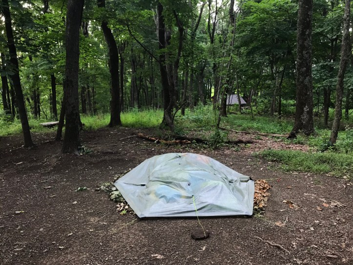
As far as we could tell, it didn’t rain the rest of the night. I had a restless, but fine sleep until the alarm at 4:30. It was hard to move, but I pulled on hiking clothes and packed a day bag for the sunrise trip to McAfee. We needed our zSeats, TP for early morning emergencies, water and a small snack to tide us over until breakfast. Then came privy visits by headlamp. I’m not sure if it was dew or spider eyes that shined back at me from the grass as I made my way down to the privy. Likely both. I left the door wide open and did my best to keep my eyes out of the corners. Someone had arrived at the shelter after we tucked ourselves in for the night as evidenced by the tarp strung across the front of the structure and the disarray inside. I put my contacts in standing by the bear box and annoyingly dropped one of them on the ground, so I had to open a new one. Then I collected my hiking poles from the eaves of the tent and neatly folded it over in the hopes that the doors would prevent any rain from getting in while the tent lay flat (picture taken after we got back because it was far too dark to see anything when we left):
We left camp at 5:09am for the 0.7 mile hike back to McAfee Knob. I saw light on the horizon at 5:14, and I could feel the urgency building in my steps, but I didn’t want to break Oakland by racing up the hill, so I tried to keep our pace reasonable (Oakland still claimed that I “ran” uphill when we finally arrived). For the last third of the trip, I had to hike with my right pole held in front of my face to keep from being completely inundated by the frequent and sticky stream of spider webs crossing the trail. Thankfully my headlamp illuminated them enough for me to avoid face planting into them.
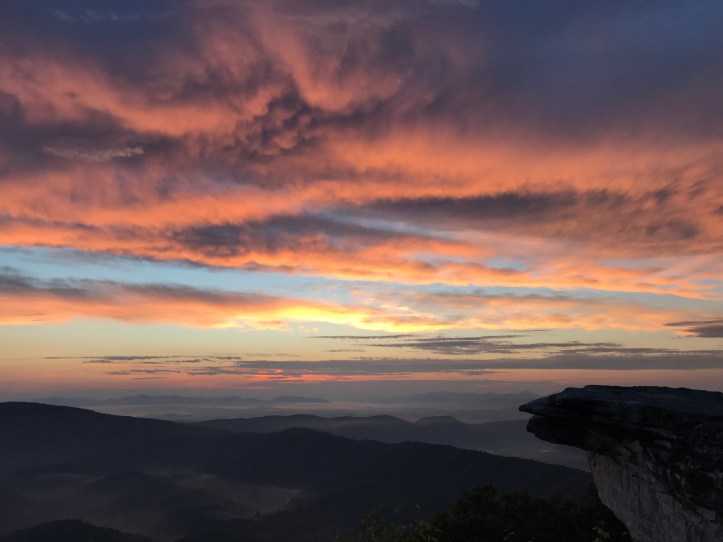
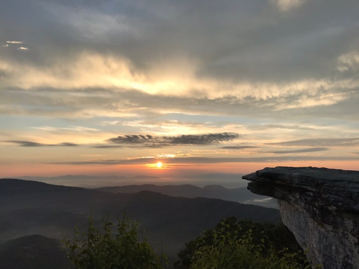
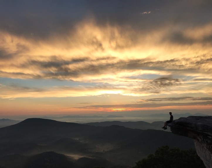
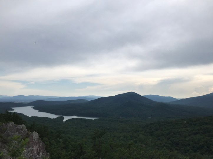
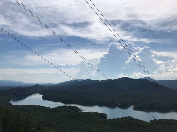
We arrived at the overlook at 5:30am. There were 2 small tents just to the left of the trail right before the path out to the overlook. Why can’t people follow rules? There are signs posted in the area that clearly state no camping. I want to wake-up in that amazing spot too, but there’s a reason we’re being asking NOT to stay overnight. Oakland and I walked out onto the rocks and found a few people already hanging out for the show. There were two sleeping hipster lumps with one of those Mexican serape blankets that seems to be a requirement to join the *hashtag vanlife* club. I scoffed at them while appreciating our mutual goal. After we took someone’s picture as requested, we settled onto a rocky perch, which I immediately abandoned in favor of standing in a position that would allow me to take pictures with the famous overhanging rock face over the horizon. Oakland patiently waited while I decided which view would suit my sunrise obsession, and then we resumed sky watching. Here are a few shots that go along with today’s top picture:


More people arrived as light slowly filled the horizon. Some guy decided to make a questionable choice and climbed down the ledge in front of us so he could capture the scene from below the knob. It’s hard to tell, but there’s a pretty sharp drop right in front of him.

A family with a couple of kids around age 10 tromped onto the rocks, triumphant and panting from the effort of having hiked up from the parking lot. Who knows how early they had to drag themselves out of bed to get here in time. A hiker I met back in Erwin, TN named John Wayne arrived. He bought a car in TN and has been having issues getting it registered ever since. I don’t understand what’s happening with his hike, but I did my best to be friendly while being thoroughly perplexed by his choices. There was also an adorable newly rescued dog who arrived with a local who got into a “who can name more local spots” contest with someone else. I tried to pet the pup, but he was a bit too nervous, so I stood far enough away to gawk and take a bad picture (because he wouldn’t sit still).

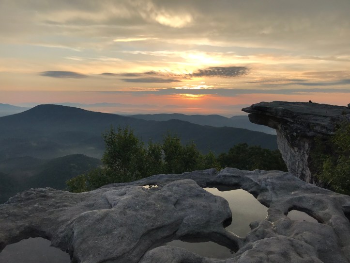
Then Oakland and I each took another seated picture to drive our parents crazy. I also took one more picture with the required puddle reflection because I couldn’t help myself.
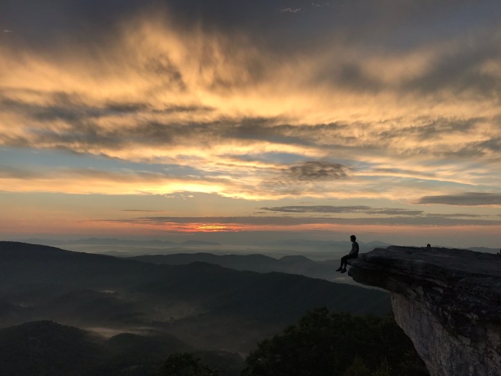
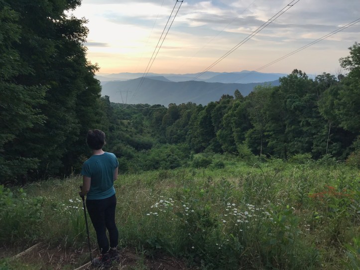
We left around 6:20 after the sun finally popped over a cloud bank. I was a little disappointed with the haziness and pastel tones, but the sky cooperated enough to make it worth the extra mileage for the day. (This is where Oakland will roll her eyes because she doesn’t have the patience for my impossible sunrise/sunset standards.) The walk back down was slow and tiring because of the already rising humidity and our moderately empty stomachs. Here’s Oakland humoring me when I asked her to stop for a picture by the power lines:
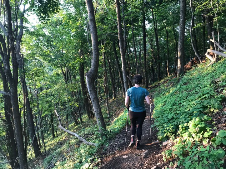
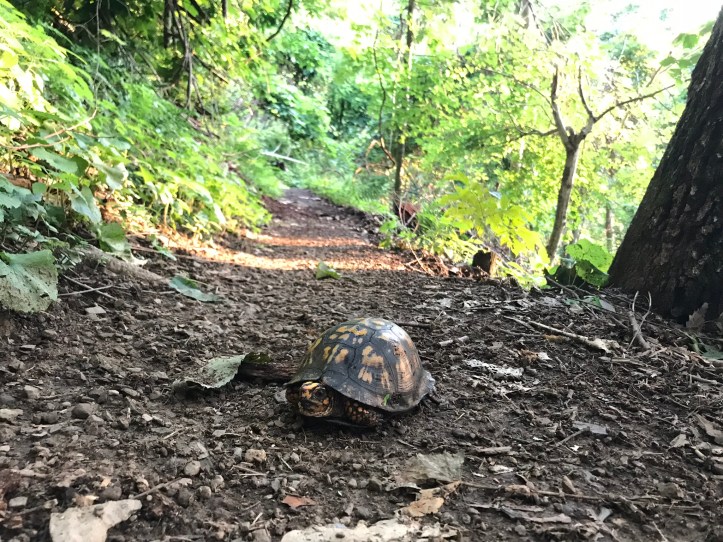
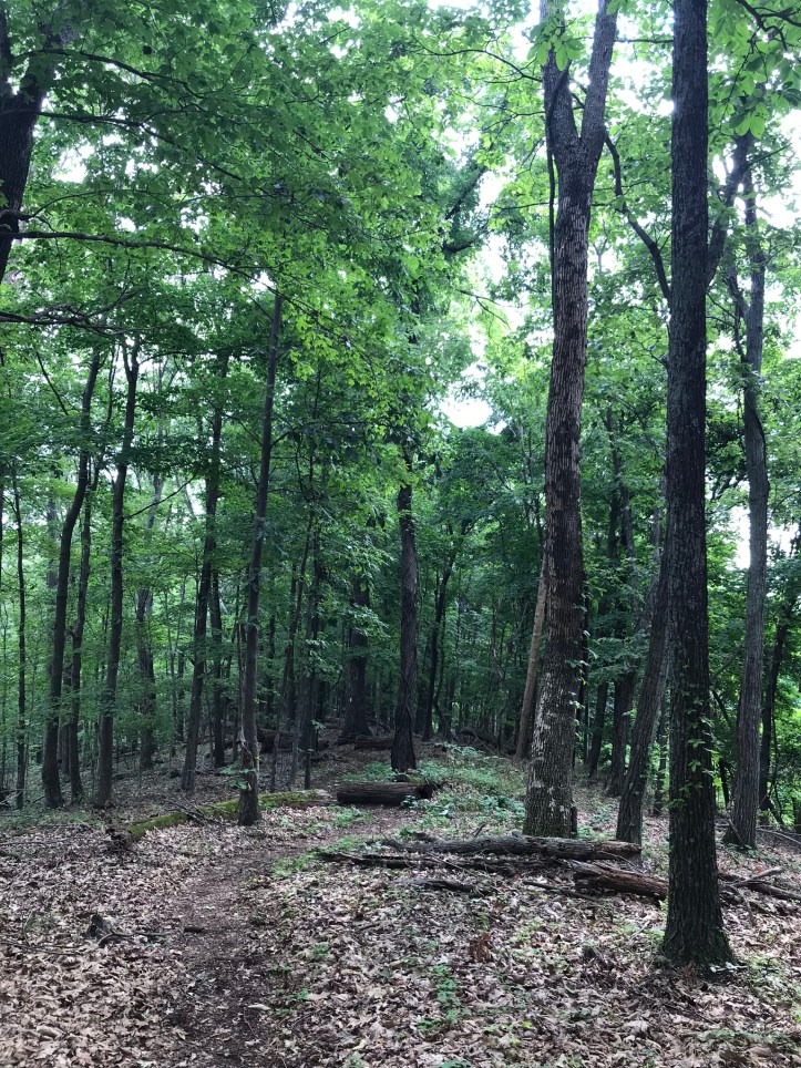
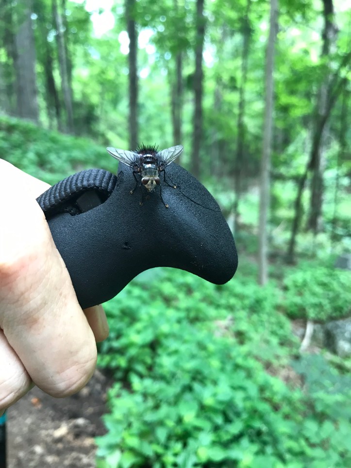
We wound our way back down through the open forest and paused to meet a new friend who sat in the middle of the trail.
When we returned to camp, we found our tent covered in ants. Akk! We didn’t bother brushing them off just yet because it was far past time to eat a proper breakfast. We walked down to the bearbox and gathered our supplies. Then we sat at the table and quietly ate breakfast while the unknown hiker slept in the shelter. Then came the great ant purge from the outside of the tent and the short but tedious process of packing our gear. We filtered water, and I packed up the tent while Oakland made another visit to the privy. The person in the shelter was still asleep when we pulled out of camp.
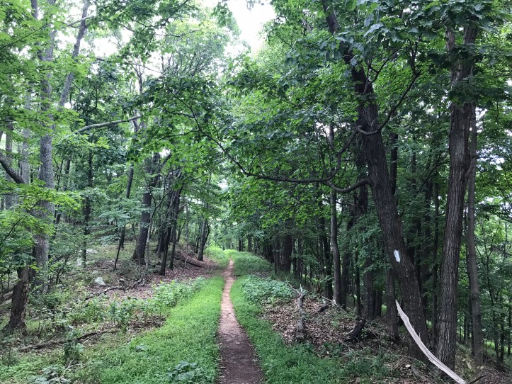
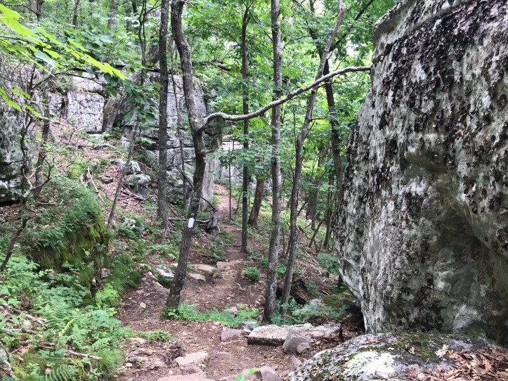
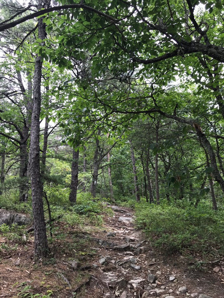
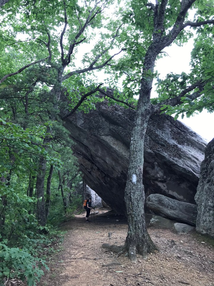
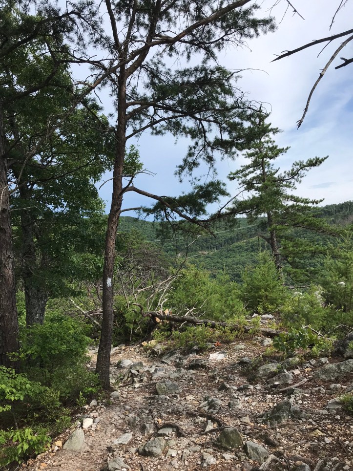
The morning started with more downhill for the first mile and a half. Light filtered in through our left and a slight, fading breeze blew over us while the birds warmed up their voices. We went down over a sharply banked trail that quickly eased up. The first mile or so was mostly sandy and then rocks crept in as we crossed a wide ridge with still air. Then came a series of doodley-doos that looked much like this the whole time:
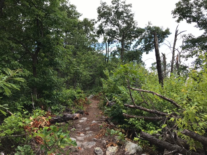
We decided on an early break because we were both hungry and exhausted by the humidity. Here are a few more pictures from the first half of the morning:
Then came another uphill and back down again where we were passed by two runners who were a minute or two apart from each other. We asked the first one where she’d come from and she said “dragons tooth.” That was a confusing distance from where we stood based on the time of day. We asked the second runner if it was a race, and she said “No, just an easy 30 this morning.” Oakland and I both grunted back at her and immediately set in on griping about her answer as soon as she was out of ear shot. Who says “an easy 30?” I wanted to trip her as she bopped down the trail in front of us.
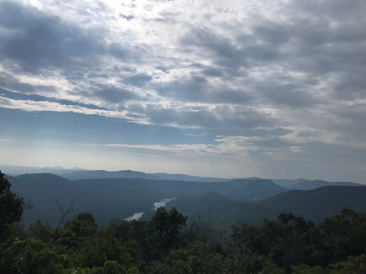
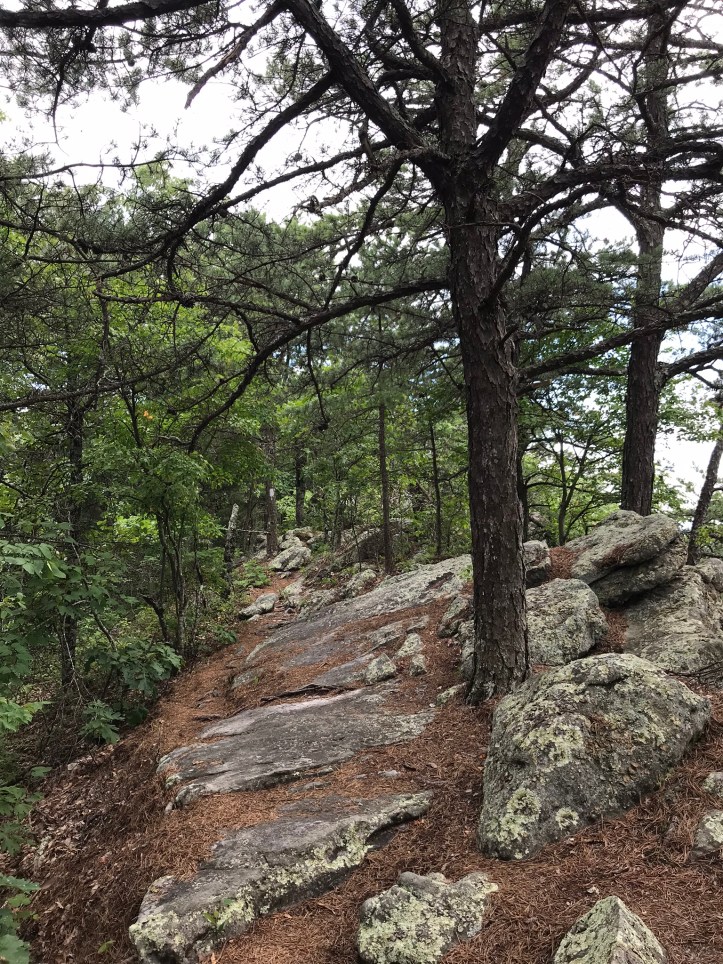
We eventually crossed an open rock face that had pretty great views of the hazy mountains around us:

Then we traversed a series of giant roller coaster hills through thick air in a sea of green with the occasional view.


Another runner passed us, but this one was in rougher shape than the first two. We leapfrogged with her as she stopped for the occasional break. I eventually dragged us at breakneck speed up one of the long hills past the runner because I was tired of trailing her, and I wanted to see if we could pass her. Oakland obliged, her trail legs showing because she kept up with me pretty easily as I succumbed to the desire to beat the runner. That hill turned out to be the never-ending 1.4 mile ascent up to tinker cliffs. Sweat poured over us as we slogged our way up to the cliffs. The runner didn’t catch up with us until later in the morning on a descent. I felt both triumphant and ridiculous for pushing us that much.

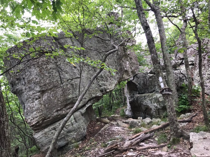
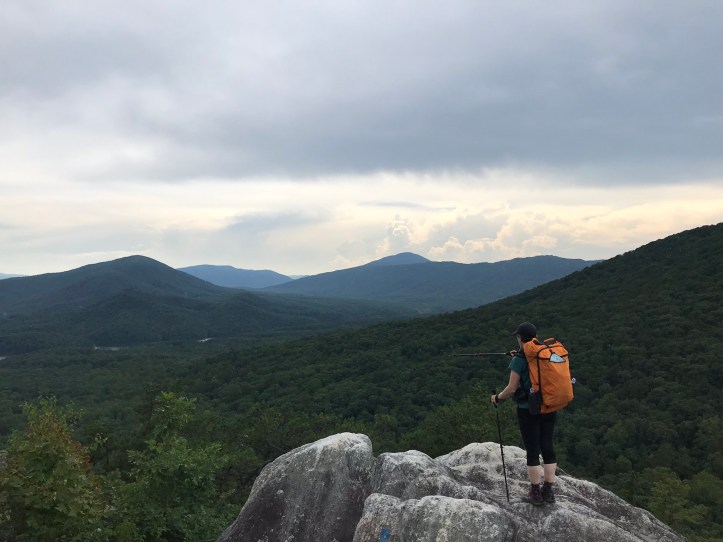
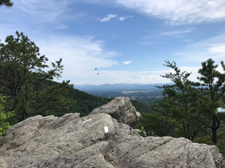
We eventually made it to the cliffs, which are a series of ledges to the left of the trail with open views of the surrounding terrain.
There were a fair number of hikers dotted along the overlooks. We heard another runner talking about his route and discovered that we had stumbled upon people doing what’s called “The Catawba Runaround,” which is a 34ish mile loop that crosses the three famous peaks in VA: Dragon’s tooth, McAfee Knob, and Tinker Cliffs. AT hikers call these 3 peaks the Triple Crown of VA (not to be confused with The Triple Crown, which is comprised of the AT, the PCT, and the CDT). Some people try to hike it VA Triple Crown all in one day. Not the craziest idea because the terrain is simple, albeit arduous at points, but I’d much rather enjoy each of those peaks rather than blow past them in pursuit of a socially constructed prize. Here’s a video from Tinker Cliffs to distract you from my judgment:
We moved on from the first overlook and covered a flat, rocky stretch where we let the world pass us including a handful of runners.

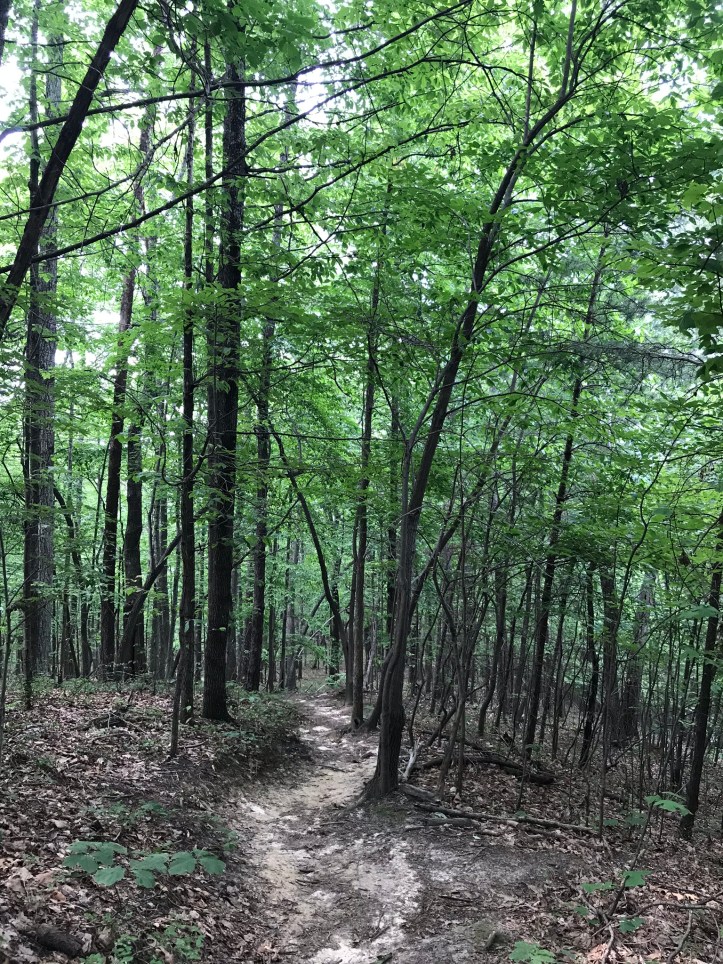
Then came a series of switchbacks over annoying loose rocks that dropped us down into a green wide open forest filled with birdsong.
We eventually saw the privy for the shelter area where we’d planned to have lunch. Two minutes later we took a right down the path towards Lamberts Meadow shelter, which is an older structure that looked like a prime spider cave. We dropped our packs amidst a cloud of tiny bees and crazy looking flies and took respective pee breaks before unpacking our food. We ate to the buzzing sound of the little flying creatures that politely and persistently hovered around us and our bags for the entire meal.
We had both been flagging for the latter part of the morning and had hoped that lunch would perk us up, but I can’t say that that really happened. We did manage to appreciate the closeness of the water source, which consisted of a small stream several yards below the shelter.
A small snake slithered into the water as we stepped down onto the banks of the slowly flowing stream. A frog plopped nearby while we took turns collecting water. When we got back to the picnic table, there were flies and bees all over our gear. They erupted in a cloud around us as we gathered ourselves to make our way north.
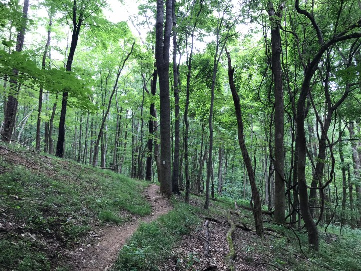
It was clearly time to bring in reinforcements, so we listened to HP as we slogged through the green tunnel. The footing was sometimes sandy and sometimes full of loose rocks, but there were easy elevation changes, so the overall effort was low. We occasionally walked through scrubby laurels and over clumps of pine needles.
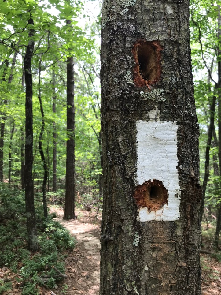
At some point, I heard a pileated woodpecker and I reached up to pause my HP while Oakland laughed at me. I can’t help myself when it comes to bird sounds. Between gazing into the trees for bird sightings and our collective picture taking needs, we are slow creatures. Here’s some handiwork of a pileated woodpecker on a tree that we passed:
Sometime in the 2pm hour, I felt the dreaded inklings of the beginning of my period. Surprise! We were nowhere near a shelter/privy, so I pulled off trail into a semi-concealed spot and confirmed my suspicions while Oakland served as lookout. Then I had the glorious task of putting in my cup with a nice view of this valley below.

When I was done, I beckoned Oakland over to see the valley and then we kept moving. The air pressed in on us and we heard distant thunder as we walked over the dry trail. We crossed a flat, sandy pine needle strewn corridor. Then came a quick climb up to a slightly higher sandy ridge that led us to boulder slabs and loose rocks. We passed straggling members of a family out for what appeared to be a few days of backpacking. Not long after greeting them, we stopped to take a break. The wind had picked up and it seemed wise to get off our feet for a few minutes, eat a snack and filter water before the impending rain. It was by no means a relaxing pit stop, but it served its purpose.
A little while after resuming the trek, we came to a dry scrubby section with a momentary view of a river that was followed by less depressing high hillside to the left and sloping steeply downward to the right. There was very little ground cover and a nearby mourning dove cooed at us. The thunder continued to increase, but there was no point in really picking up our pace because we had a ways to go before hitting Daleville.

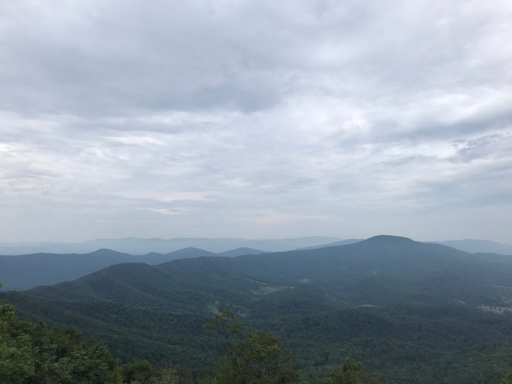
We scrabbled up the occasional hill and crossed beneath a set of power lines with a rocky, unsightly side trail that proved worth the detour because it led to this view:
Then came a rollercoaster ridge with variable footing. Sometimes it was a rocky mess and other times we padded across soft clumps of pine needles strewn across sand. We took another short snack break with the company of a thousand flies and did our best to remain upbeat in the browbeating humidity. Here’s Oakland underneath a giant rock slab for a little perspective.
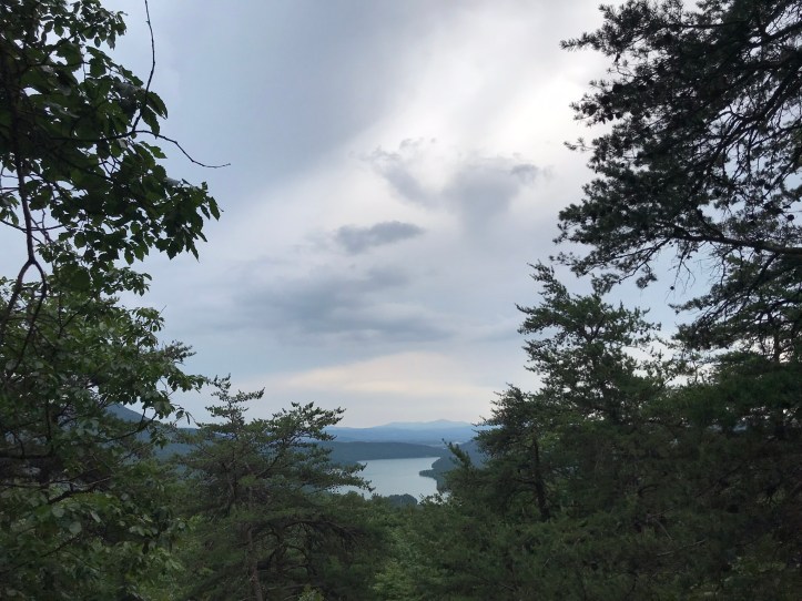
Then we went up over boulders and across a rocky dry ridge that led to another power line crossing with an intense buzzing, a flurry of bird activity, and this view of the nearby Carvin Cove Reservoir:
We took a few turns and wound around a set of switchbacks that dropped us behind the power lines, adding the dulcet tones of road noise to our manmade soundtrack.
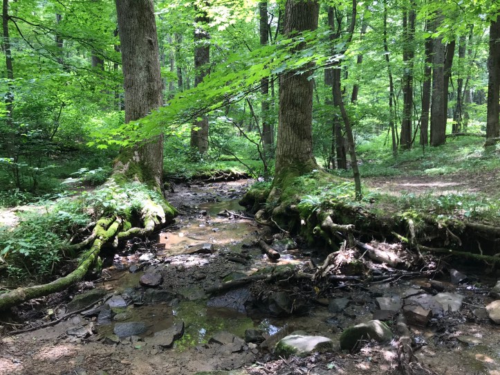
We wound our way through pines and hardwoods over soft trail and eventually crossed tinker creek (sorry, no picture) and a set of railroad tracks.

Then came a short climb that leveled out to a muggy, dense forest with low trees and little light. At that point, I was so ready to be done and the bugs had intensified, so I gave up on taking pictures. The road noise increased until we finally popped out onto a 4 lane business highway with our Super 8 in sight. We carefully crossed the major road (Appalachian “frogger” time) and walked through the edge of a gas station parking lot, past our soon to be beloved Pizza Hut and down the long driveway to the hotel.

The front desk was littered with American flags. We wandered through the air conditioned hallways to our second floor room and dropped our bags on the carpet. We immediately decided that food needed to come before showers, so we both changed our shirts (oh, the futility of that gesture) and walked over to Pizza Hut.
The 3 minute walk made me realize how fried I felt and how much I had no desire to be in direct sun. Task rabbit and her partner met us there and talked to us while we plowed through our salads. The duo weren’t planning to order food, but they ended up getting pizza anyway. They also invited a hiker friend they know named samba who joined us for a few minutes towards the end of the meal. She’s having some challenges with her hiking partner that we talked about briefly. We also found out that task rabbit will be jumping ahead 200 miles to side-step her pink blazer.
Oakland and I both tapped out on the social time pretty quickly and said goodbye after finishing our food. We got back to the room to find our neighbor, who happens to be “Heard the Call,” practically shouting in her room. Poor Oakland was devastated at the thought of having loud neighbors ruin her sleep yet again. We made a back-up plan and tried to let it go rather than dwell on what could happen. Then we threw most of our clothes in the laundry (again, even though we just did laundry) and took showers. We sat on the bed in our air conditioned room and ate the last two pieces of our dinner pizza while we watched softball championships and a thunderstorm raged outside. Oakland was in heaven. Tomorrow is a zero day! I’m finishing this to the sound of the AC (which I hate, but which is a necessary evil right now), thunder, the Toby Maguire Spider-Man movie, and the occasional small child shouting in the hallway. Heard the Call is blissfully quiet for now.
Mile 714.3 to mile 729.7 (15.4)
Checklist total miles: 738.5
Oakland total miles: 259.1
Creature feature: a cedar waxwing on mcafee knob, a chickadee at lunch, the snake in the stream, a few frogs, several lizards, the turtle, a thousand gnats, and the dogs on mcafee knob.
