August 8, 2019
Oakland woke me up around 5am. We lay in bed whining and generally being lumpy until about 5:15. We donned our hiking clothes and muddled through the morning routine. My yogurt and granola breakfast twisted my stomach again. I did a final gear check and Oakland made sure she had snacks and water for her drive home. We were on the road to Shenandoah by 6:40am. The roads were relatively empty in our direction so we made good time with just 1 rest stop on interstate 81. Oakland turned into the small gravel parking area for Reeds Gap at 9am. The night before, we had hatched a plan for Oakland to hike with me for 2 miles, head back to the car and meet me at the next road crossing for an orange soda and a snack.
The cicadas were already in full swing when we got out of the car to slather on sunscreen. I had a weird sensation of having never left VA because we were in the same spot we’d stood on July 14th, yet we’d hiked over 200 miles in Maine and survived the dreaded Katahdin summit.
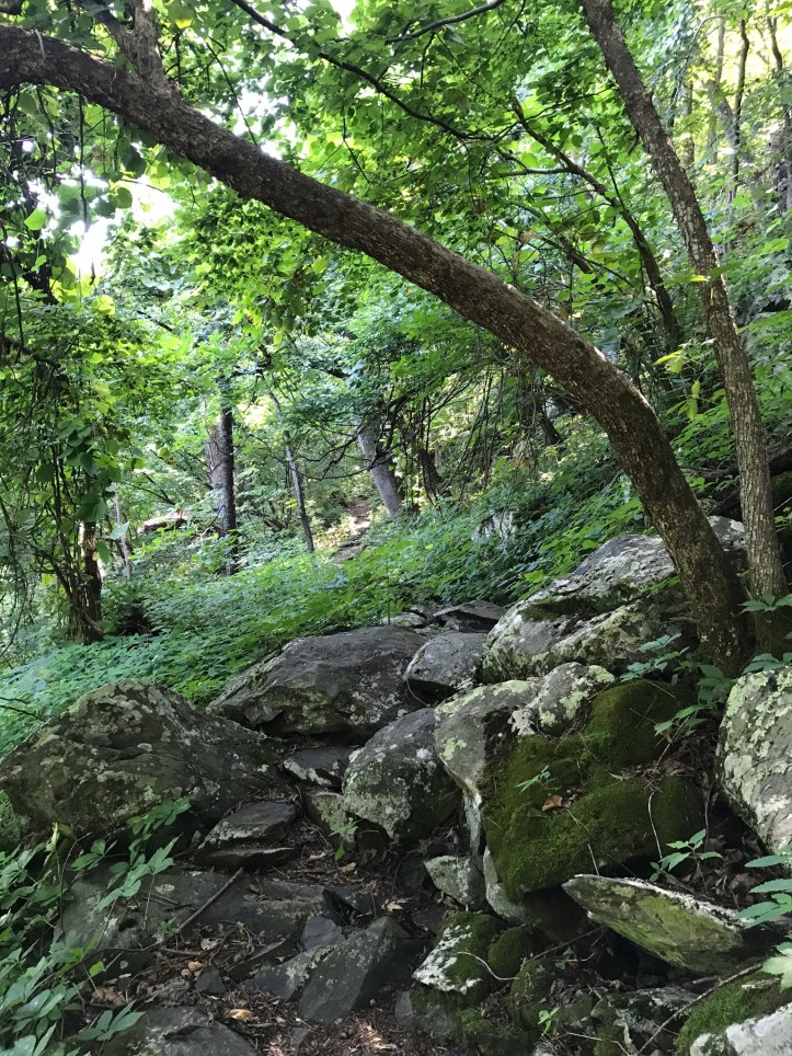
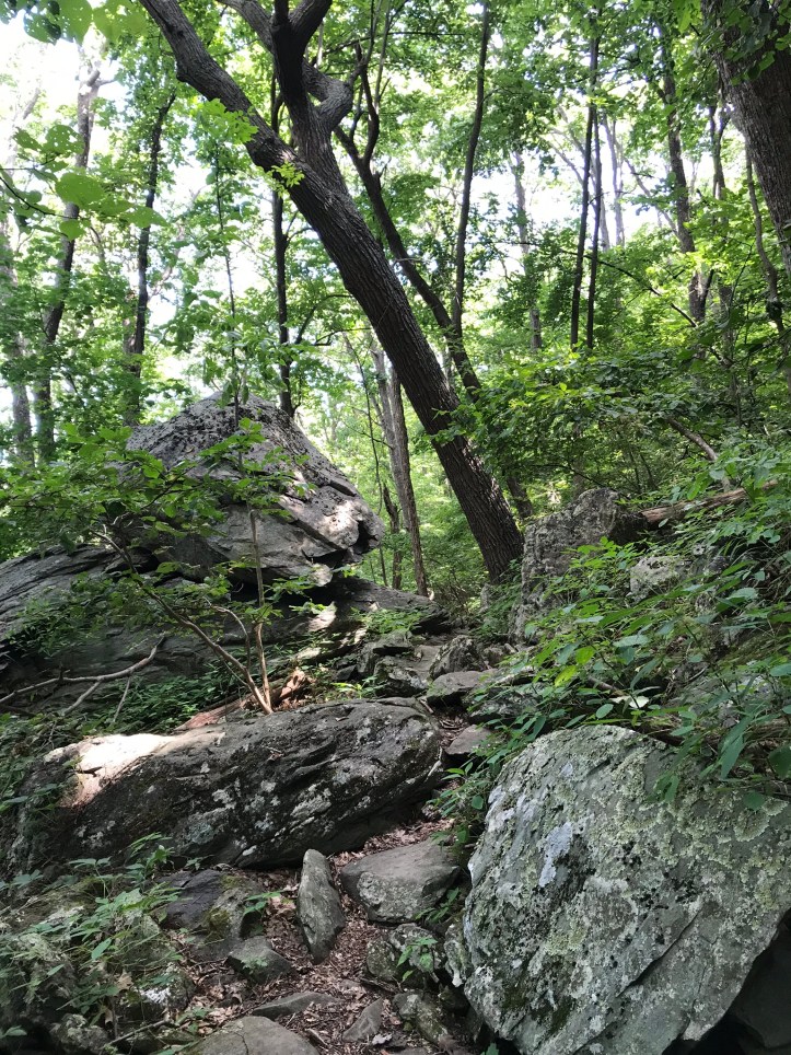
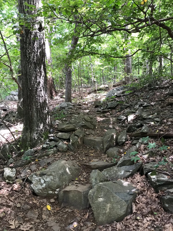
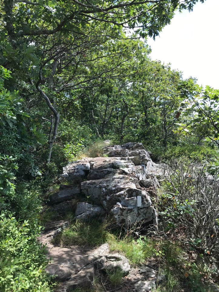
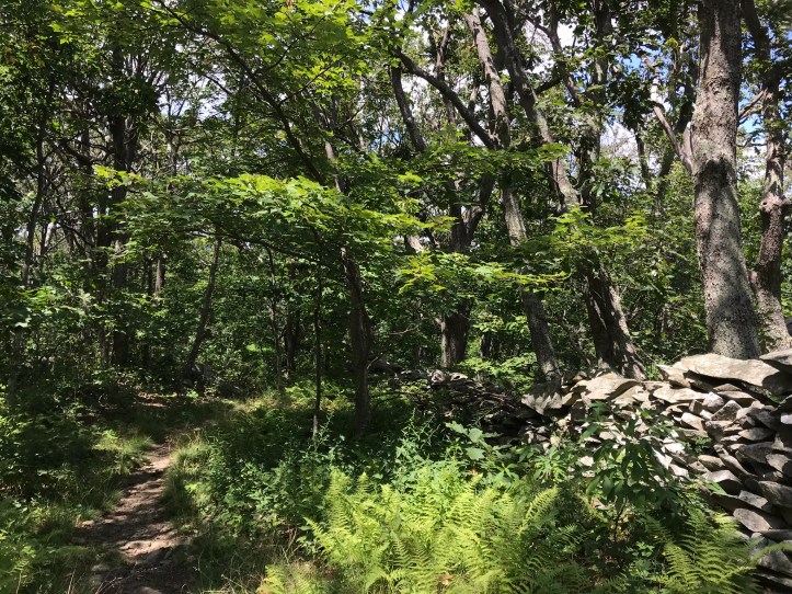
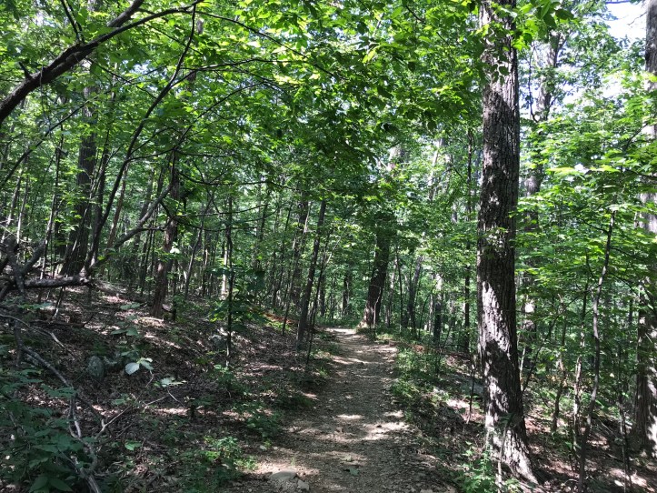
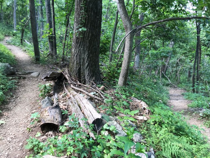
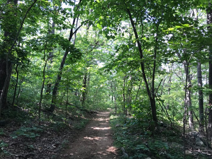
We crossed the busy road and headed into the woods. We passed a small green field that turned into a green tunnel with a fair number of rocks. I’d forgotten about the rock piles of VA, and I was sad to see them because I had imagined smooth sailing after the wilds of Maine.


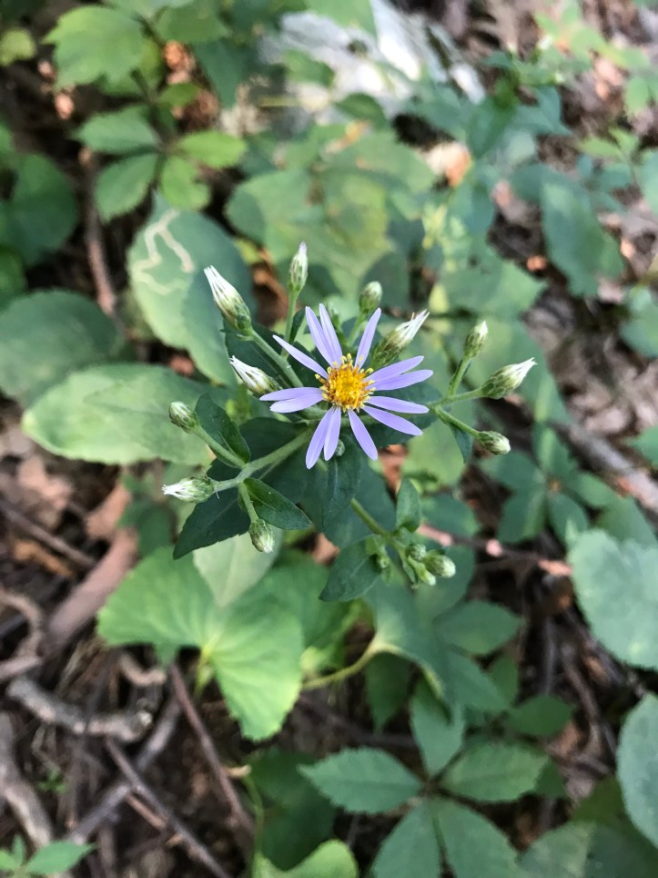
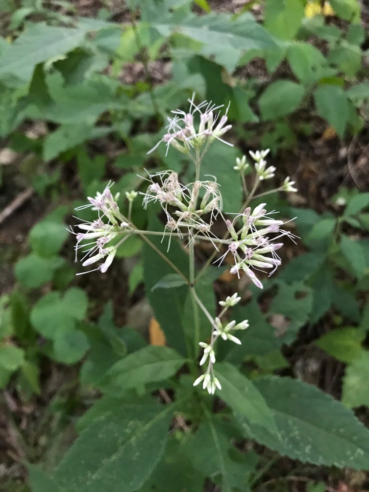
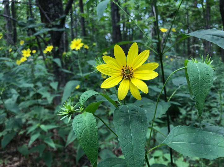
Thankfully, the slate jumble didn’t slow us down too much. Spider webs occasionally broke across my face as the cicadas continued to provide a classic VA soundtrack. I stopped to catch a few new-ish wildflowers:
I dreaded the moment Oakland would drive away for good. It was going to be hard to transition back to solo hiking. I had gotten so used to Oakland’s steadfast and enjoyable company, meltdowns and all.
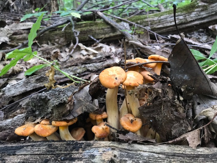
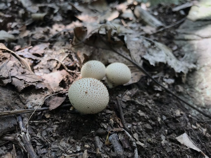
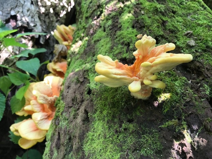
We reached the 2 mile mark and paused in the middle of the trail to say our first goodbye of the day. There were tears and hugs before we both made resolute turns in opposite directions. I tried not to look back, but I couldn’t help myself. Oakland was more unwavering than me, and I watched her disappear down the trail before turning northward. The woods immediately felt flatter. I spied a clump of mushrooms and stooped down to take a picture for Oakland.

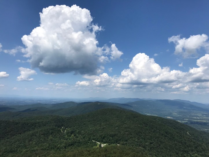
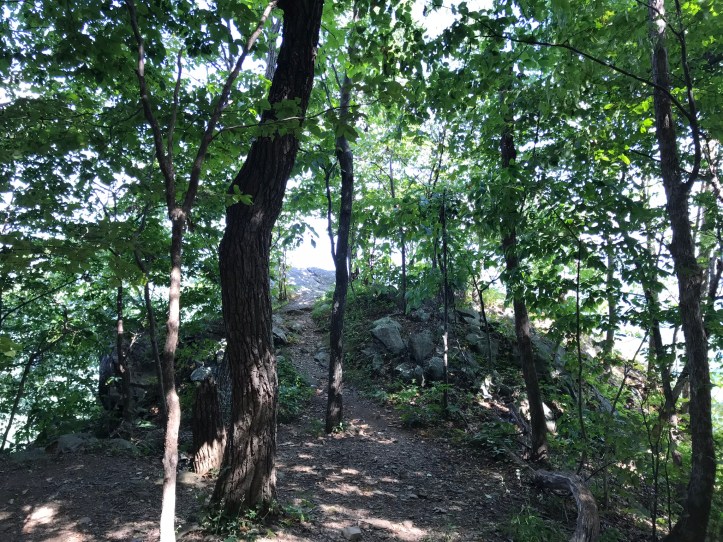
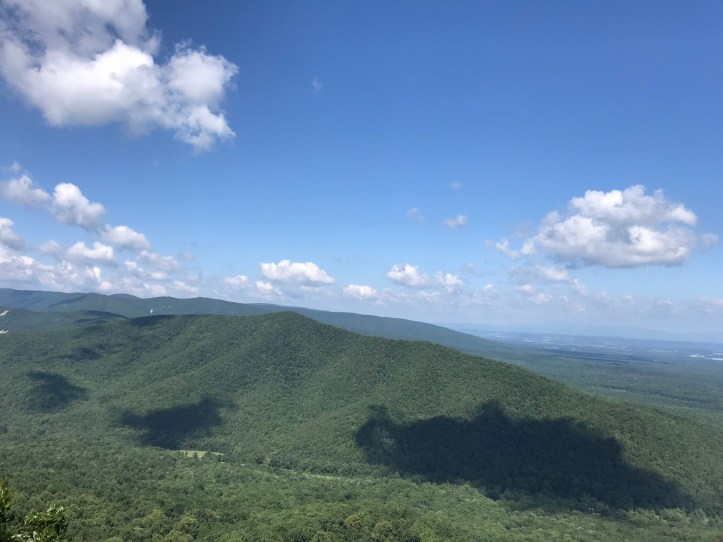
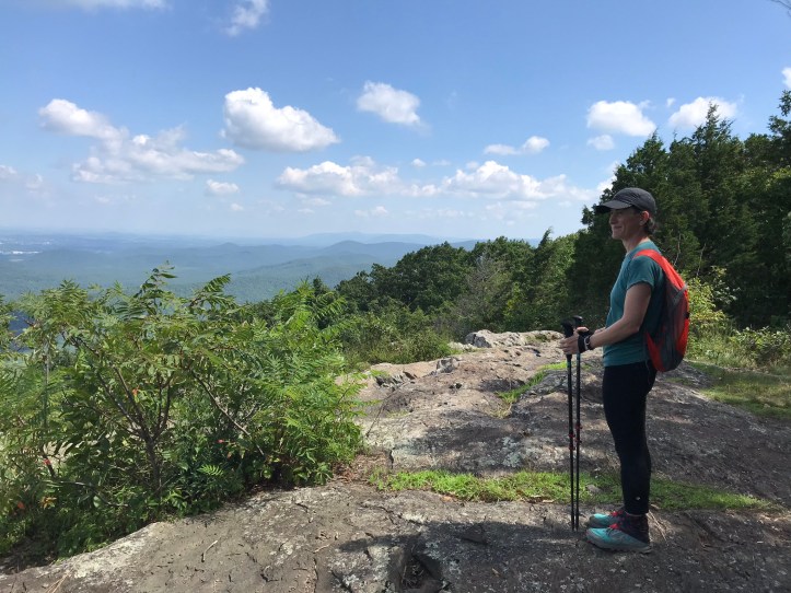
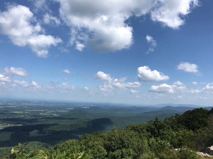
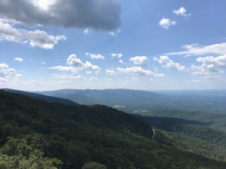
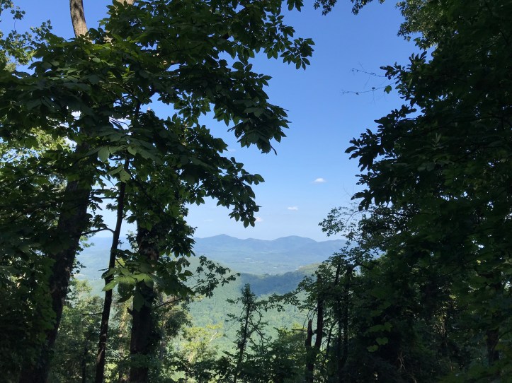
A little while later, I reached a side trail to an overlook, and I forced myself to engage with the view rather than completely mope my way through the woods. I dropped my pack at the intersection and walked to the rocky outcropping where I found a good view of the mountains to the left of the trail and Waynesboro.
I took a quick pee break on the way back to my pack. A few minutes later, a southbound hiker asked me about water with a desperate edge to his voice. I told him there was a stream with a low flow south of us. Given his tone, it seemed wise to ask what kind of water options lay ahead of me. I can’t recall his answer, but I know he told me that I was facing a huge mountain to the north of us. After Maine, I’m not sure what I’d have to see in VA to feel like I was on a “huge mountain,” but I kept my opinion to myself and thanked him for the information. We parted ways, and I took a moment to check the terrain between myself and Oakland. I noticed that she could get one more view if she hiked about a half mile from her parking spot, so I texted her with the idea. She jumped at the chance for more hiking and agreed to meet me at the overlook. I could feel the antsiness in my step as I put my phone back in my chest pocket. I knew we were prolonging the inevitable, but why not?
I reached the overlook about 2 minutes before Oakland. I had a 14 mile day planned, so we didn’t dally too long, but we took a minute to enjoy the sweeping skyline of mountains before hiking towards the road.
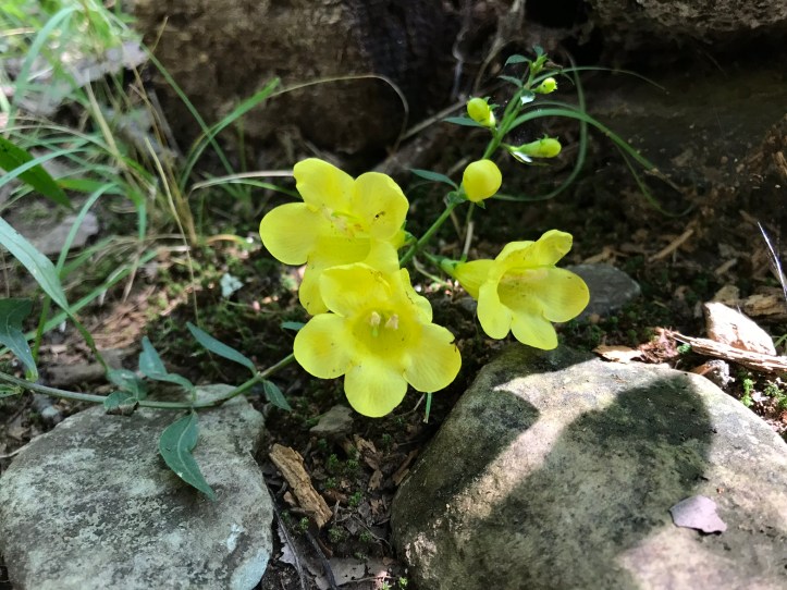
We crossed some slabs and the trail eased back into a green tunnel until we hit a sharp rise to reach street level. This little yellow friend stood out enough for me to pause for flower picture number 7,843
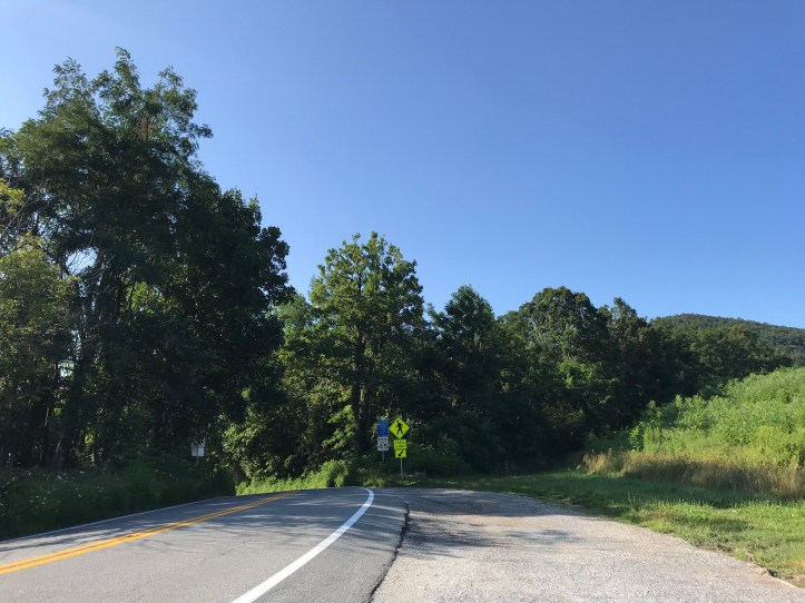
A trio of cars were parked in the small cutout for the aptly named Dripping Rock parking area. Oakland grabbed our refreshments out of the car, and we sat on a rock near the roadside spring.

I joked that it should have been called dripping nose parking area because our impending goodbye had turned us both into a soggy mess. It was 11:40am when we arrived, so I decided to just eat an early lunch instead of the previously planned snack. I have no idea what we talked about, but I know we were both severely mopey, while also happy to be sharing an orange soda on a humid summer day. After another round of hugs, we said goodbye and Oakland drove away at 12:25pm.
I turned away from the blacktop and headed into the woods. The trail gradually ascended, thus adhering to the up after lunch requirement. A few minutes from the road, I found a water stash with a note from “naturist dave” detailing the provenance of the water.
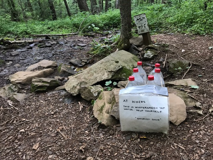
I had almost full water bottles, so I left the resource for someone who actually needed it. As I walked through the green tunnel, I followed my sadness protocol which entails putting one foot in front of the other while doing my damnedest to find small bits of beauty or curiosity, such as another clump of mushrooms.
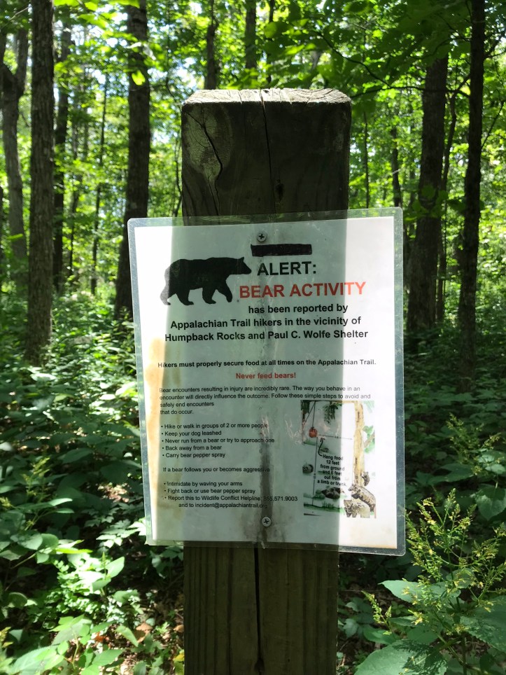
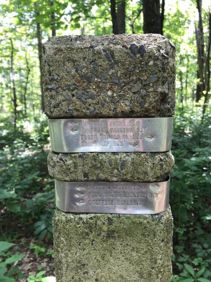
There was a modest climb over a smattering of rocks with a handful of steps here and there. I passed a bear activity alert for humpback rocks and Paul C. Wolfe shelter, which made me simultaneously cranky (humans & littering) and wary (I had plans to camp at that shelter). I also stopped to admire the engraved metal bands that serve as mileage markers. They always remind me of my first overnight trip in the Shenandoahs with a close friend back in the early 2000’s.
A couple of southbound day hikers with a dog asked me if I needed anything, clearly giving away their experience of meeting long distance backpackers. I told them I’d just started back from a break, so I was all set. One of them asked me my trail name, and she laughed when I told her it was Checklist. We went our separate ways with friendly goodbyes.
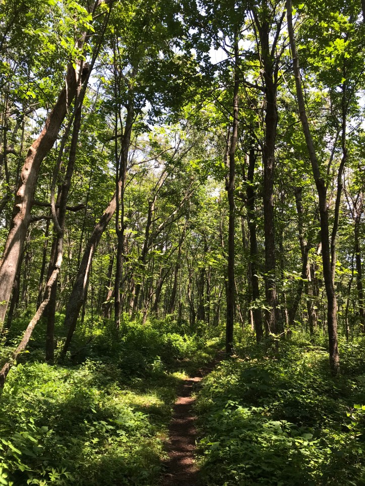
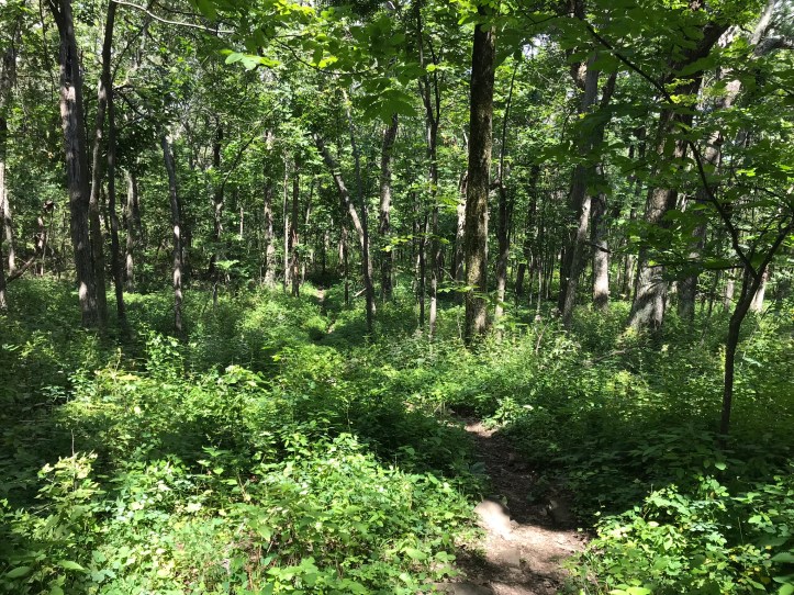
Waist and sometimes shoulder-high greenery lined the sides of the trail. Stinging nettle brushed my exposed legs a couple of times, leaving my shins itching and stinging for several minutes at a time.
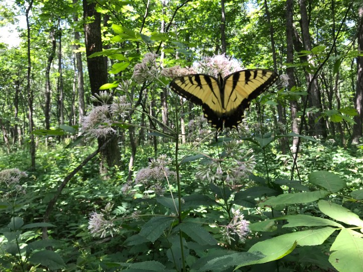
Swallowtails floated around me and took great interest in a ragged looking cluster of blossoms from a particular wildflower. There was just enough breeze to give my camera fits, so here’s an out of focus picture of one:
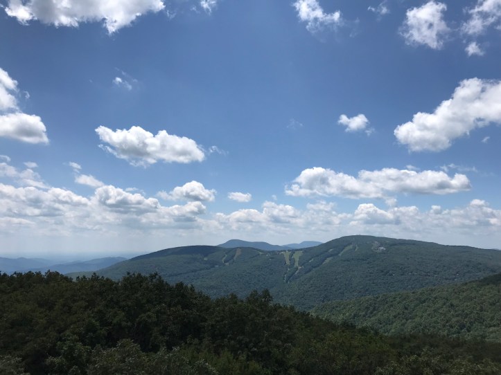
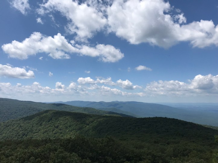
At some point on the climb to the Wintergreen view, I heard a flap of wings and looked up to find a ruffled scarlet tanager about 10 feet overhead. At this point, they weren’t an uncommon sighting, but their brilliant red feathers always stopped me in my tracks. I admired the tanager for a moment before continuing to the view of Wintergreen ski resort.

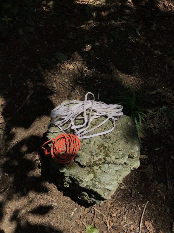
The trail skirted the rocks for a minute and then dipped back into the woods where I saw a stealth campsite. Someone had neatly coiled two pieces of line and left them sitting on a rock. Trail magic for someone in search of rope, I suppose.
I hiked to the soundtrack of crescendoing cicadas and the distant roar of planes. A frequent and cooling breeze blew through the woods, which I very much appreciated. What I did NOT appreciate was the loose rocks and the continued assault from overgrown stinging nettle. I also kept stubbing my right foot, which obviously led to cursing. I stopped for the occasional mushroom picture (something I used to do frequently before Oakland took over the all important fungi documenting) and noticed a stone wall that someone put a lot of work into.

I eventually reached the blue blaze for humpback rocks. I checked my watch to see how the detour would fit into my day, and I heard a tweet that belonged to an American goldfinch. I watched its bright yellow body with dark wings and a dark cap. The finches in Oakland are primarily (or exclusively?) the “lesser” goldfinch, which are not as intensely yellow as the American goldfinch.
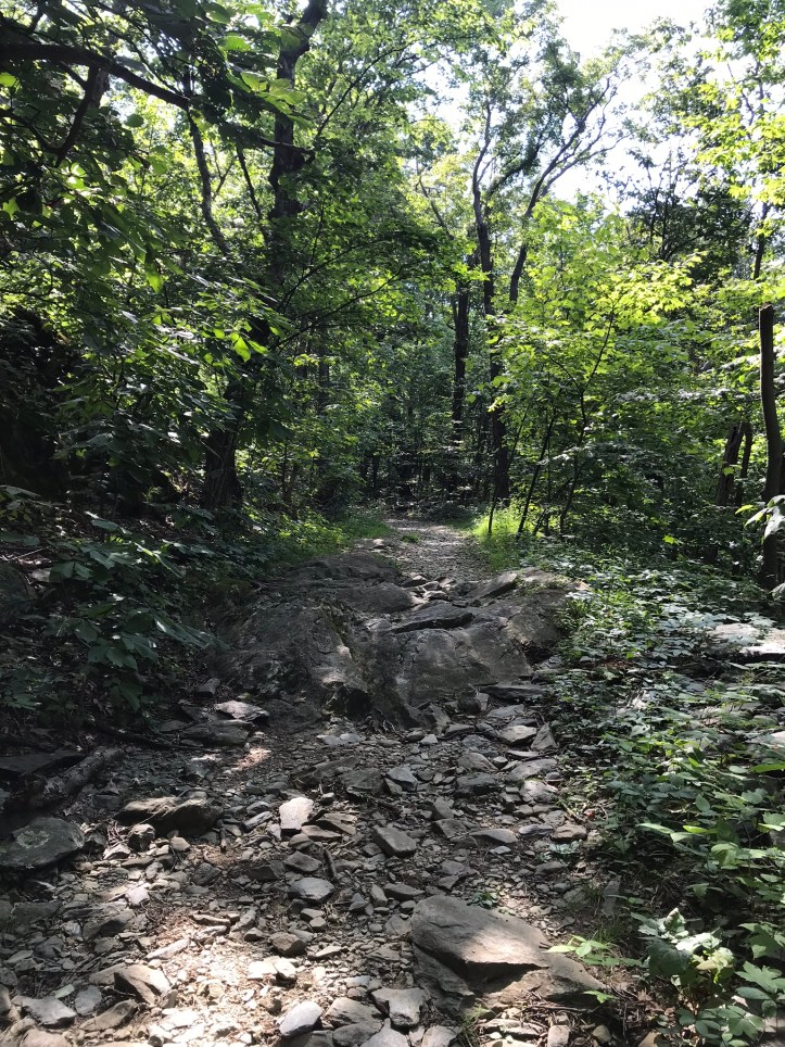
The side trail to Humpback rocks wasn’t very steep, which gave me a good gauge of what VA guthook commenters think is steep versus what Maine guthook commenters rate as steep. I grumbled about the loose rocks while I felt sanctimonious about how easy the trail was compared to Maine.
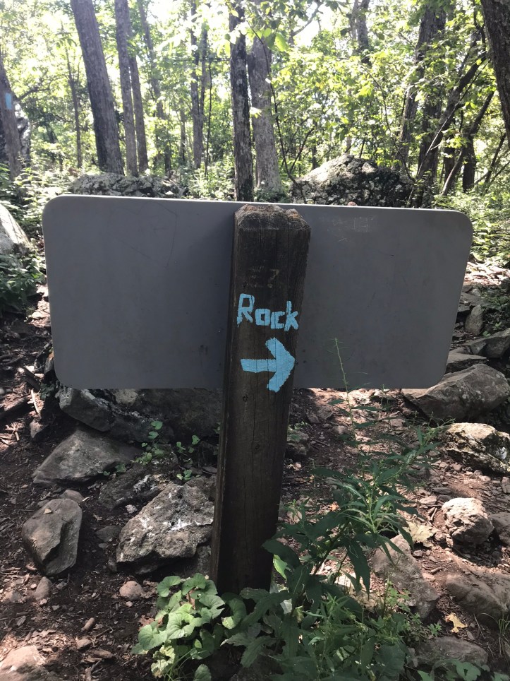
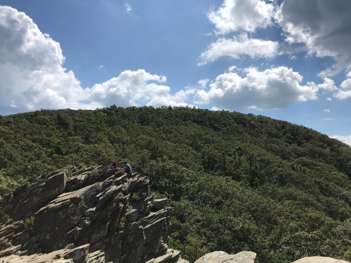
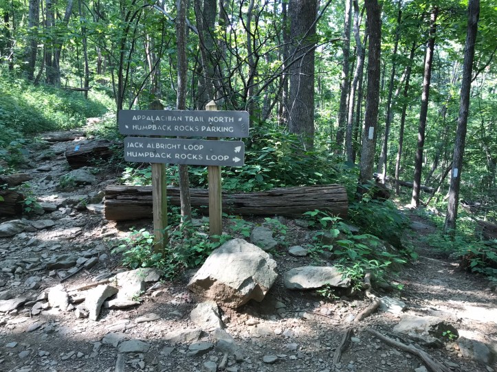
Not far from Humpback rocks, I came to a busy intersection with multiple signs. Someone had scrawled “rock” in blue paint with an arrow. I followed the graffitied instructions and came to base of the large, rocky outcropping known as Humpback rocks (the formation looks like breaching whales). For whatever reason, there’s also a massive pile of rocks at the short side trail that leads out to the formation.


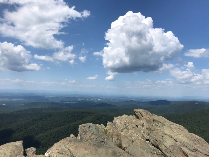
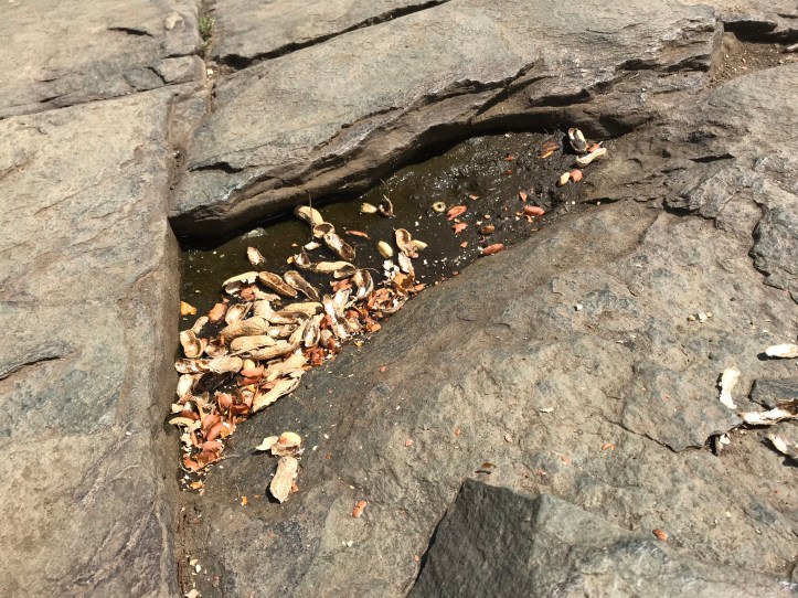
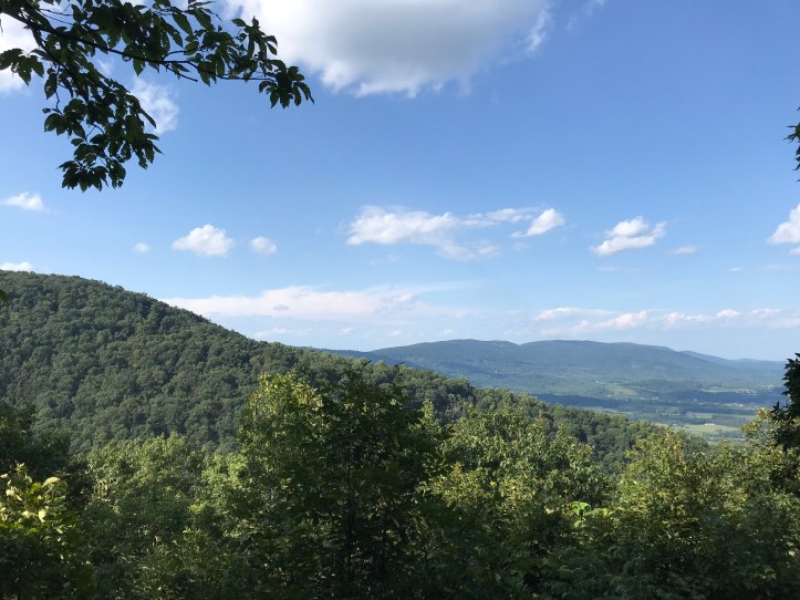
A small clump of day hikers gathered on the left formation, so I dropped my pack and scrabbled towards the right to take in the views and get a few pictures (one of which is today’s top photo). I’ve actually been here before on an impromptu hike during the long drive between Swannanoa, NC and my old apartment in Brooklyn, NY. It was strange to stand in the same place with so much life between then and now. Peanut shells littered the overlook, which sent a wave of irritation through me. No wonder bears are an issue around here.
More day hikers arrived as I climbed back down the rocks. I slung my pack over my shoulders and headed back to the AT, happy to be alone for the moment. The left turn back onto the trail was the start of a little over 3 miles of descent. There were a plethora of switchbacks, a welcome flat stretch in the middle, and a few sections that had smooth footing, which was a relief from the somewhat steady stream of loose rocks. All in all, I’d lucked out with a mild, sunny day for VA in August.
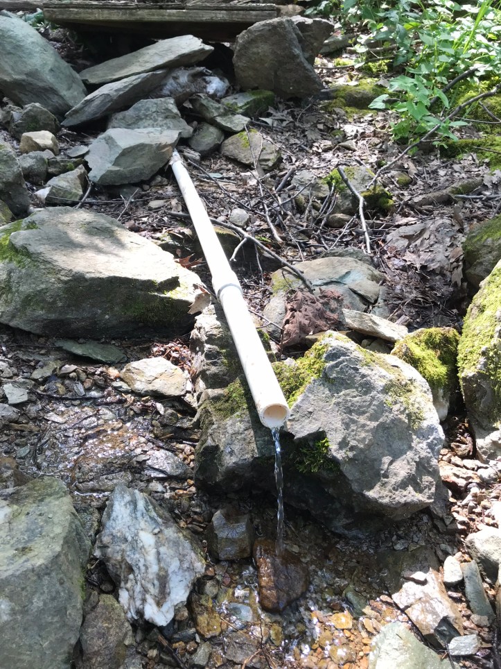
With about 4 miles to go, I stopped at a piped spring to fill up and eat a snack. A small column of water flowed out of the pvc piping, but it was more than enough to work with, and it was delightfully cold. A couple of day hikers passed me while I crouched in front of the pipe with my sawyer bag.
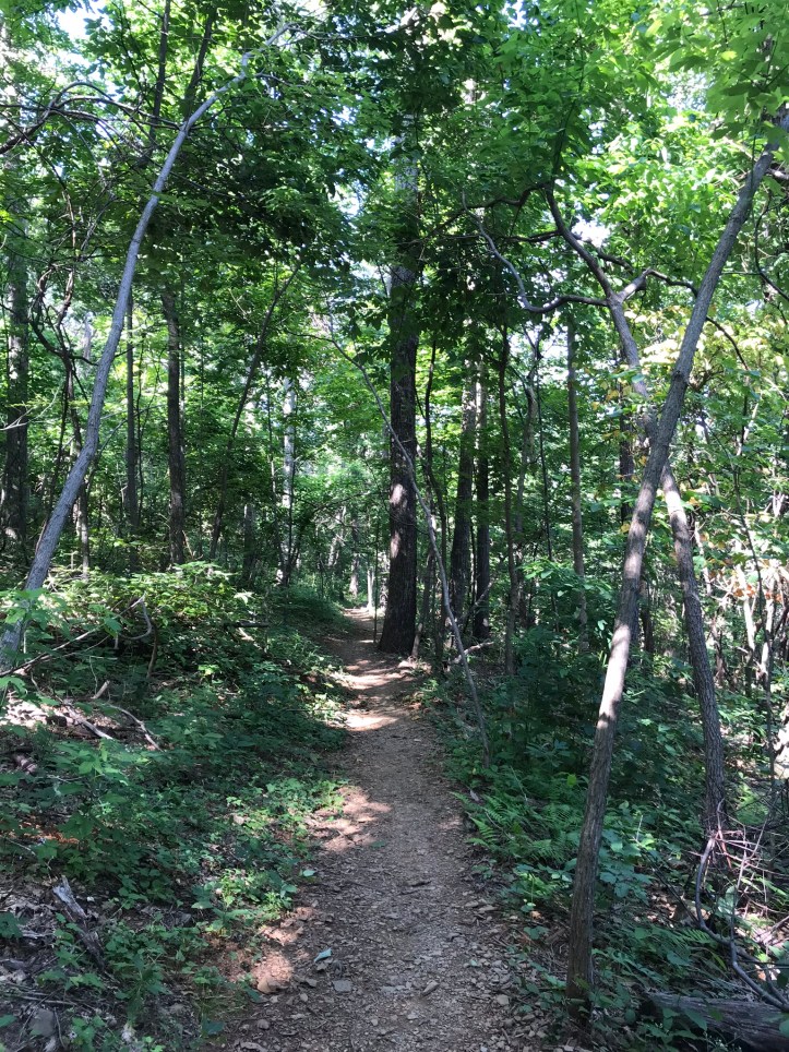
Sadly there weren’t any decent seating options, so I refueled while standing and continued on my way. I covered an easy stretch of trail that was followed by an increase in rocks that felt like walking in a dry stream bed.

Right after I took that last picture, my right calf exploded in fiery pain. I quickly switched my right pole into the other hand and swiped at my leg, knocking off an unknown winged creature that had just buried its stinger in my calf. A welt formed immediately, and the skin around the sting reddened and was hot to the touch.
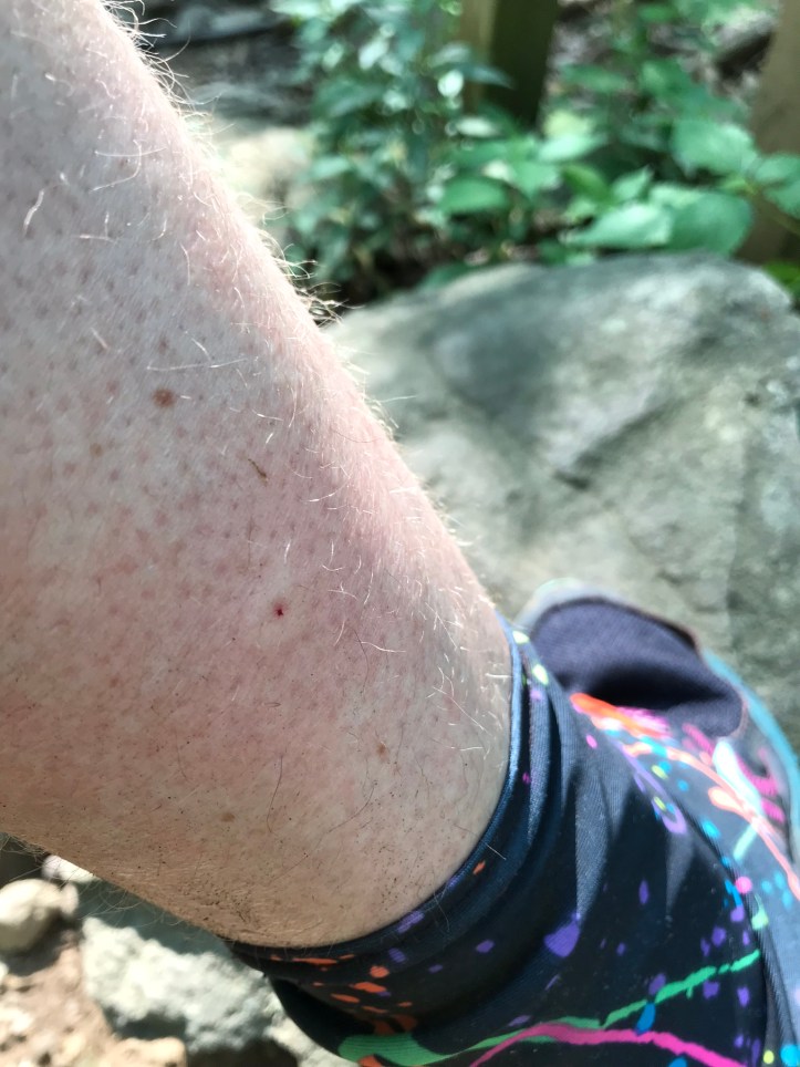
Cue second cursing spell of the day. My leg hurt. Thankfully, I’m not allergic to stinging creatures (or so it would seem based on the variety of things that stung me on the AT). I drank a few sips of water in the shade, and took a right at a fork in the trail to stay on the AT.
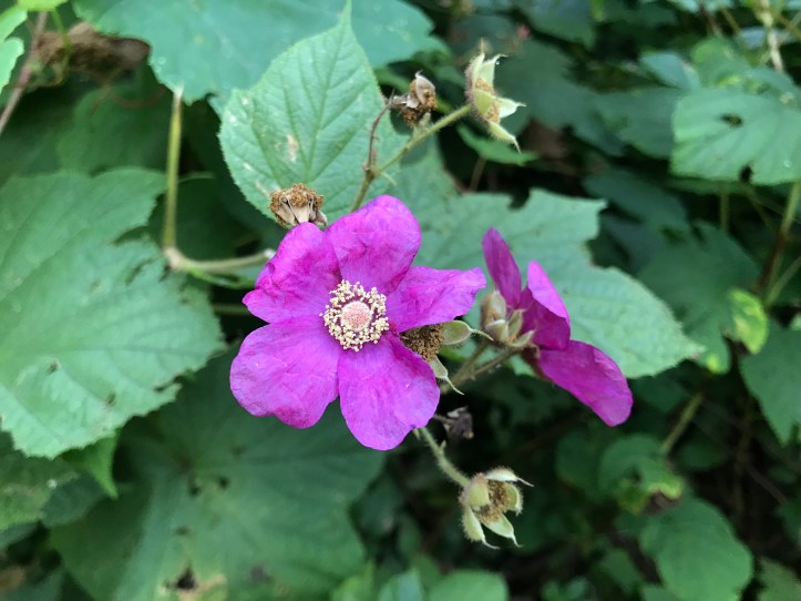
A southbound hiker slowly approached with a full pack on his back and a school bag hanging from his front. He was quite the sight, and he had that same desperate tone I had heard from the hiker this morning when he asked me about water sources. I told him the piped spring a couple of miles back would have what he needed, and we went our respective directions. I continued over loose small rocks as the trail wound me down switchbacks and other small twists. About a mile from the shelter, I came across a small but satisfying view of the nearby mountains and a purple-flowering raspberry plant.
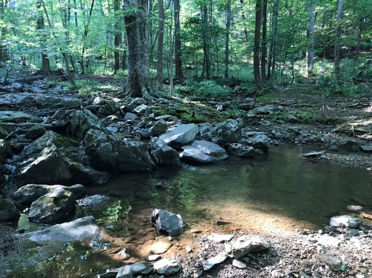
Not long after, I heard a pileated woodpecker call overhead, and I stopped in my tracks to watch two more of the flying dinosaurs take flight about 20 seconds apart. Around and around the switchbacks I went, until I finally heard the babbling sounds of Mill Creek. I checked the map and was surprised to see that I still had 0.3 miles to go. The water was so loud, I had expected it to be right around the corner.
When I reached the creek, I was relieved to see that it would be a breeze to cross. Nothing like the treachery of Maine.
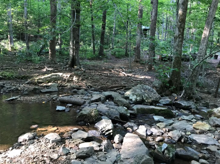
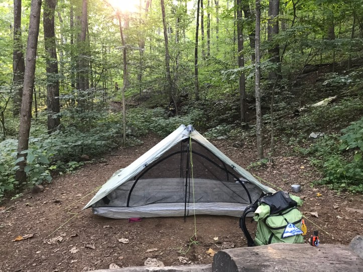
I noted the tenting area to my left and continued to the shelter to see what it was like. A hiker sat at the picnic table in the gargantuan “porch” of the shelter. I dropped my pack and proceeded to have a frustrating time trying to get him to understand the structure my hike (he asked). At one point, he said “oh, so you’re just doing a small section” and I tried to hide the exasperation in my voice when I said, “no, I’m a thousand miles into my hike.” He told me about the structure of his flip flop hike and his plans to have various friends help him “flop” up to Maine and eventually Katahdin. I tried to tell him about the insanity of the hunt trail without sounding like too much of a fear monger.
After our extended chat, I took a moment to rejoice at the sight of the metal bear pole (no throwing of rope for me!). Then I left my food and cooking gear at the shelter table and went down to the tent sites to set up my home for the evening. I was tired and hungry, and I clearly should have eaten more throughout the day. I half heartedly cleared my intended site of small rocks. It wasn’t nearly as much fun to groom the ground without Oakland there to make fun of me. The tent stakes went into the rocky soil easier than I expected, and my duplex was up in a matter of minutes.
I didn’t have the energy to set up my bed before dinner, so I threw my pack inside and went back to the shelter. I made a packet of “cheesy noodles with green peas” for dinner and accepted an offer of additional peas that had been given to the flip flopper by a day hiker. Sadly, I put too much water in my bowl, which made the meal pretty bland. I forced it down while I had a decent but somewhat manic conversation about the hiking community and idiotic bear/food practices we had both witnessed. It turns out the flip flopper had stayed at the Punchbowl shelter that Oakland and I had avoided, and his food had been stolen by the infamous raccoons! He’s also gone so far as to throw his food bag on the shelter roof to avoid having it stolen by bears. Not sure how I feel about that plan, but it worked for him. I told him that hikers generally don’t hang their food in Maine, and assured him that I’d been horrified at first, but it had worked out just fine for everyone I’d met.
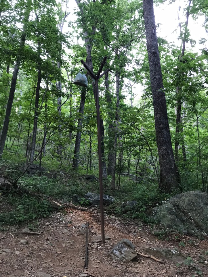
After dinner and dishes, I ate a few Fritos and half a Twix for dessert. I brushed my teeth with last of my water and somewhat gleefully hung my food on bear pile. I say “somewhat” because it was hard to get my newly stocked food bag so far up in the air while also wielding the heavy metal rod that hikers use to lift their bags. I was keenly aware of how impossible that same task had been with one functional arm when I’d tried it back in 2017.
I said my goodnight to the flip flopper and went to finish my evening chores. I grabbed my water filtering gear and had an easy time filling up at the stream. I didn’t bother collection extra water because the sources for the first half of tomorrow seemed good according to guthook. Then I went through the tedious task of setting up my bed while I pondered my plans for tomorrow. I had two basic options that would not involve stealth camping, which I was loathe to do alone in highly populated bear country. I could hike just under 13 miles to the next shelter or 25.7 miles to the shelter after that. One option felt too short and the other option felt way too far.
I changed into my evening clothes, taking care not to graze my angry sting. It was hot to the touch and fluid had begun to collect around the front of my ankle, all of which was unpleasant, but not too worrisome. I looked at the map while I waited for Oakland to be ready for a short phone call with my floppy, but functional phone service. I felt pretty pathetic while we talked. The tent was empty without her, I was anxious about bears, and I couldn’t decide how to plan my next day. The moon shone through the tent while Oakland listened patiently and told me a few stories about her afternoon. We reluctantly said goodnight around 8:30pm to maximize sleep and minimize battery drain. I wrote the basic bullet points for the day in my notes and crossed my fingers that I could piece the rest together with pictures and map data. I’m finishing this to layered sound of nighttime bugs and the low rush of the stream. I’m hoping the bugs will drown out the bear footsteps that I’m bound to hear in the middle of the night.
Mile 844.6 to mile 858.7 (14.1) – Paul C. Wolfe shelter
Checklist total miles: 1079.5
Oakland total miles: 592.8
Creature feature: the pileated woodpeckers! A few frogs, many pesky squirrels that all made me jump, the tanager, the goldfinch, so many butterflies and daddy long legs everywhere.
