
August 4, 2019
I slept with my head inside my sleeping bag for half the night to stay warm in the chilly Maine air. Thanks to an eager bladder, I tossed and turned from 4am to 4:45 when our alarm went off. Oakland started rustling around before me, but I asked her if I could have first dibs on the privy because I’d been squirming for so long. I stiffly made my way to the chateaux de poo and reveled in the luxury of “free” toilet paper. It was so relaxing to not worry about whether my arms were going to brush up against an 8-legged acquaintance because the walls were well away from the drop toilet. I passed Oakland on my way back to the tent and whispered to her that I would retrieve our food bags from the bear cables. I hadn’t put on my ankle brace for the privy trip, so I paid extra attention to where I stepped as I made my way past OSHA’s tent and over the exposed roots in the dim morning light.
I decided today would be a good day for eating breakfast in bed, so I changed my clothes, packed up most of my gear, and cozied up in my sleeping bag with my jar of skippy and a Probar. Oakland also chose the luxury of a warm bed for her last trail breakfast of the trip. Sadly, she had a shoddy night of sleep because she’d been too worried about crowding me on the sloped tent pad. By the time we packed our spic and span tent, OSHA had emerged and was rummaging through his food at the picnic table. We poured water from the platypus into our bottles and split our remaining unfiltered water between our sawyer bags. Neither of us are keen on relying on seasonal springs, but we also decided to go easy on our water supply to keep our loads as light as possible.
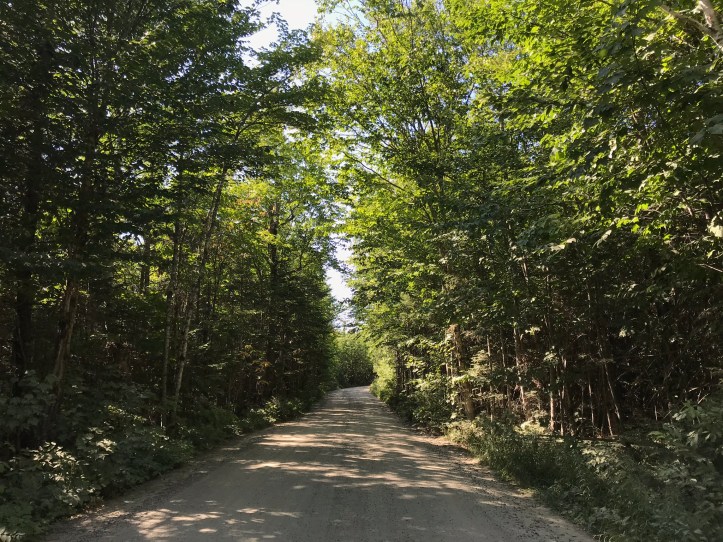
We brushed our teeth and went through the tedious process of applying bug spray to nearly every inch of our bottom halves. We said our goodbyes at 6:04am and walked down the gravel road towards the ranger station.

It was a pleasant stroll without the presence of cars to kick up dust. We picked out 2 larger day packs for our stuff and took them out to the picnic table to rearrange our gear. A lot of AT hikers carry the park’s day packs up the mountain, but we made the choice to offload most of our gear and use our own backpacks for the trek. We quickly realized that there was no way our unneeded gear would fit into the day packs, so we decided to leave the larger items in our compactor bags on the porch and tucked the smaller stuff from our outside pockets into the park’s day packs. We made tidy piles in the corner of the ranger’s porch and made the safe assumption that it would all be there when we returned. As we rearranged our gear, I got miffed about the weight of my pack compared to Oakland’s. I can’t remember the details of whatever infinitesimal inequity I perceived. Oakland disagreed with my assessment and got cranky with me for obsessing over differences she couldn’t see (real time editor’s note: Oakland was probably right, and I was clearly anxious about our summit hike). I apologized for getting snippy, and we continued divvying up our gear without further issue. Despite the static, we were still making good time as we walked away from the ranger station at 6:25am. We headed back up the side road towards the start of a detour that the park had created to reroute hikers around a washed out footbridge over Katahdin Stream. We were allowed to take the original Hunt Trail starting point, but neither of us had any interest in fording a stream in the first mile of an unpredictable day of hiking. My perfectionistic, trail-purist self felt sheepish about taking the “easy” way out, but I decided that preserving my sanity was more important than 1 mile of trail on a day that already involved high levels of anxiety. Oakland reassured me that we weren’t cheating; we were merely taking the suggested detour, and as such, we were using what was considered the current AT. She continued comforting me by explaining that other people in years’ past hadn’t forded that stream – there had been a bridge – so we weren’t skipping some well-established obstacle. Most of me knew she was right, so I did my best to ignore the nagging feeling of being a scaredy cat.
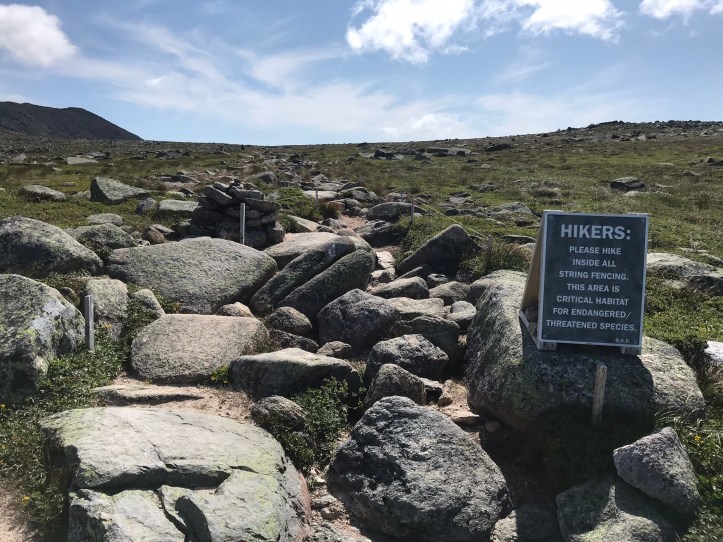
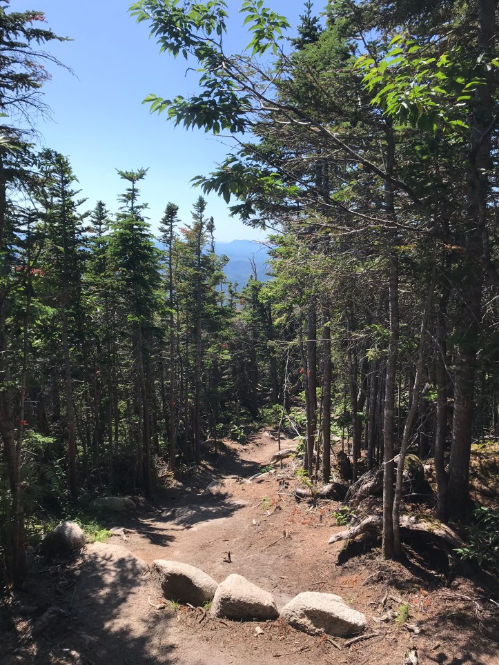
We signed the daily self registry at the detour’s trailhead. A few people had already started up the mountain. The detour consisted of lumpy trail cut through scrappy, dense pines with a medium amount of rocks and roots.
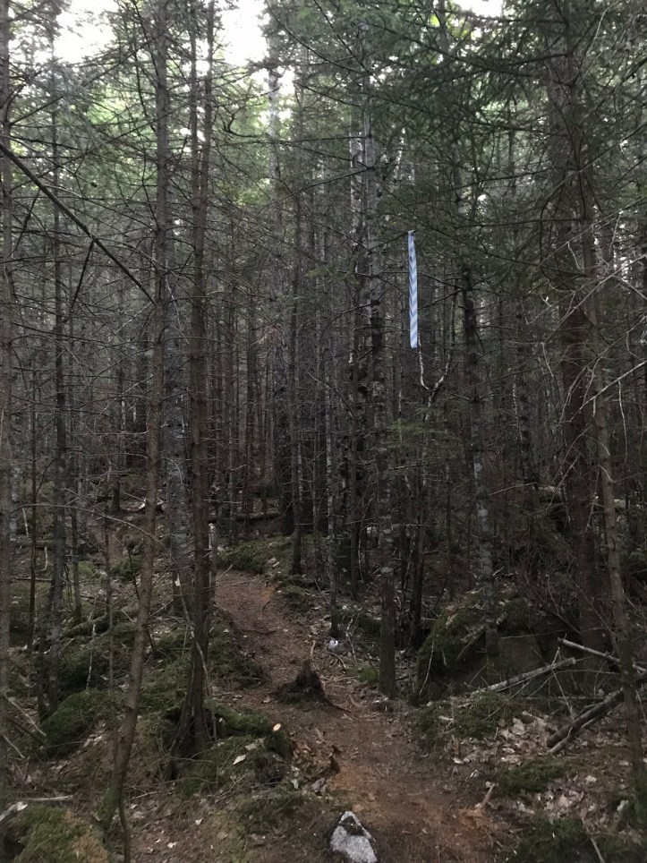
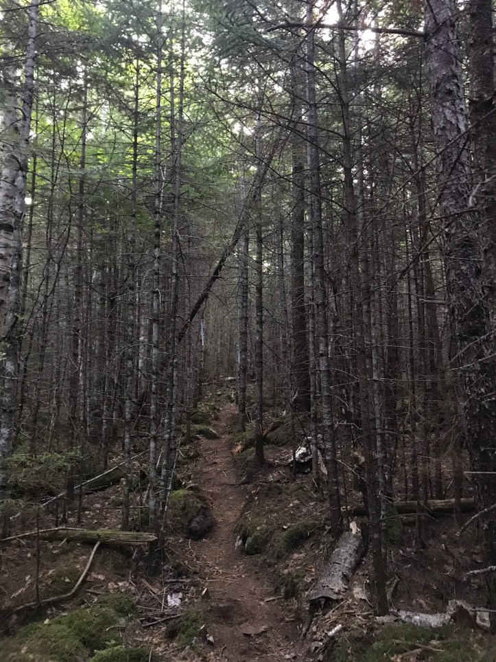
It periodically felt like a dirt bike course because of the repetitive ups and downs over lumps. A fraction of the morning light penetrated the dense evergreens as we followed the blue and white flags marking the trail. We walked with rain jackets on for the first 20 minutes and then took them off, but we decided to wait on bug spray because there were mercifully no mosquitoes. Confusing, but GREAT. We arrived at the intersection with the original Hunt trail around 7am. We were both surprised to see a privy sitting to the right of Katahdin Stream. I took the opportunity for another nervous pee because there would be no privacy once we reached the exposed Table Lands. We paused long enough to admire the stream and investigate the crossing should we decide to make our return trip via the Hunt.
*Logistical tangent: I don’t think I’ve spent much time explaining the debate about which trails one can use for their return trip. There are several options, the two most popular being the Hunt Trail (i.e. the official AT) and the Abol Trail. We weren’t even considering a third option call the Knife Edge because neither of us cared to experience Maine’s version of a trail with that name. Reviews on Guthook for Hunt versus Abol were conflicting (no shocker there) and my friend halfway had described the first half of Abol as a steep rock pile, which was a strike against it. We decided we would assess the idea of descending via Hunt on our way up and ask other people about their plans along the way (my least favorite way to gather information).
The Katahdin Stream crossing looked straightforward minus the small piece of wood that had been placed over the longest gap.
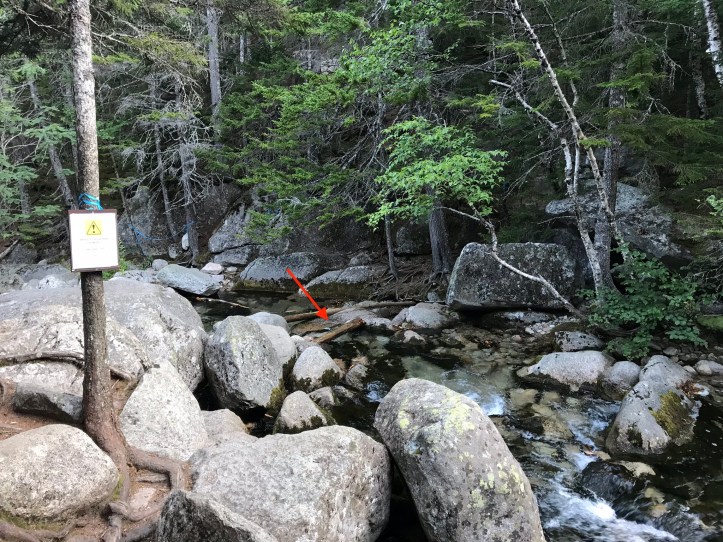
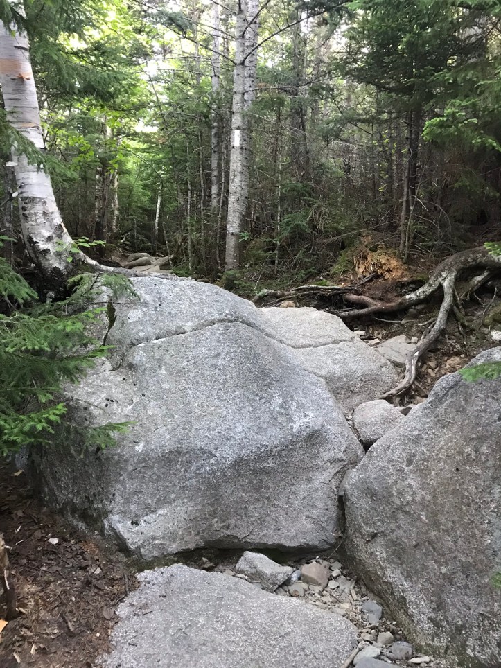
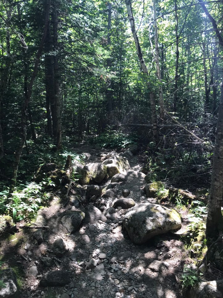
As we assessed the crossing, we saw an older hiker creeping up the Hunt towards the stream. Neither of us wanted to be around for his stream crossing, so we continued on our way. The trail started out as a long slab with blueberries on either side of us, but the incline quickly increased, as did the root quotient.

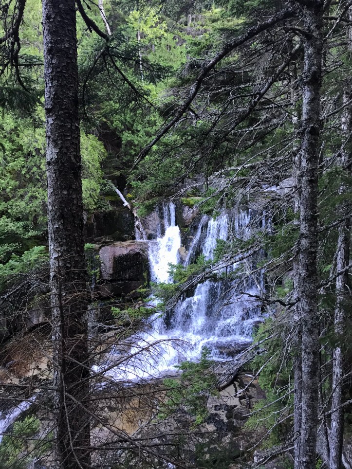
Katahdin falls roared to our left. There was a steep drop off at the viewpoint, which might have given us a more open sightline, but we both wanted to save our scrambling energy for later. Here are the falls in picture and video form:
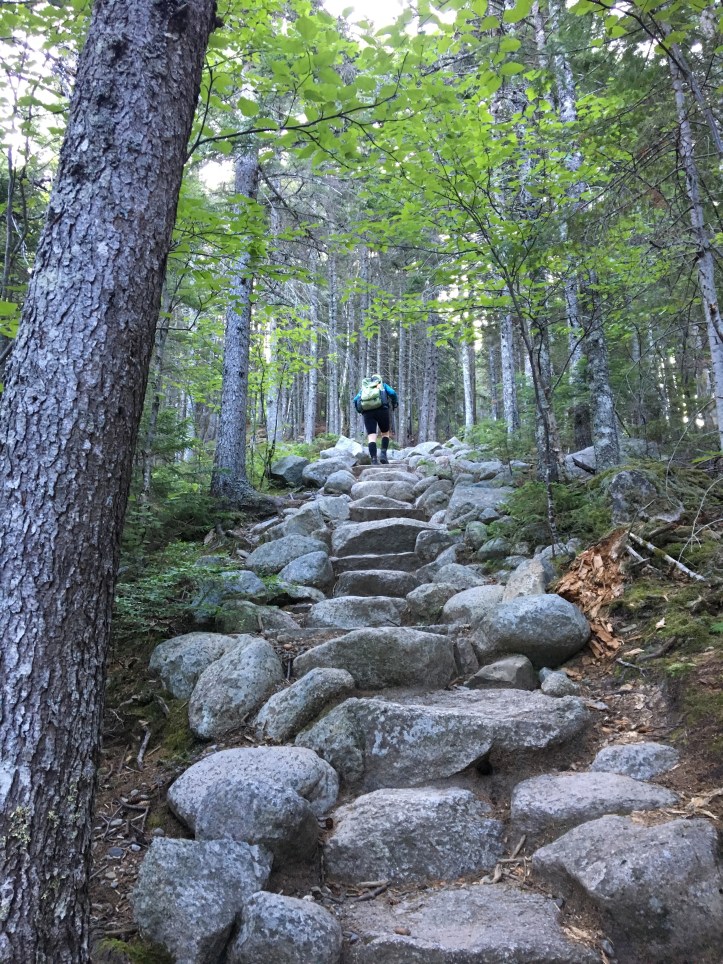
We walked up stone steps with the sun slowly rising in our faces. Things seemed pretty simple for a little while. The boulders increased and the incline steepened, but they were mild changes for Maine.


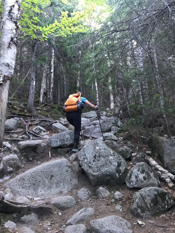


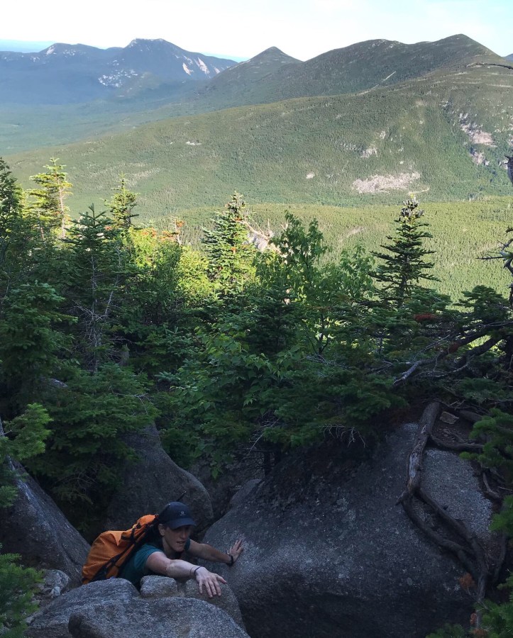
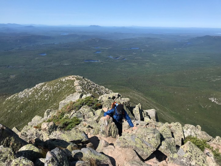
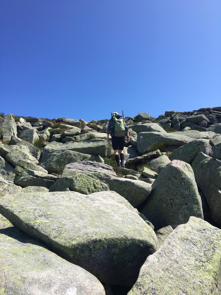
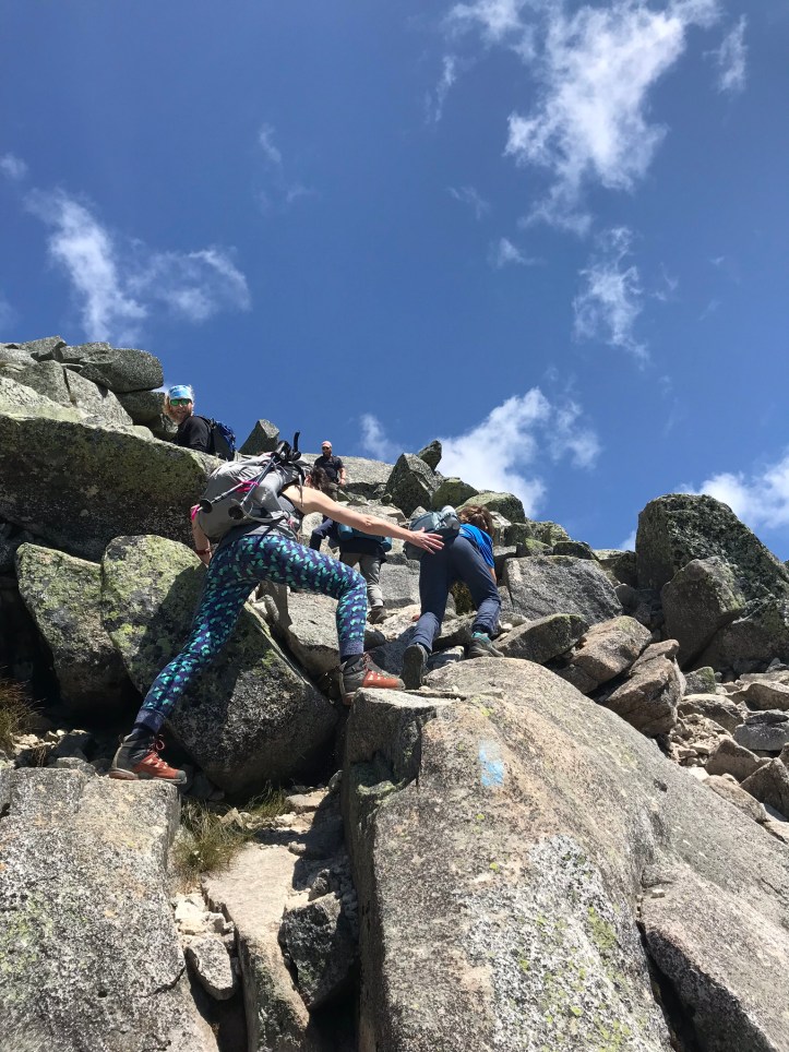
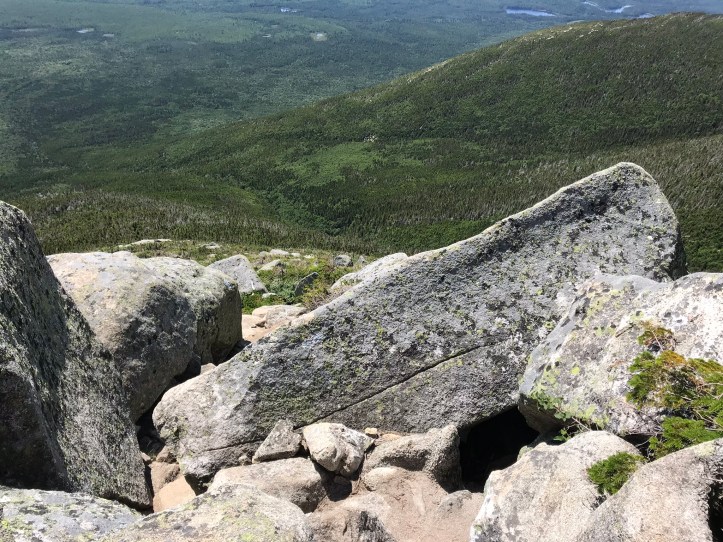
Then things started to get a bit hairy with much larger boulders to scale and little in the way of footholds. It’s hard to tell, but the boulder with the white blaze in the first picture was nearly chest high and the boulder with the white blaze in the third picture was about eye level.
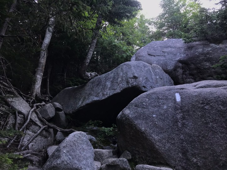

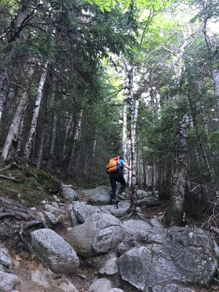
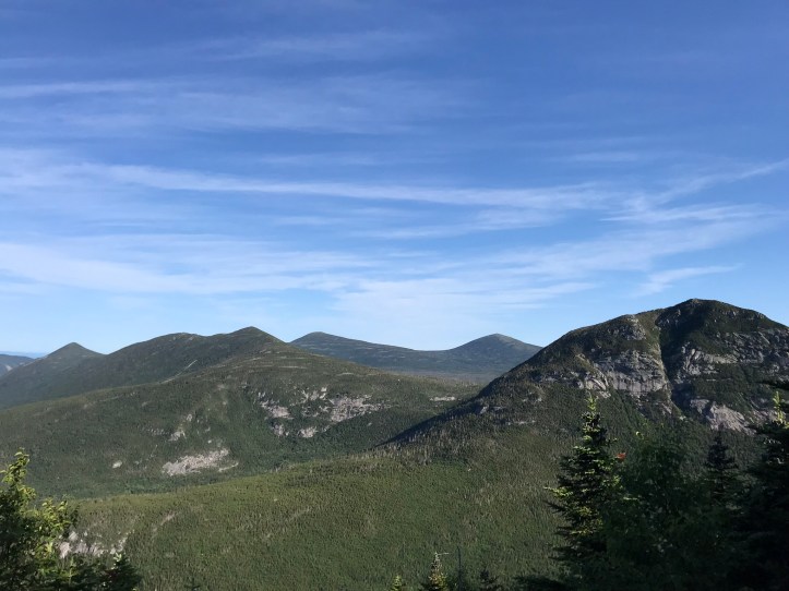
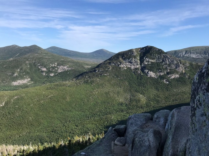
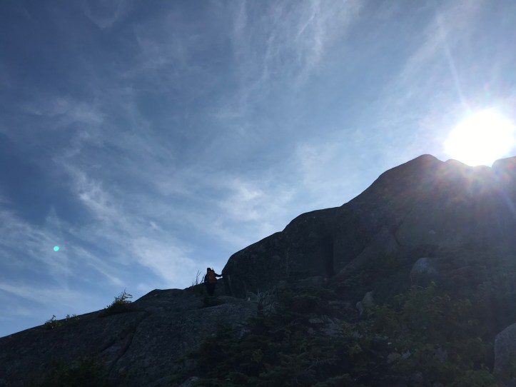
A very tall and lanky couple in trail running gear with small hydration packs passed us at one point and they scrambled up a vertical rock face with little effort. I stared at the stone in front of me, and I had no clue where I could get purchase and make safe transitions from one foot to the next. Oakland and I conferred, and we finally settled on taking the far right route with a tree that had clearly been used for leverage before. Oakland went first and scuffed her way up the rock face. I followed suit and managed to pull myself up by my arms when I lost a bit of footing. We recovered for a moment on a flat area and saw two people come around the far left side, which consisted of dirt and roots. Neither of us had noticed the narrow bypass around the left, and we felt ridiculous for spider monkeying up the boulders. We started to pay more attention to whether there were secondary routes or “short people trails” as we started calling them because some of the scrambles were just not meant for little people. About an hour past the stream, we reached our first view of the surrounding mountains and the beginning of the real Spiderman features.
We could occasionally see the two people that had passed us earlier, but for the most part, we were on our own amongst the jumble of mammoth boulders. I unfortunately didn’t take pictures of a lot of the scrambling because I was so overwhelmed by what lay in front of me and by the thoughts of how in the F we would get DOWN, should we choose the Hunt Trail. I distinctly remember scraping and scrabbling up one particularly long, steeply sloped boulder not long before we hit tree line. There were no handholds to speak of, and I was having a lot of trouble maintaining my footing (nearly on all fours) despite the gritty surface of the rock. I had visions of trying to scooch our way back down that boulder with little in the way of brakes save our own bodies, and I almost cried as fear coursed through me. Needless to say, I also wasn’t taking notes as we sweated through one challenging move after another. The rest of this post is cobbled together from our collective memories, guthook data, and pictures.

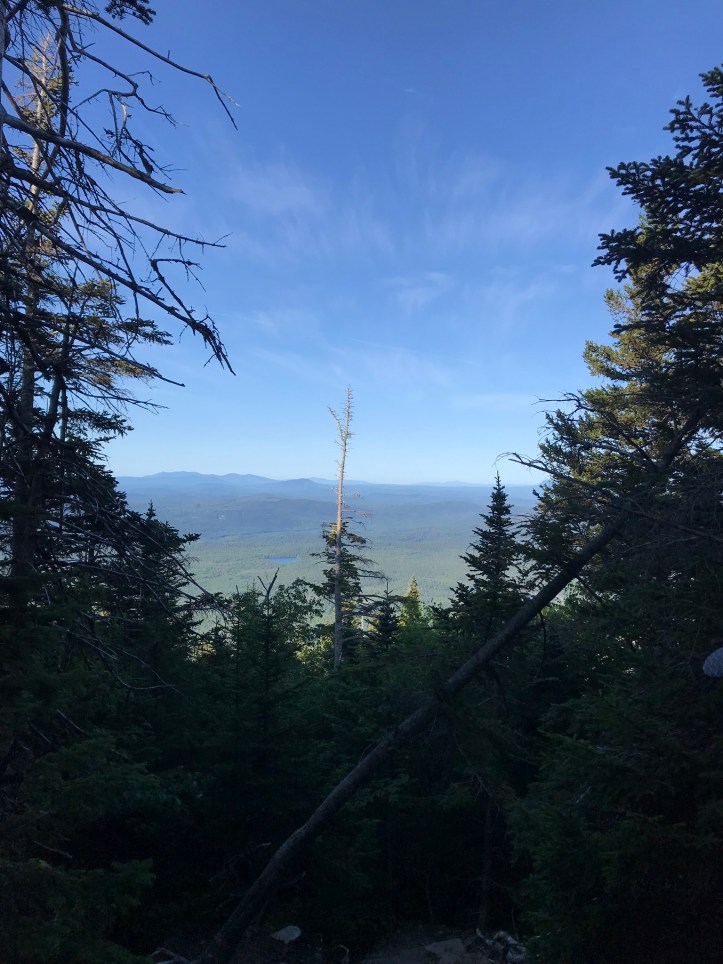
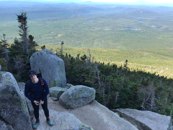
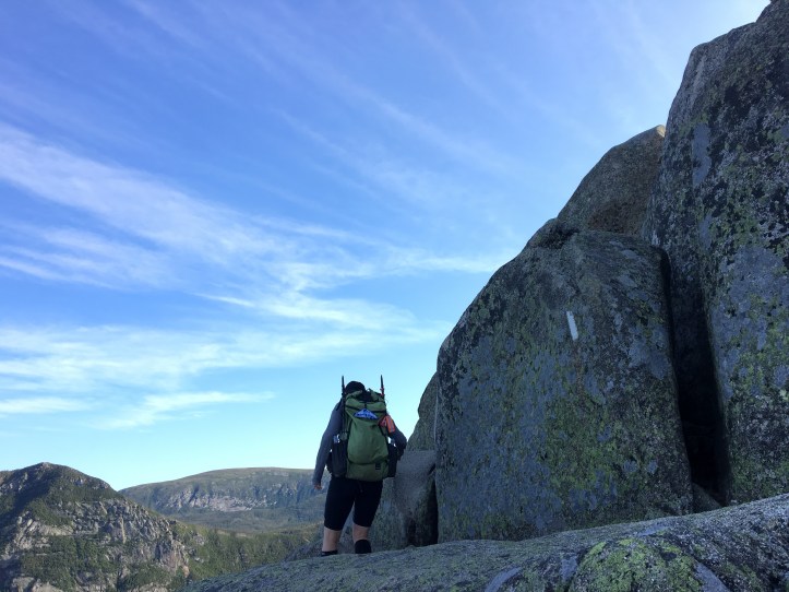
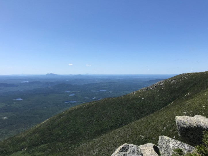
We made it to tree line around 8:15am. The views were astounding, as was the drop in temperature. We became painfully aware of how much the trees had been protecting us from the wind. On went our long sleeve wool layers. We decided to save our raincoats for as long as possible so we wouldn’t chill ourselves even more by getting too sweaty. Here are a few pictures just above tree line:

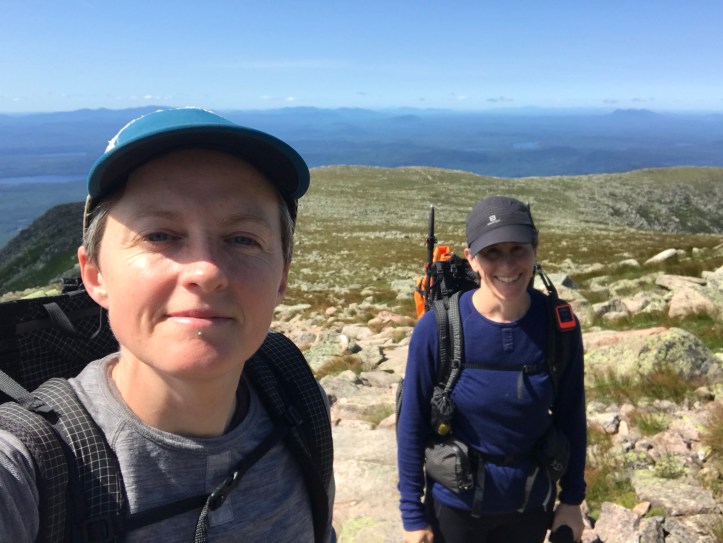
Look how excited Oakland was to be in the middle of Maine 3,300 feet in the air:
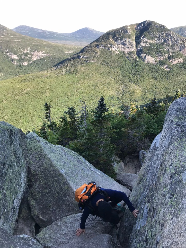

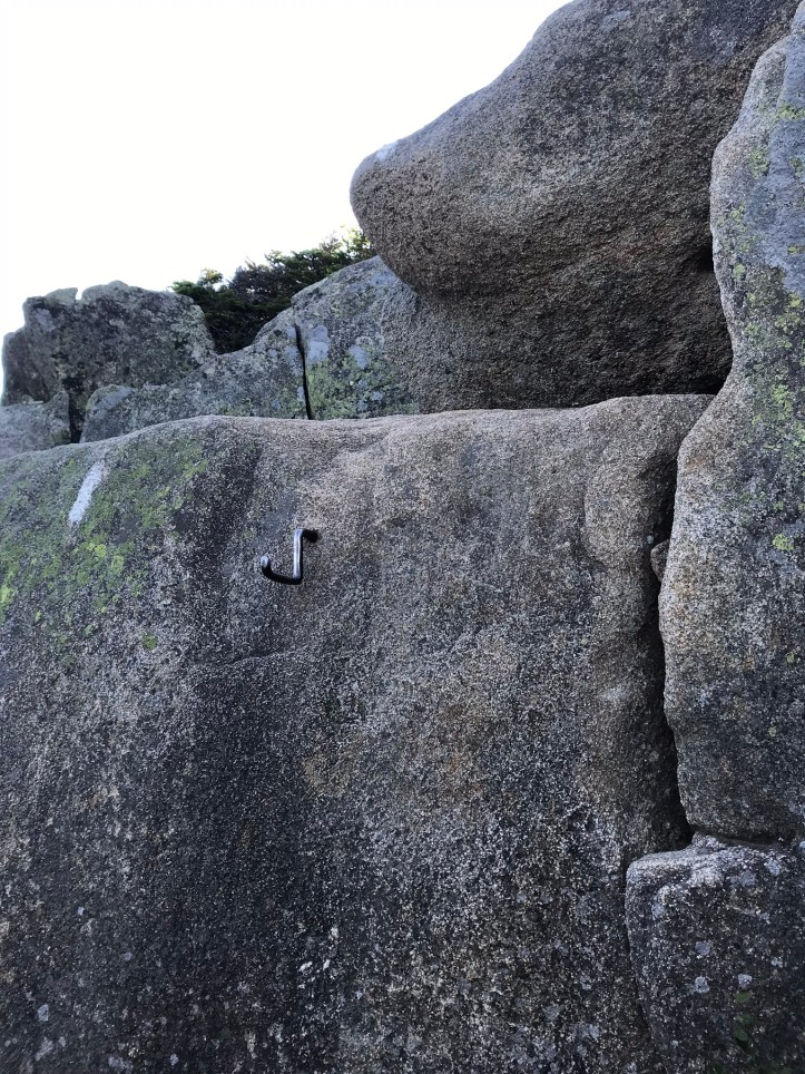
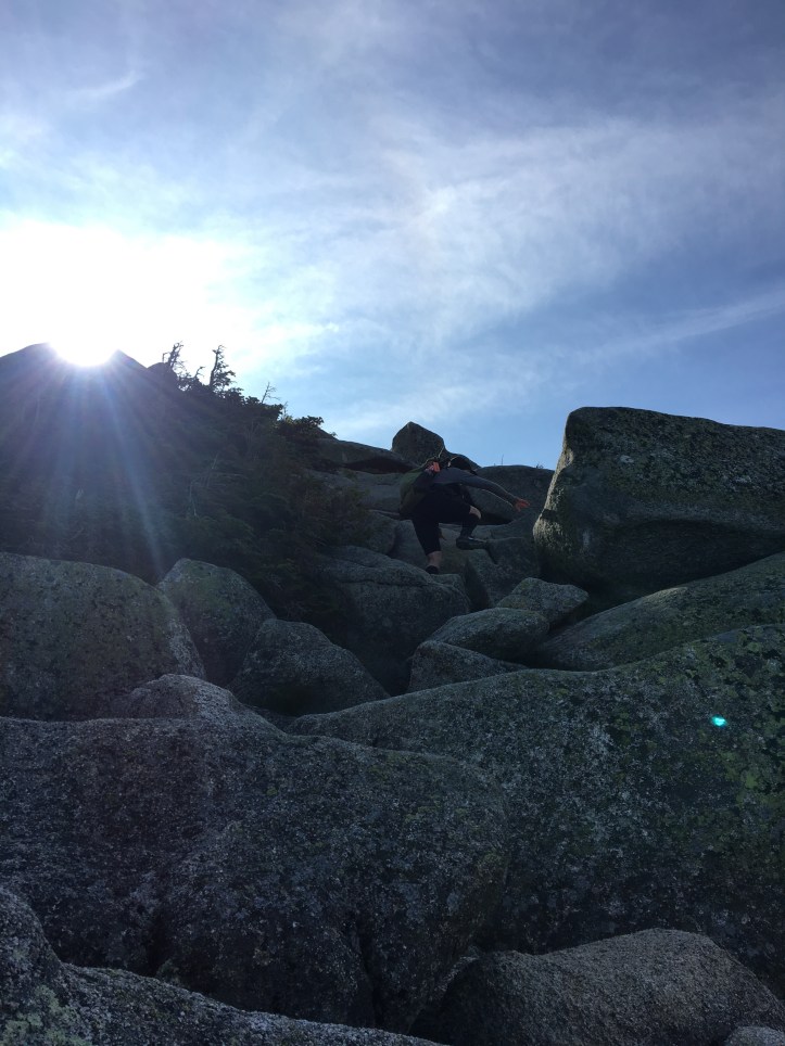
We gained about 1,150 feet in the 0.7 miles between tree line and the Gateway (according to the internet widget I just used, that’s a 31.4% grade for people who care and/or know about those sorts of things). Not long after crossing tree line, I stood in front of this rock face with a small piece of rebar around eye level.
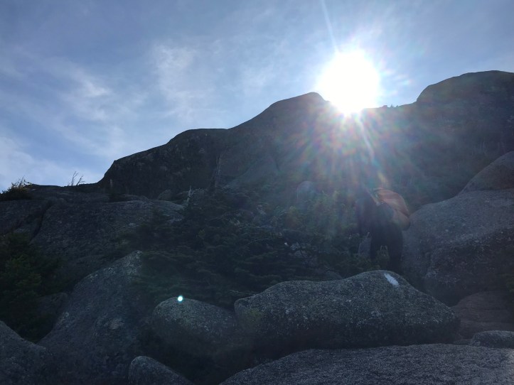
There was nothing to do but curse, laugh at the absurdity of basically rock climbing, and start experimenting with footholds to scale the boulder. Crying just makes it harder to see where you’re going, especially when the sun is already in your eyes.
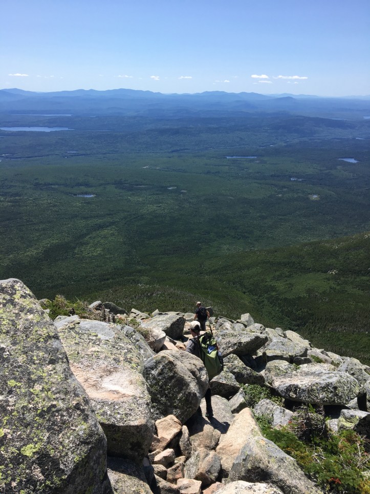
We took a short snack break at a flat area called the Hunt Spur. We put on our raincoats to keep us warm while we were stationary and did our best not to sink too far into our collective overwhelm. Chatty Dave and OSHA caught up with us while we rested. Oakland chaffed at Dave’s cheerleading. Something about his tone felt paternalistic to her and she bristled at his unsolicited support. I stewed in my own pot of aggravation because I resented the fact that Dave and OSHA both were at least 6-8 inches taller than us. They weren’t eating their own knees on the higher steps or barely scraping over the tops of boulders. We both did our best to hide our feelings while also clearly sending the message of “Thanks, now goodbye to you.”
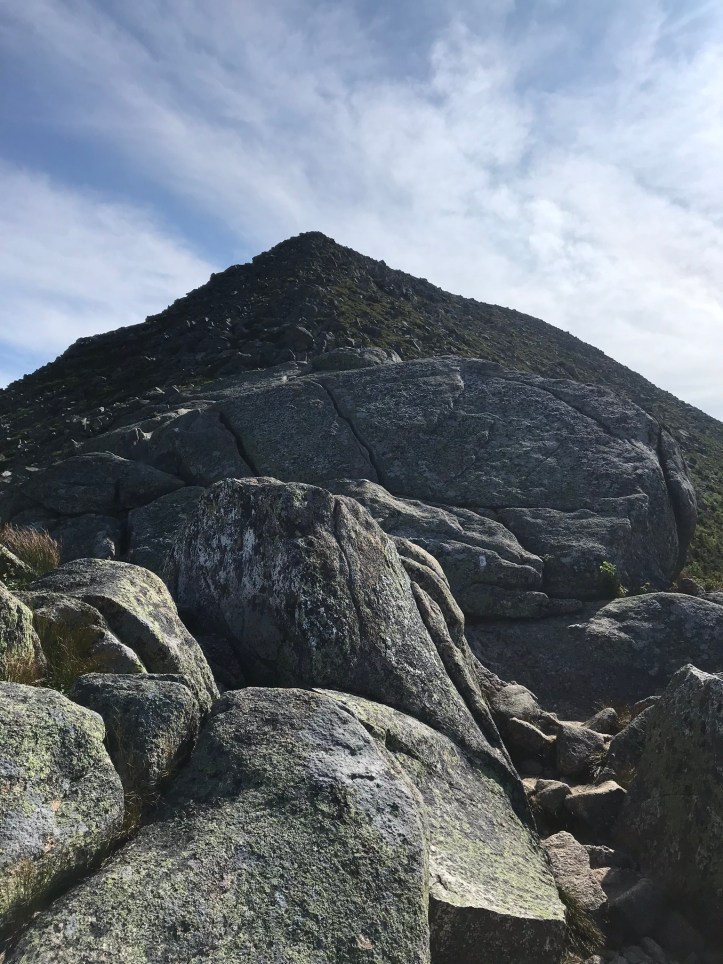
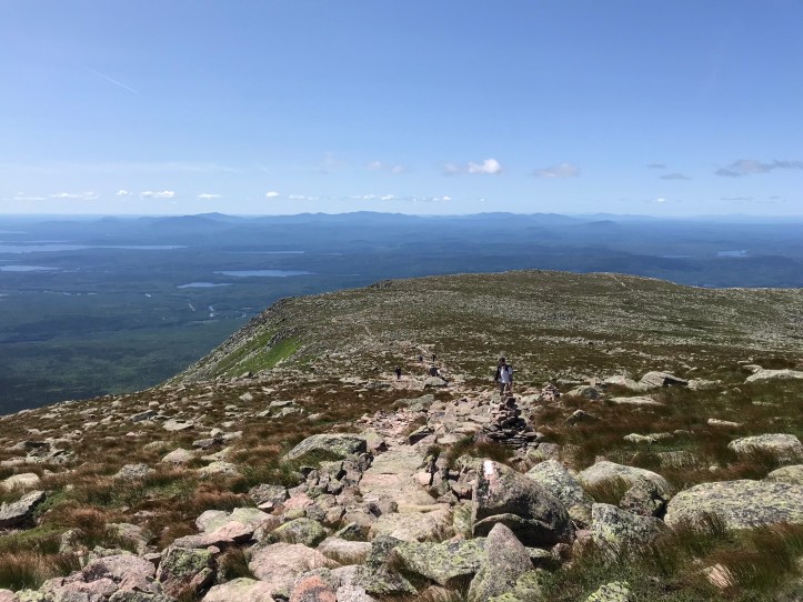
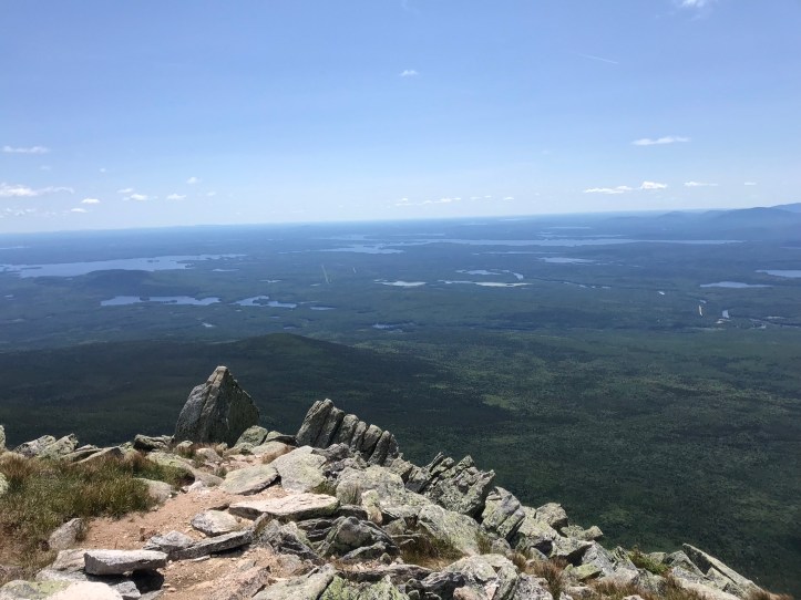
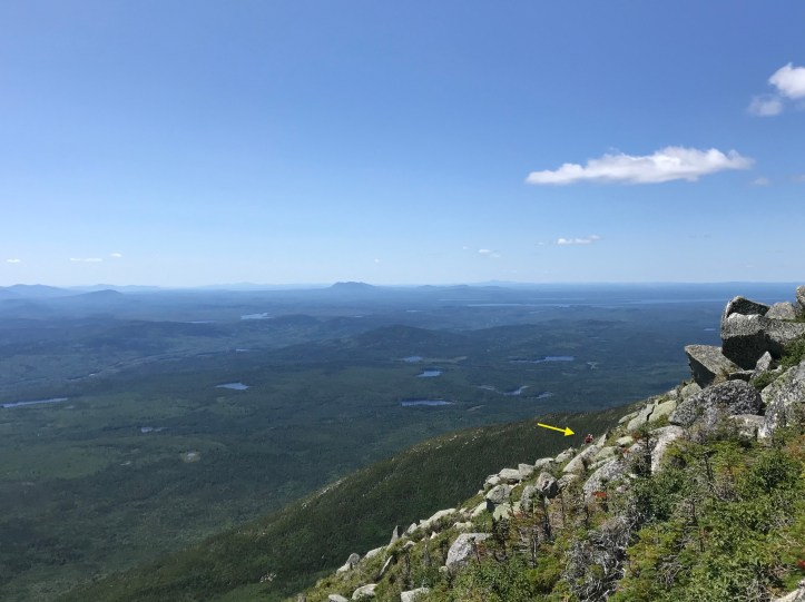
We let Dave and OSHA gain some distance on us before we hauled our exhausted selves from our perches and continued putting one foot and/or arm in front of the other to cover the last 0.5 miles before the Gateway, which marked the end of our nosebleed climb and the beginning of the Table Lands. The views behind us were dizzying and spectacular.


I will never forget the swirl of emotions I felt every time I stopped to take in our surroundings. I was equal parts 1) terrified, 2) mesmerized by the breadth of our views, and 3) overwhelmed by the relief and elation of finally climbing the mythical beast that I had worked so hard to reach. The trail had broken my arm and my heart, and I couldn’t believe we were really on Katahdin. Sadly, I couldn’t marinate in my reverie for too long for fear of breaking some other part of my body on the perpetual jumble of rocks.


Just before the Gateway, a troop of teenagers came down the ridge line towards us. It turned out to be the same youth group we had seen tromping down White Cap Mountain, yet another jagged rock pile. We stood aside and gave them ample room to pass on the narrow ridge.
They must have started their ascent at a ridiculously early hour to already be this far from the summit. I could not imagine being the leader of a youth group on such a dangerous mountain. No thank you. I barely wanted to lead myself on this particular challenge.
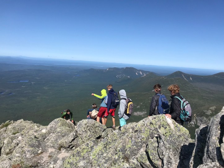
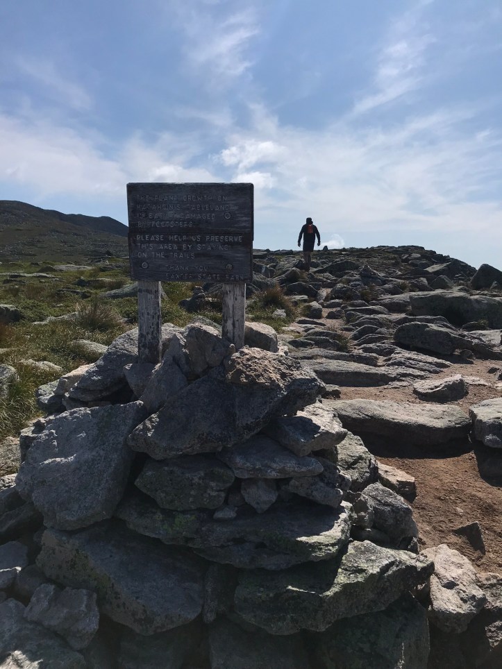
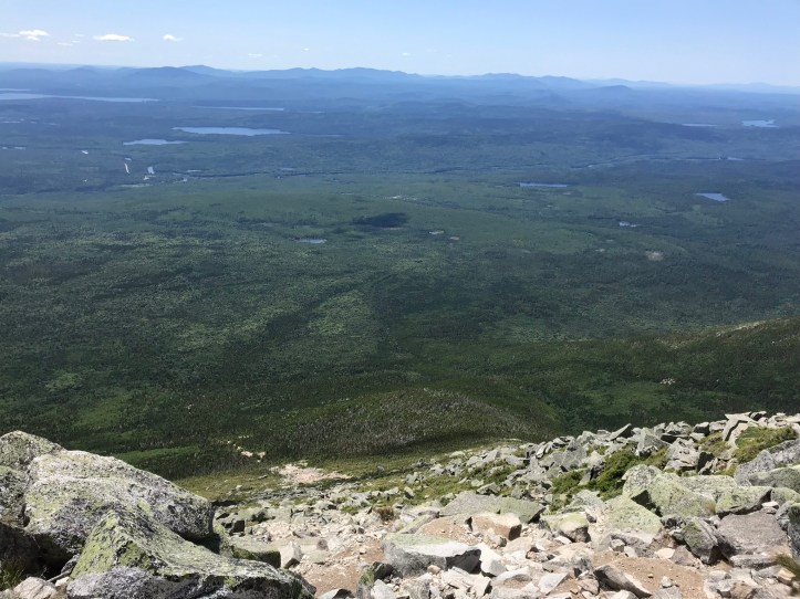
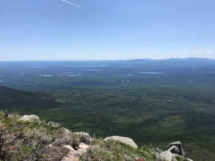
We finally crested the Gateway and made it onto the flat section known as the Table Lands. This is the part of Katahdin where I had promised to rage text a hiker we’d met in the HMW who promised us that it would be smooth sailing.

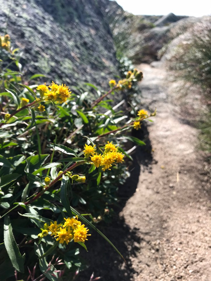
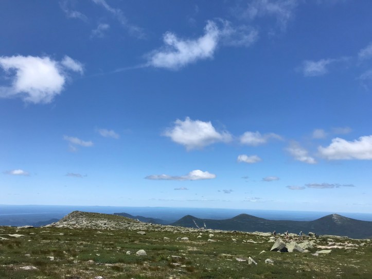
As predicted, there were just enough rocks to make our progress slow, but we were both relieved to take a break from the death-defying section of the climb. We kept our raincoats on to dampen the persistent, chilly wind whipping across the plateau. I stopped for the occasional flower picture, including this little yellow number that I think is a new to me flower:
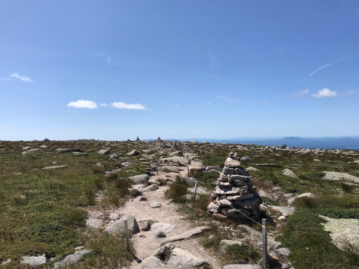
We made sure to stay within the narrow corridor roped off by the park service to keep hikers from trampling the surrounding vegetation.
Our hiking poles were relatively useless because of the density of rocks, so we kept them stowed in our packs as we slowly picked our way towards the summit. When we reached the Abol trail intersection, the number of hikers increased exponentially. We were both thoroughly confused and dismayed by the influx of people dotting the trail ahead of us. I hate to say this because it feels dismissive or potentially condescending, but there was something disappointing about seeing dozens of people dressed in all manner of clothing happily clomping their way towards the summit as if they were in the middle of a Sunday stroll. The blood, sweat, and anxiety I had experienced to get there felt diminished somehow. It’s hard to articulate, but I can say for sure that it wasn’t a helpful frame of mind. I also felt resentful that we had to share the mountain with so many other people who hadn’t put themselves through a physical and emotional rollercoaster for hundreds of miles. Again, not helpful or equitable, but it’s the honest account of what I was thinking as I watched people with fresh legs bounce past us. We still managed a few smiles despite our grumpiness:
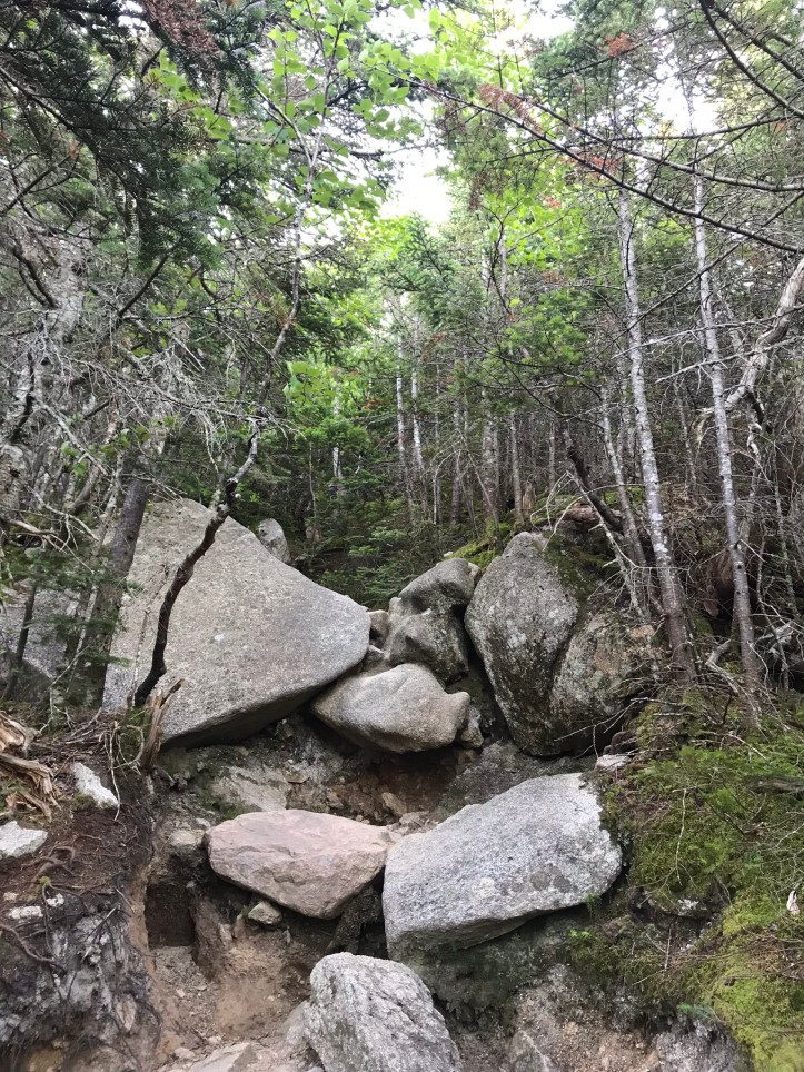
The trail slowly gained elevation in the last half mile, and the rocks became denser and more angular. I preemptively loathed the idea of descending the jagged staircase.


We asked several of the day hikers which trail they had used for their ascent and tried to get a sense of how acrobatic their experience of Abol trail had been relative to the Hunt trail. Their answers tended to be vague, but did seem to point towards Abol as a less technical option. We also made the disparaging assumption that Abol couldn’t be that hard based on the range of abilities we’d seen thus far.
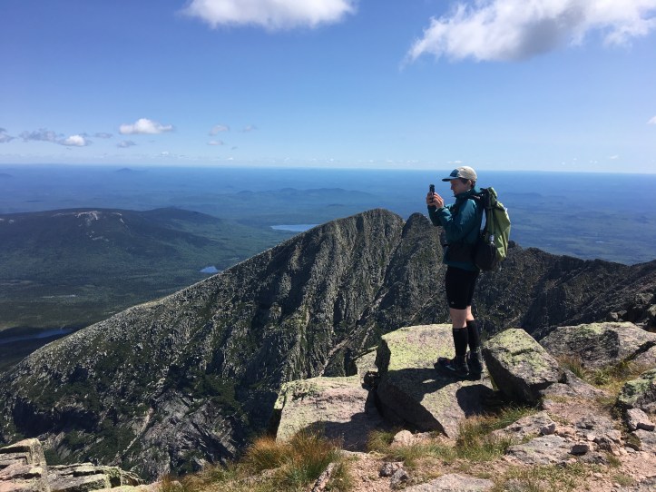
My experience of the last hundred yards to the summit was mottled by my irritation that there were so many people milling around, but I tried to focus on what we were there to do (i.e. be mesmerized by nature). Unfortunately, that goal became even harder when we reached the summit and immediately began receiving congratulations for having finished our thru hike. Oakland and I corrected a few people and eventually gave up because it wasn’t worth the effort. To make matters worse, neither of us felt “done” with anything because we still had to get ourselves DOWN the massive rock pile we had just climbed. We patiently loitered near the Katahdin sign so we could have the requisite picture taken. Neither of us could figure out what to do with our arms once we had finally positioned ourselves on the sign (it was surprisingly hard to get up there). We settled on a version of the customary triumphant pose in today’s top photo and clambered safely to the group so the next person could take their turn.

Chatty Dave and OSHA made their way over to us through the cluster of hikers. Dave loudly congratulated us for being done. We both remarked on how we were still concerned about getting down the mountain. Dave batted away our remarks one too many times for Oakland. She is a generally amiable and tolerant creature (far nicer than me), but Chatty Dave’s perpetual cheer leading and mansplaining dismissal of her anxiety about the descent were too much for Oakland to bear. She launched into a terse rebuttal of our “doneness” and left a silent Dave in her wake. I raised my eyebrows at him and silently walked away to join Oakland. We sat on the rocks and ate a snack, trying our best to tune out the human noise and focus on the immense beauty in all directions. I then proceeded to take a thousand photos and several videos (including today’s top photo):


I also spent nearly 10 minutes trying to make a phone call to Pamola shuttle service to schedule our ride to Millinocket. I think we finally managed to settle the timing via text, but neither of us can quite remember how the frustrating connection issues were resolved. After several more minutes of gawking, we agreed that we should get farther away from people to have our lunch. We slowly made our way over the rocks until we found a wide spot in the trail with a comfortable, out of the way perch.
I dined on pop tarts and “all dressed up” chips (my new obsession) while Oakland made herself a tuna wrap. We continued our unofficial trail survey by asking the occasional passerby which trail they’d taken and how death defying it had felt to them. Ultimately, we based our decision on the aforementioned bias that nearly all of the day hikers we asked had taken Abol, which likely meant it was a more accessible trail.
Our packs felt like air as we headed towards the Thoreau spring intersection with the Abol trail. We took a left and walked a short ways towards what looked like the edge of a cliff.
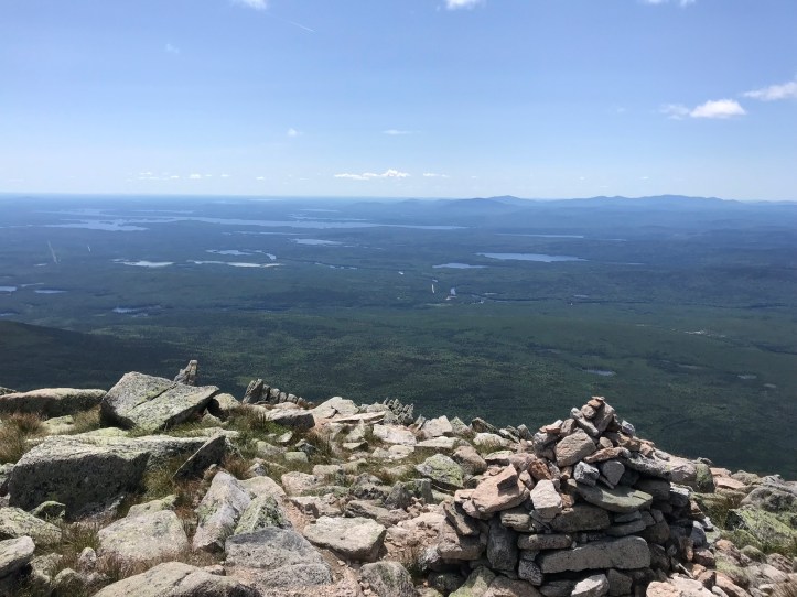
That impression was somewhat accurate based on the sharp descent that awaited us. We crested the plateau to find a distant sea of green dotted with bodies of water, and in the foreground lay a plunging pile of rubble with a steady trickle of hikers following the dusty, rocky trail. There are teeny tiny humans dots in the third picture, but I’m not sure you can see them with the photo quality on the blog.


Halfway’s description was apt when he said the top section wasn’t so much a trail as “a steep pile of rocks and occasionally slippery debris with blazes marking the route.” When we weren’t lowering ourselves down large boulders (so many scoochertunities), we were slipping and sliding on the silty trail. I’m pretty sure I landed ass-first in the dust at least once.


About halfway down the rock slide, we stopped to gawk at a family of four making the ascent with a kid who seemed to barely meet the 6-year-old age minimum to hike above tree line.
We managed to soak in the beauty despite the intense concentration required to inch our way down the mountain. There were some dicey moments, but nothing like what we had experienced on the Hunt Trail. The trail was hard to follow at points, so we guessed our way through the rock maze based on the tiny bobbing heads we could see below us.

We were both happy with our choice and expressed gratitude for the clear day no less than a dozen times before we hit tree line. The angle of the descent softened as the scrubby dense pines rose around us. We were relieved to be out of the scramble, but we had to keep our eyes glued to the ground to navigate the patchwork of rocks. If we weren’t dodging rocks, we were slipping and sliding on the silt. Oakland kissed the ground with her butt a couple of times (not pictured).


Neither of us had been prepared for the amount of dust and sun we would be exposed to on our slow descent. I felt desiccated by the time we made it to the shadier section of the Abol trail. We passed a safety sign stated that rescuers may be many hours away, and I shuddered to think about what it would be like to be in need of a rescue in the hairier sections of the mountain or to be on the rescue crew responsible for saving someone.

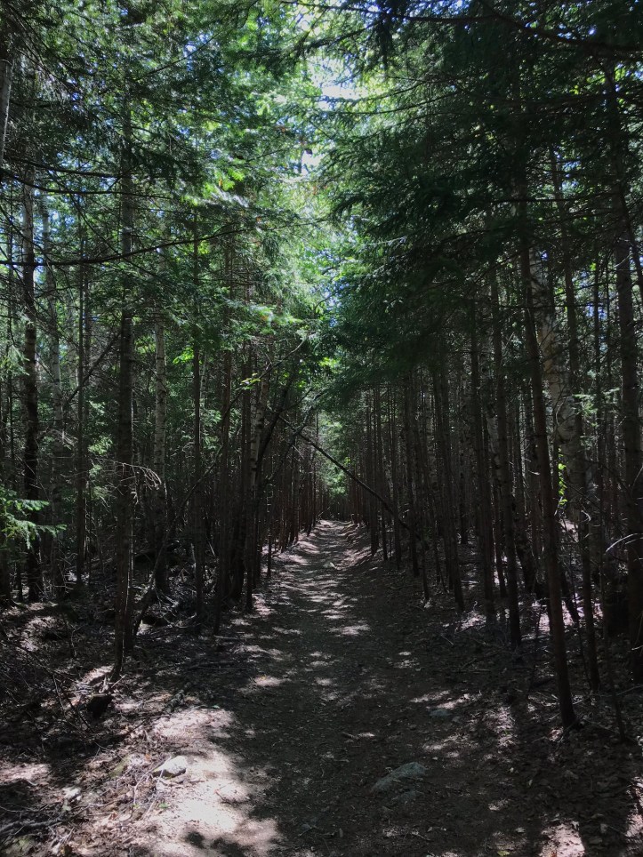
The shady section started with the occasional rock farm and transitioned into gloriously mild terrain for the next 30 minutes.

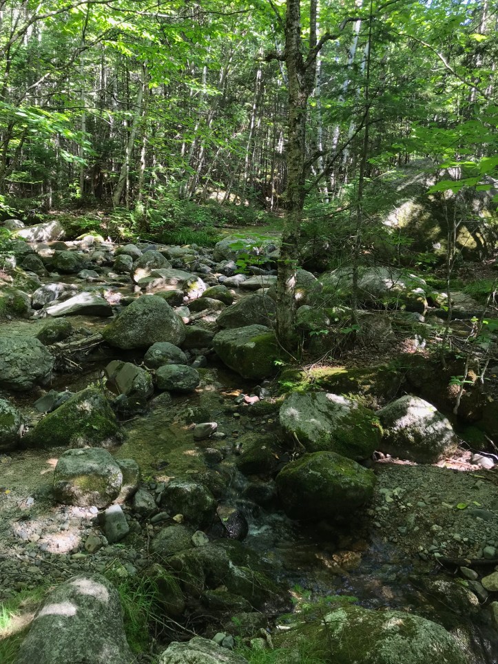
We eventually popped out at the Abol Campground feeling exhausted and triumphant. We made a pit stop at the privy and filtered water from Abol Stream in an attempt to rehydrate for our walk back to KSC.
We followed the dirt road through the campground and took a right on the main drive, which was a dusty, green tunnel.
We walked for about 5 minutes before a ranger truck pulled up alongside us and offered us a ride back to KSC. Hurray! That cut 1.5 miles off our trip and was far more enjoyable than dodging cars and inhaling dust for the next 35 minutes.
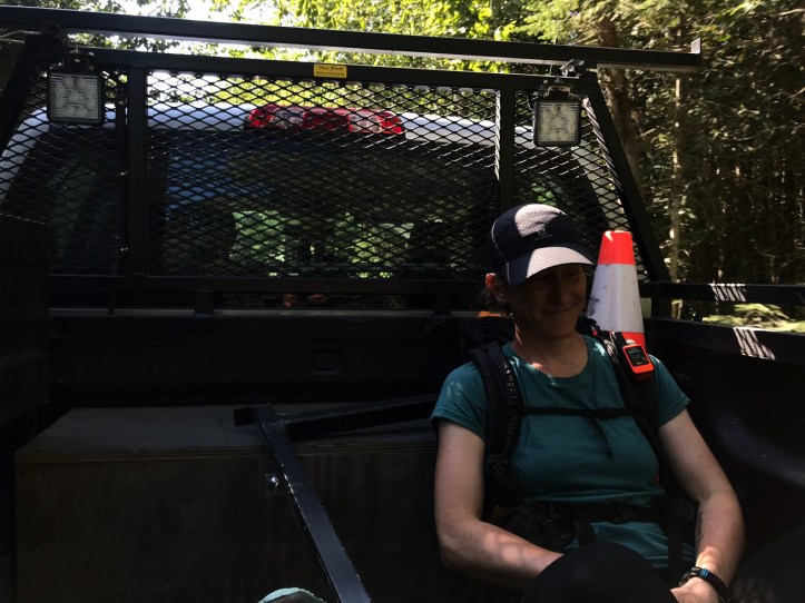

I sheepishly took a selfie of us, hoping the ranger wouldn’t see me because it made me feel like such a tech obsessed twit. Sadly, the bumpy road and rapidly changing light made it impossible to get a clear shot. This one is blurry, but you can still get a good sense of how happy we were to be done:
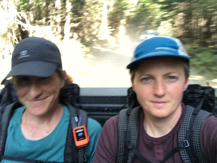
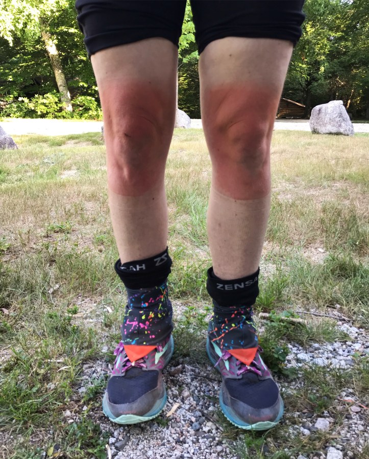
We hopped out of the truck bed in the KSC parking lot and thanked the ranger for making the last leg of our trip so much easier than we expected. We walked back to the ranger station and repacked our bags with all of the gear that had been safely stowed on the porch. Then we walked back towards the parking lot and plopped ourselves down under a covered picnic table and proceeded to stuff our faces for the next 30 minutes. We split a packet of ramen and mowed through most of our other snacks. I marveled at the ridiculous knee sunburn I had acquired on the Abol descent.
A long distance hiker of some sort sat at another picnic table having a loud and tedious conversation with a hiker he seemed to have just met. When the seated hiker lost his conversation buddy, he decided we were the next best targets and proceeded to talk at us for like 15 minutes. I had a hard time following the story of his hike because he sounded vaguely unhinged and his timelines were wonky. We offered to pack out his trash because we had a ride on the way, and he was grateful for the small favor. Said ride showed up not long after that, so we extracted from our unsolicited table guest and entered another long stretch of small talk. Thankfully, our shuttle driver was less brash and far more comprehensible. The road to get out of Baxter felt somewhat interminable, but we finally arrived at the park gate and turned onto the road to Millinocket. Our driver turned out to be Chris, the owner of Paloma Lodge. He doesn’t normally drive the shuttles, but his usual driver wasn’t available. Chris told us to be on the lookout for moose because we were more likely to see one while along the road than in the woods. I had nightmare visions of a moose bombing out of the woods in front of us, but that didn’t happen. Nor did we see any loitering along the edges of the many ponds and lakes we passed. There’s so much water in Maine.
After about 40 minutes, we arrived in the hotel parking lot where we found HQ standing beside her car. I still can’t believe she drove over 12 hours, one way, to pick us up. There was a quick round of introductions with Chris, and then he puttered away in his SUV. The three of us entered the Katahdin Inn and were hit with a wall of chlorine smell from the indoor pool that filled much of the cavernous lobby. HQ checked us in and we took the rickety elevator up to our room. Given the late hiker hour (7pm), Oakland and I decided it was far more important to eat than to shower (potentially to HQ’s chagrin). We changed into the street clothes that HQ brought us and piled into the car to head to the Scootic In Restaurant, which seemed like it would have the widest variety of food for our various dietary needs. We toodled through the sleepy downtown Millinocket scene and eyed the ice cream parlor just up the street from the Scootic. We walked in and found a bustling restaurant filled with a mixture of hikers and locals. Thankfully, we were immediately led to a booth. I have no memory of what I ordered, except to say there were french fries involved. Oakland and I were beyond exhausted at this point, and I’m sure HQ wasn’t firing on all cylinders after her driving marathon.
Sadly the ice cream shop was closed by the time we left the Scootic, so we divvied up m&m’s from HQ’s stockpile at the hotel. Then Oakland and I forced ourselves to take showers so we wouldn’t torture HQ for the 13 hour drive back to VA. I wished we could have taken our time and stayed another day in town rather than have such a tight turnaround time with a 4:00 am wakeup call. But alas, we were on a schedule, and it made the most sense to stick to it.
Mile 2186.8 to mile 2192.0 – Katahdin!
(5.2 AT miles & 3 miles of Abol trail, not counted in total mileage below)
Checklist total miles: 1060.7
Oakland total miles: 583.3
Creature feature: good question! there must have been dark eyed juncos below tree line, but I have no memory of noticing anything else.
