July 27, 2019
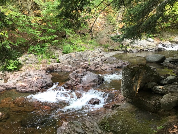
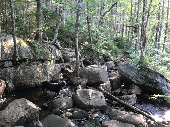
I slept pretty well until 5am when the birds began chattering. It was difficult to stir from my cozy bed, especially with the white noise of the stream just outside our tent. Oakland heeded the call to the bushes first and retrieved her food bag. I desperately had to pee, so I took care of that matter before taking on the process of digging a cat hole. My stomach didn’t cooperate very quickly, which made my knees cranky and left my thighs more exposed to the hordes of mosquitoes. I went back to the tent with itchy legs, changed clothes, and packed up most of my gear. Then we ate breakfast on our sleeping pads because neither of us had the energy to put on deet in that moment. As we rotated from one uncomfortable position to another, we looked at the day’s mileage in our guthook apps and groused about the lack of reliable water sources for the first 10 miles, which of course involved a lot of elevation changes. Then I prepped my feet and went through the tedium of collapsing my sleeping pad. We finally dragged ourselves out of our bug-free haven, and broke down the tent, which had an annoyingly silty bottom. Oakland wandered off for another visit to the bushes, and I filtered water from our friendly stream neighbor. Here’s a video of the small cascade that kept us company overnight:
We both drank as much as we could manage with full stomachs in an effort to get ahead of the water shortage. Then came another layer of toxic, and oh so helpful, chemicals (I’m surprised we waited that long) before we set out for the morning.
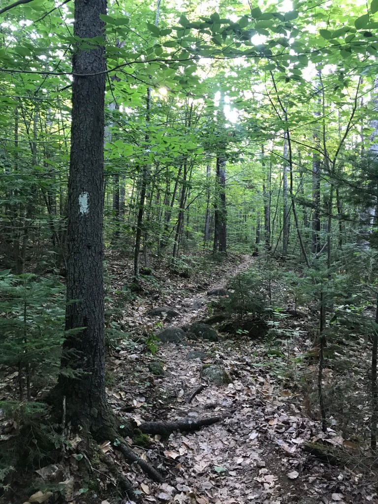
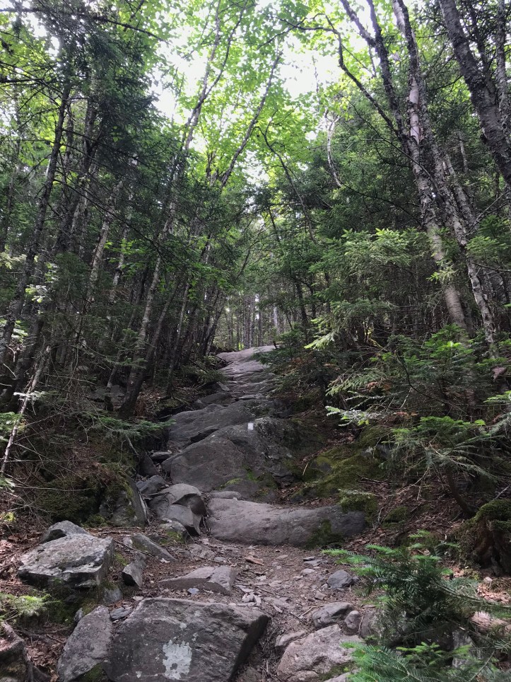
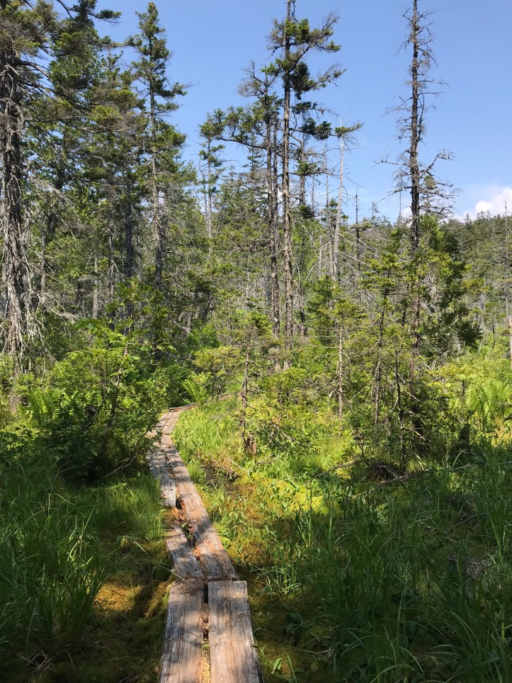
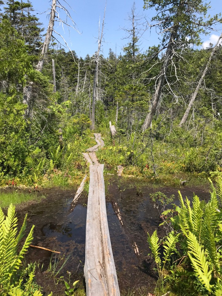
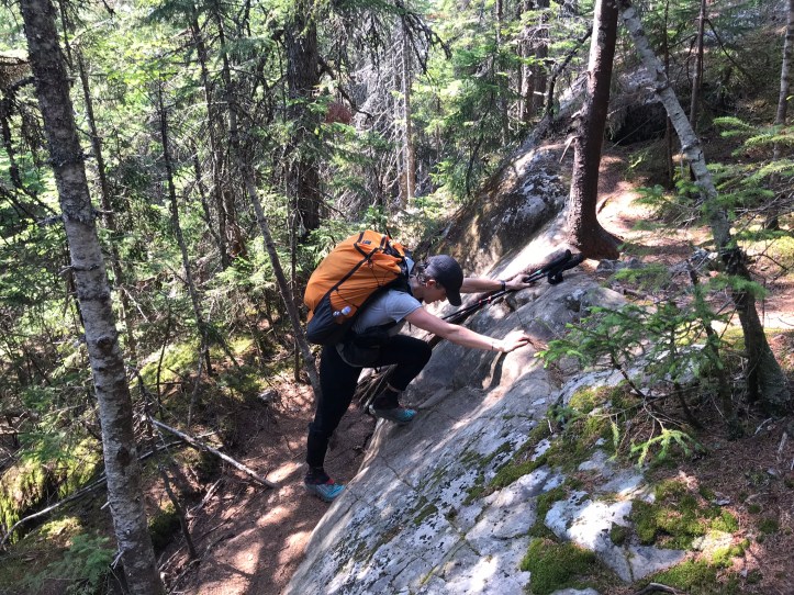
The day started with about 30 minutes of green tunnel over a range of footing that led us to the dreaded Long Pond Stream crossing. Guthook had mixed reviews about the feasibility of a dry crossing. We stood along the edge of the stream surveying our options, and finally decided to attempt a rock hop.
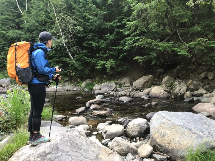
I went first, and easily made two moves before getting to a tricky spot with a flat, but potentially slippery, rock that was my only chance of making it to the large dry rock several feet away. I dug my poles into the stream bed, and lowered one foot down onto the suspect rock. I was in the process of shifting my weight towards the next rock when my planted foot slipped, and I went ass-down in the stream. Water rushed over my thighs as I struggled to get my feet underneath me. I managed to stand up relatively quickly, and sloshed my way slowly across the fast moving stream. Goodbye dry feet and shorts, hello bruised ego. I’m ashamed to admit, the damage worsened, when Oakland managed to make a dry crossing. I had a full blown meltdown while I made sure the contents of my pack were dry despite the soaking wet bottom (check! thank you compactor bag). For whatever reason, I felt like my fall should disqualify me as a “real hiker.” Today, it’s hard to access the depth of shame that my slip unleashed, but I know in the moment it was real and felt bottomless. I spiraled into a sad zombie as Oakland walked quietly behind me, doing her best to be supportive from outside the splash zone (no pun intended). Yet another moment I’m not proud of, but I’m including because it happened.
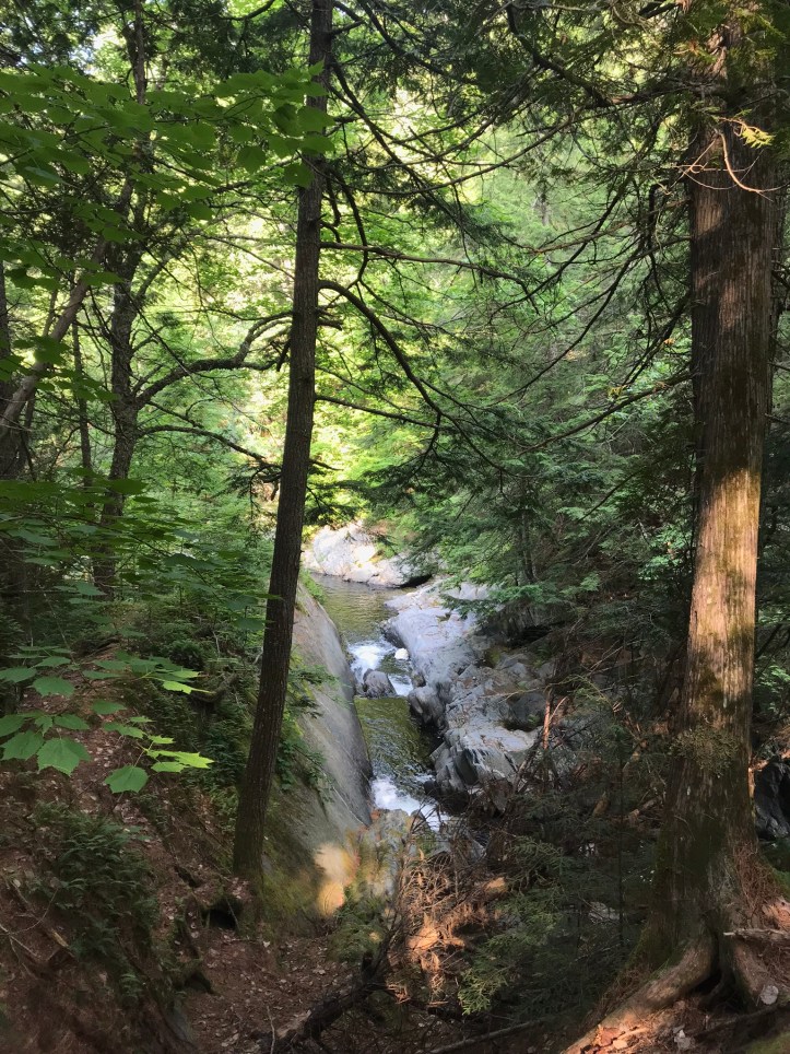
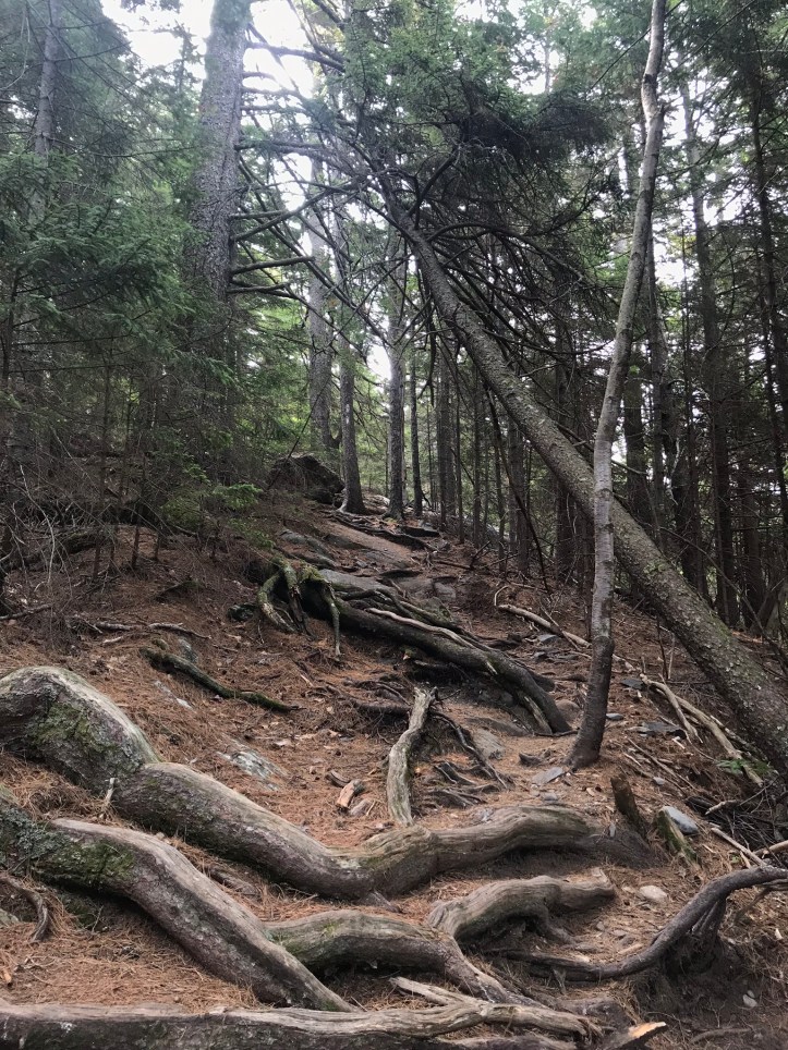
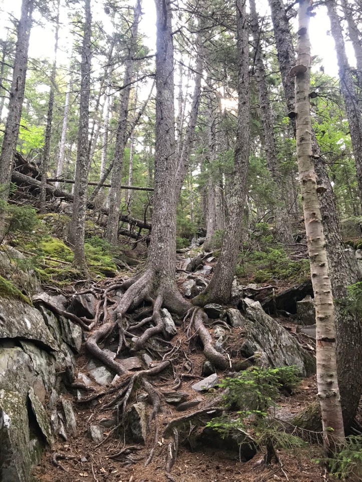
The trail went upstream from the water for a few minutes, over networks of exposed roots and in sight of several small cascades. We stopped to remove our raincoats and add deet to our upper bodies (I also reapplied to my lower half after my dunk in the stream). Then the trail turned right and we made the steep trip towards Barren Ledges. My shorts dried quickly enough, but my socks were wet long after I recovered from my shame spiral. The trip up to Barren Ledges was a doozy. There were roots and rocks and stretches where it felt like we were walking up the down escalator.
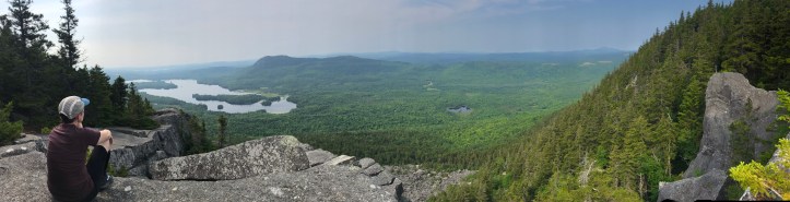
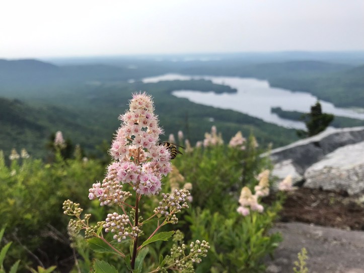
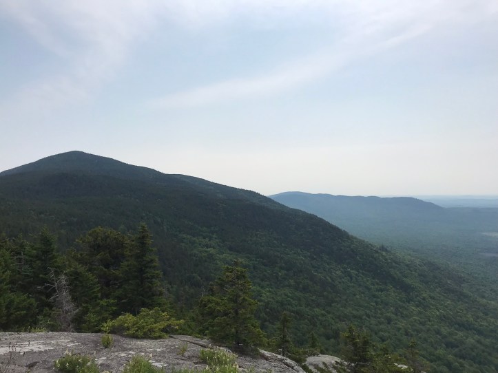
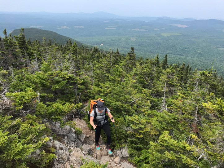
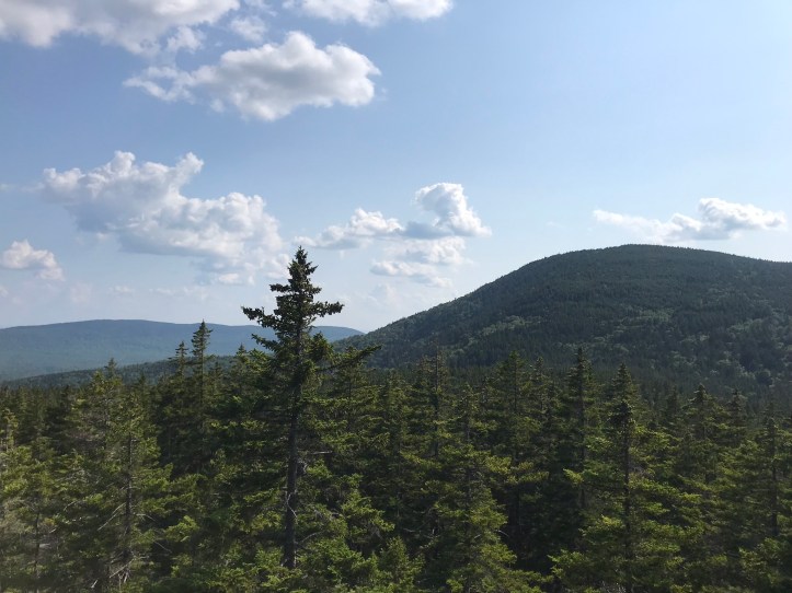
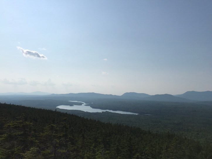
We took a detour near the top to see the view from Barren Slide, which was well worth the short side trail. We wandered carefully over the scratchy boulders and took in the views of Onawa Lake and the sweeping green forest below us (the “Bodfish Intervale” according to guthook). Today’s top picture is from this pit stop, taken by Oakland, the panoramic extraordinaire.
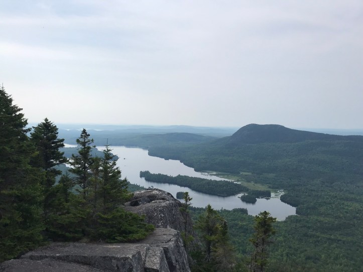
We heard what sounded like logging activity down on the forest floor and watched a motor boat slowly makes it way across a small portion of the lake. It was a hazy morning, and we were drenched in sweat from the climb, but we were both grateful for dry skies. Here are the views in video form:
We went back to our packs and hiked a few more minutes before making another stop at Barren Ledges. We ate snacks, and I continued to admire the view even though my brain felt like glue. I had the distinct feeling that Maine was getting the best of me and, in turn, bringing out the worst in me.
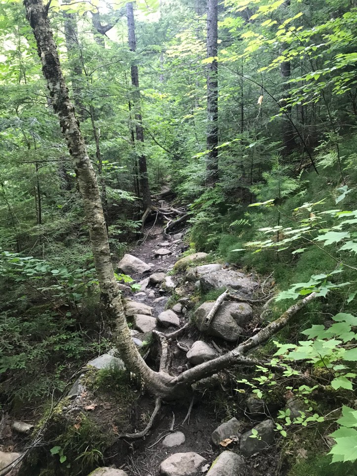
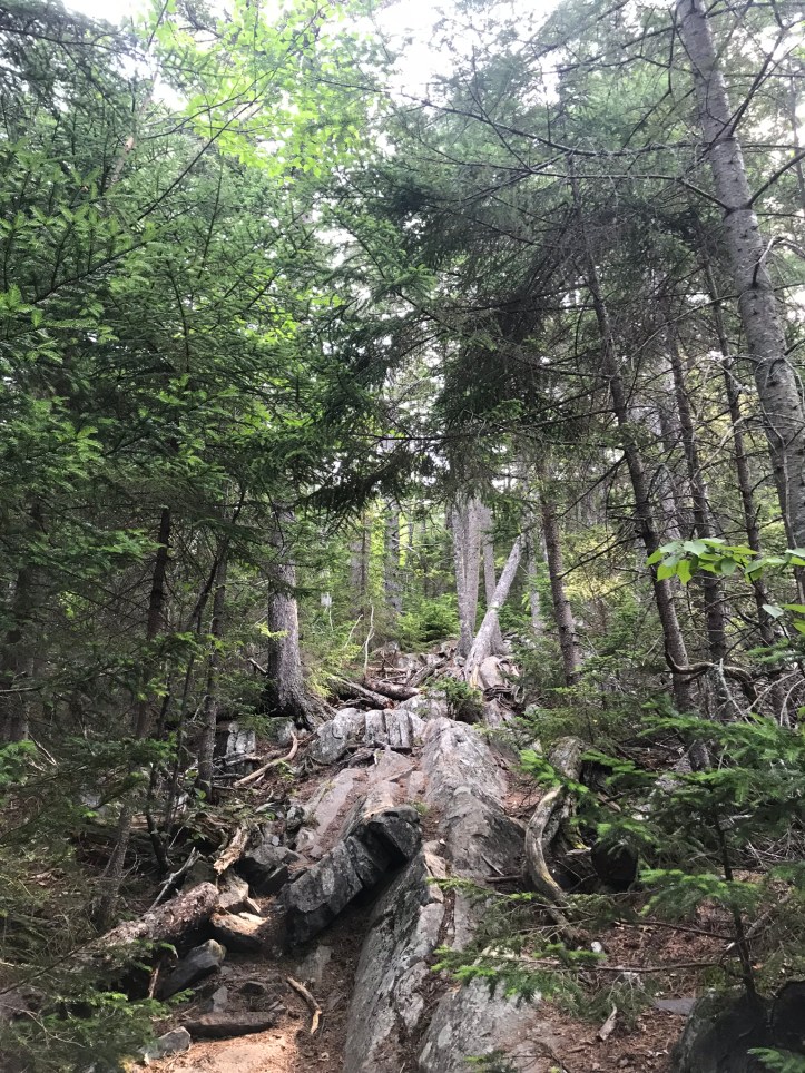
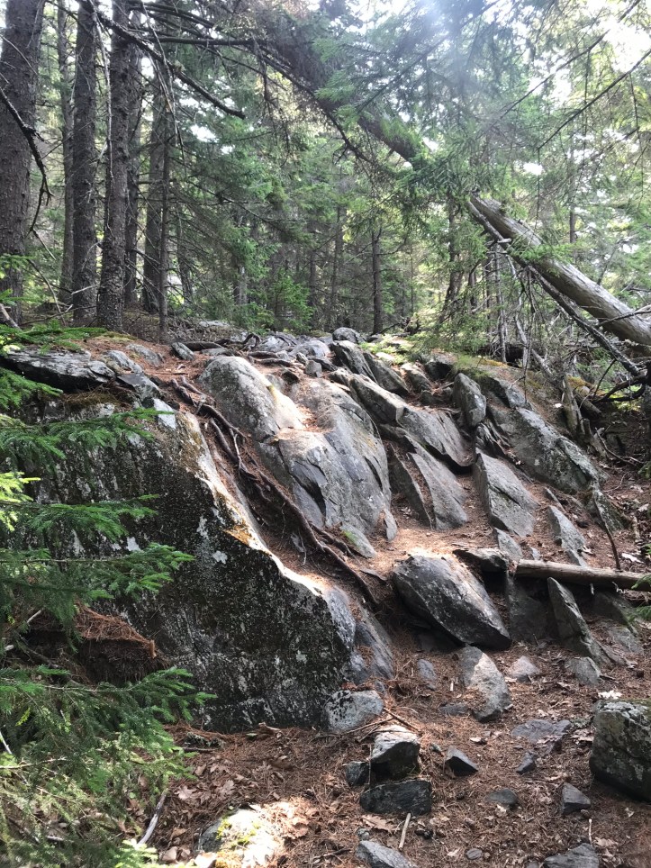
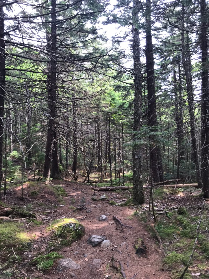
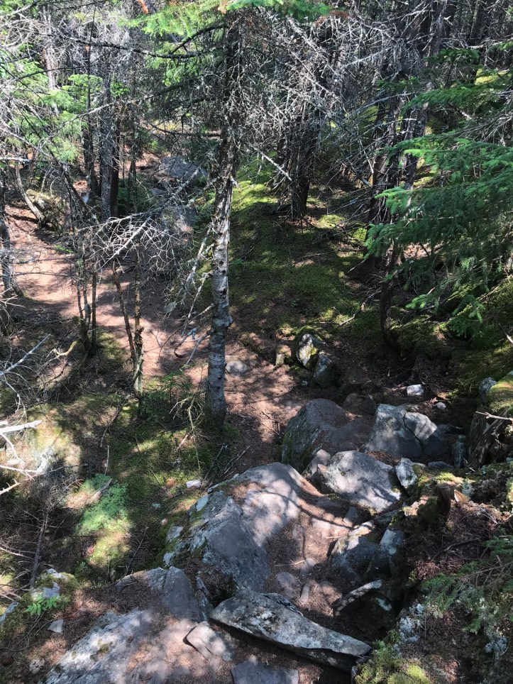
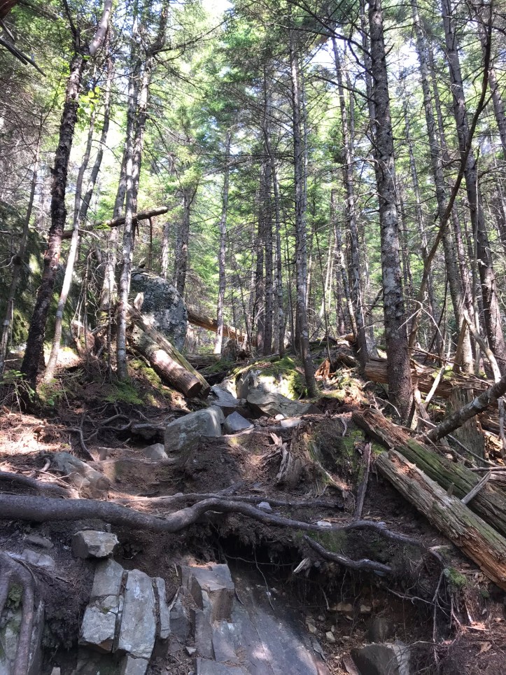
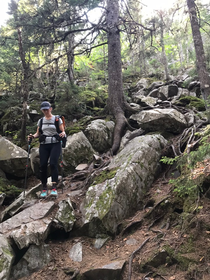
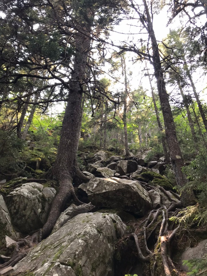
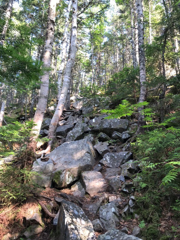
The hike from the rock slide to the Barren Mountain summit was moderately flat at first and then went into full Maine mode with roots and rocks galore.
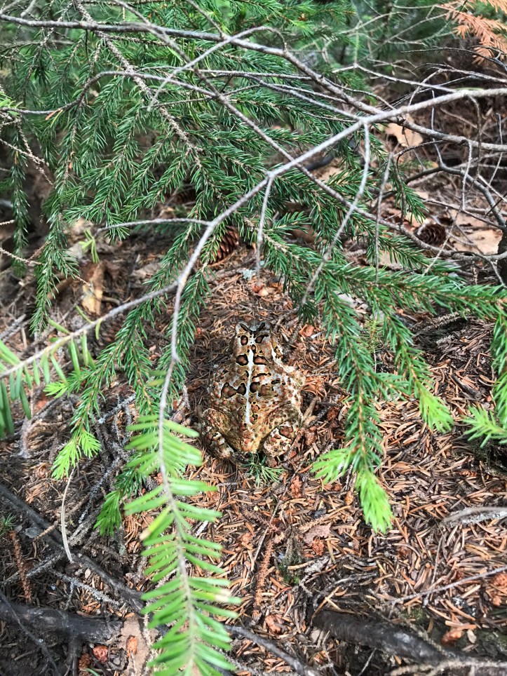
This little camouflaged friend made us both smile as we chugged our way up the mountain:
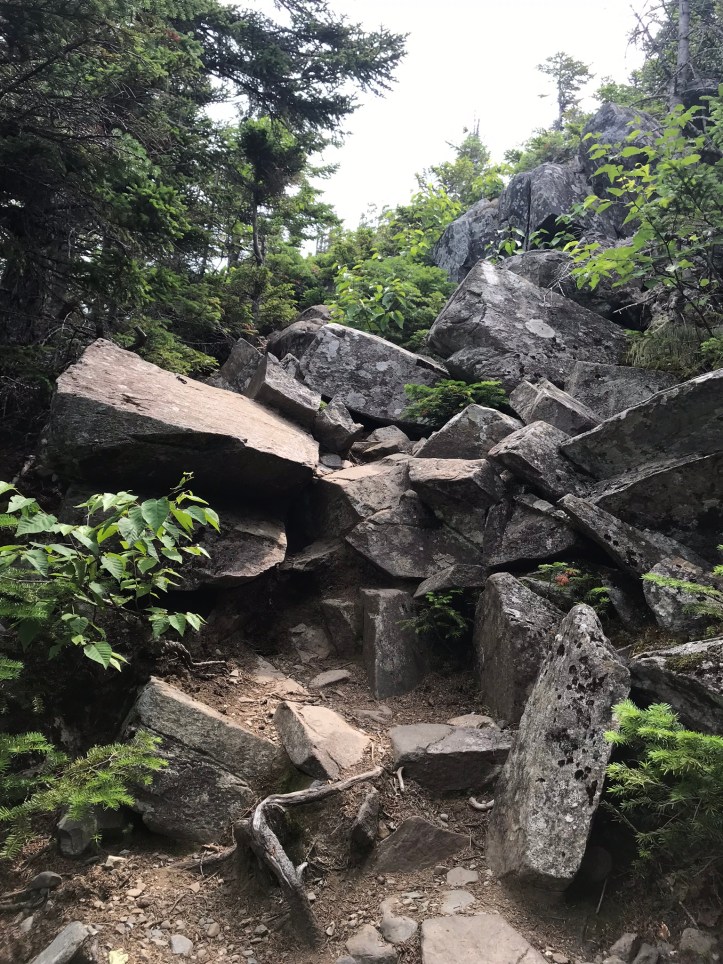
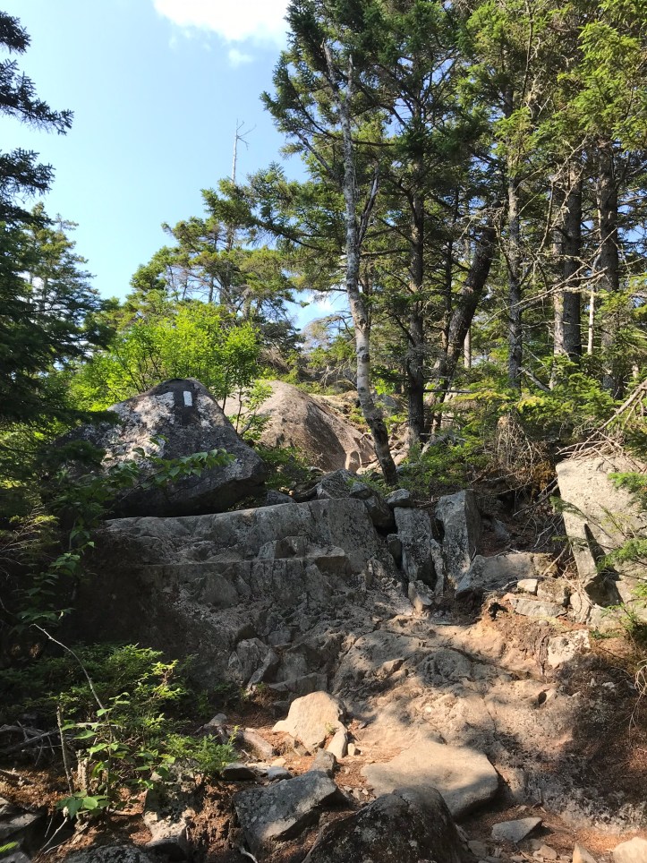
The last third of a mile switched back to reasonable terrain until the very end when the trail returned to a boulder sneeze.
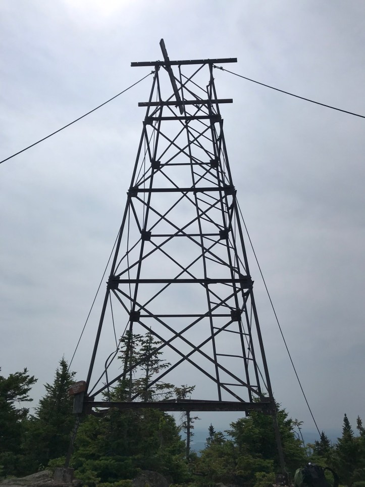
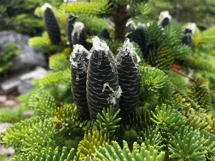
Somewhere along the summit, we saw a metal structure with a ladder that tempted me, but I resisted the urge to climb it. We stopped to gawk at blue green tightly bound pine cones on what I think were fir trees. They had blobs of resin wiggling out of their tips that looked like someone had attacked them with a hot glue gun.
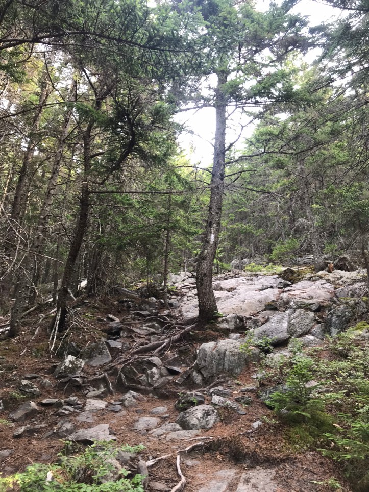
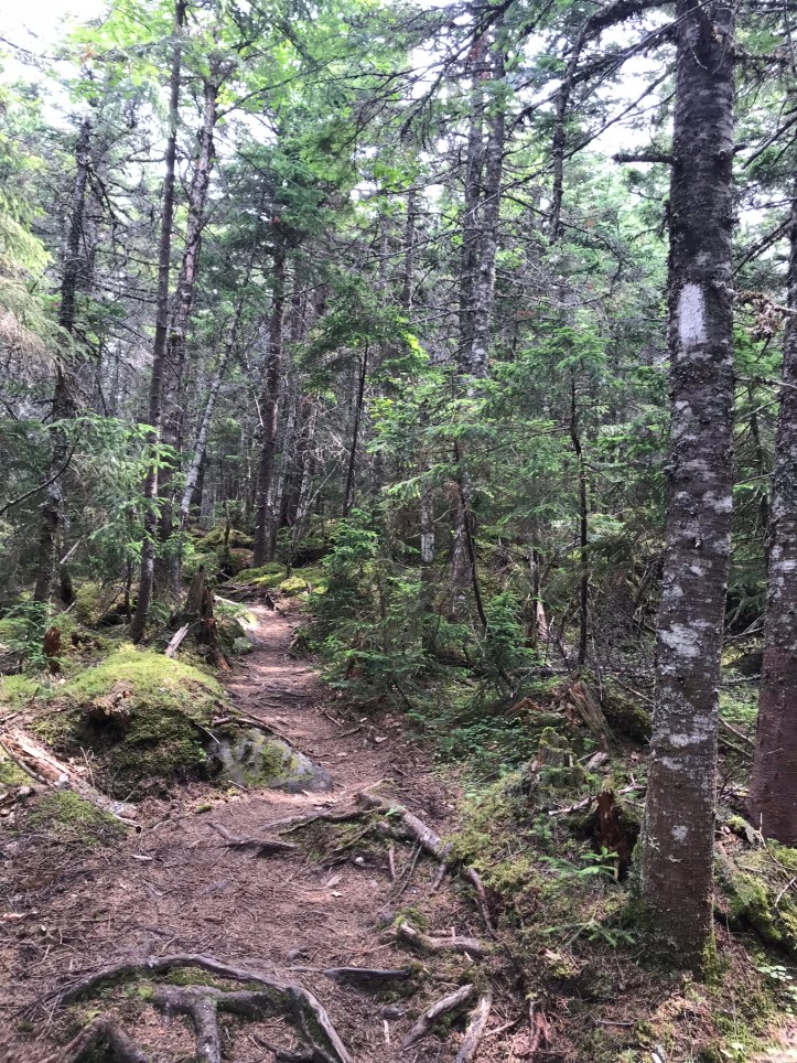
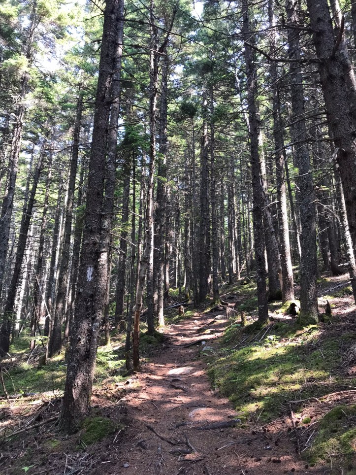
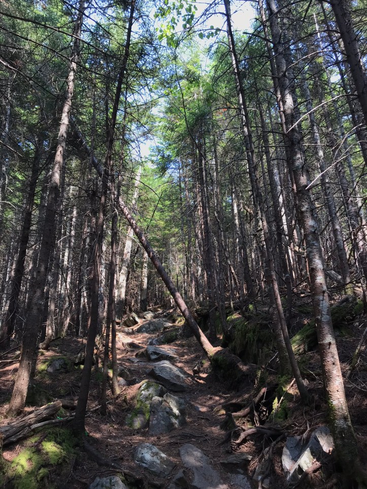
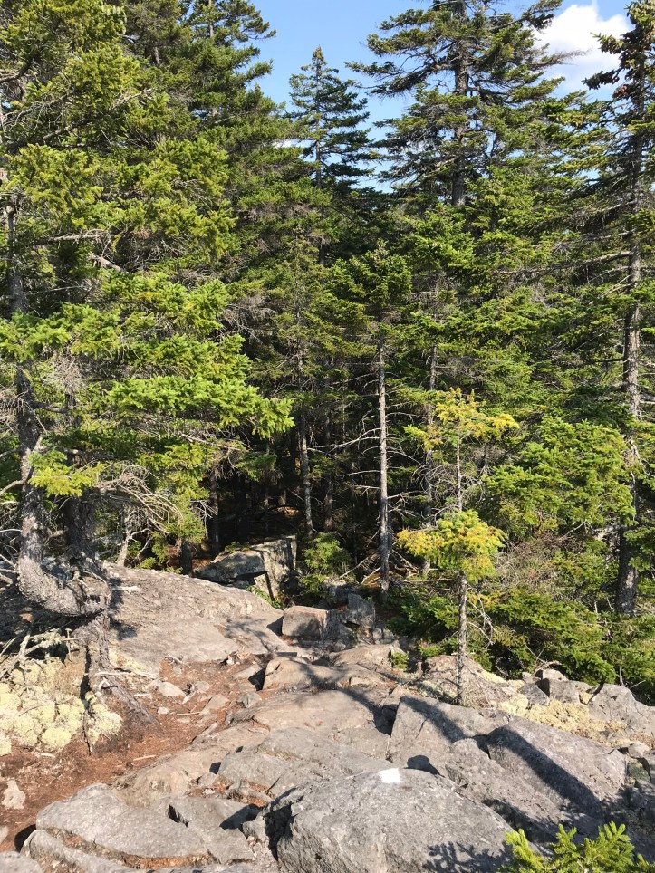
The trail switched over to pine needles and rocks with little elevation change for awhile.
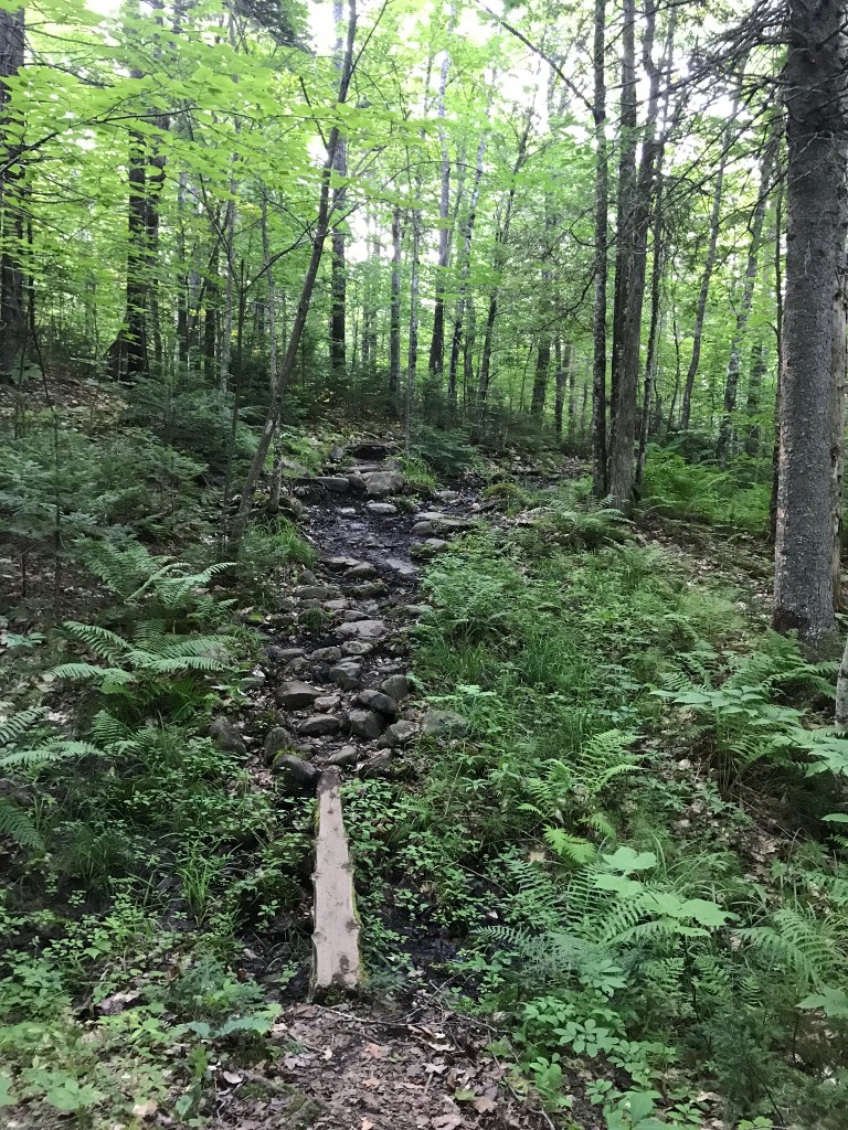
There were annoyingly frequent muddy patches, which made it hard to pick a lunch spot because we didn’t want to plop ourselves down anywhere near moisture (BUGGGS). We eventually stopped on a wide, sloped rock basically in the middle of the trail because we were desperate for the break. Three hikers passed by while we ate, one of whom was a person of color, which is an unfortunately rare occurrence.
The sun shone above us, and a light breeze filtered through the woods. I got a couple of pesky gnat bites, but the bugs were far less troublesome than they could have been. Before diving into my poptarts and beef jerky/cheese combo, I took off my shoes and socks to air out my sad, pruned feet. They had dried nicely by the time I finished my lunch dessert, but my shoes and socks were still damp – four hours after having taken a dip in Long Pond stream. After lunch we walked briefly over the remainder of a reasonably graded section with small ups and downs over flat rock faces and the occasional mucky patch. We were passed by about 7 people all toting blue five gallon buckets.
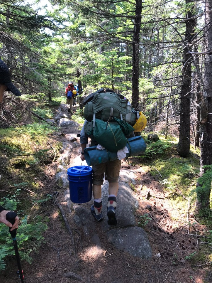
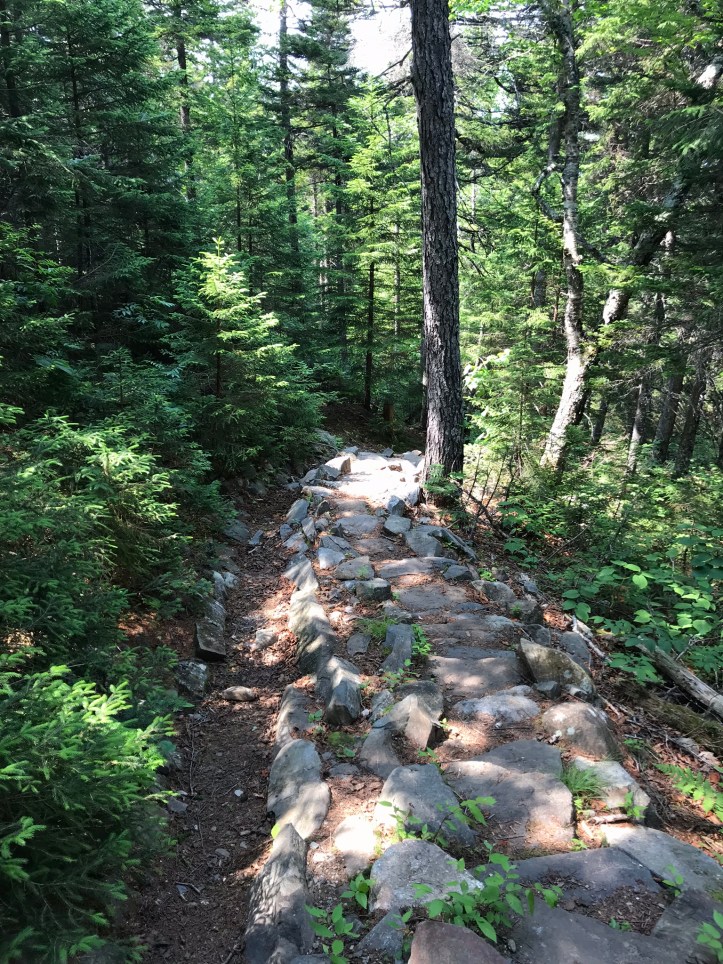
I asked the first person in the group what they were up to and they said, somewhat gruffly, “trail crew packing-in to do maintenance.” I thanked the last guy in line because he actually made eye contact with us. In return, he said “thanks for using the trail.” We continued downhill, occasionally crossing over newly constructed stone steps, but more often over a snarl of roots and rocks.
An older couple stopped to chat our ear off for a couple of minutes telling us all about their hike and the upcoming water issues. We were both a bit overwhelmed by the unsolicited info, but grateful to have water intel. We apparently did not have a reliable source at our intended shelter. The woman described it as “pitiful.” That basically meant we should pack water up from the last stream crossing of the day, 1.8 miles from the shelter. That is a long way to carry extra weight in Maine terrain. In checking out the mileage, we realized that we had a stealth camping option 1 mile short of shelter. We both put it in our brains for a bailout option should the day run too long (again). We were already behind schedule because of the terrain and my morning meltdown.
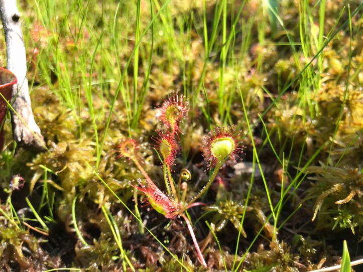
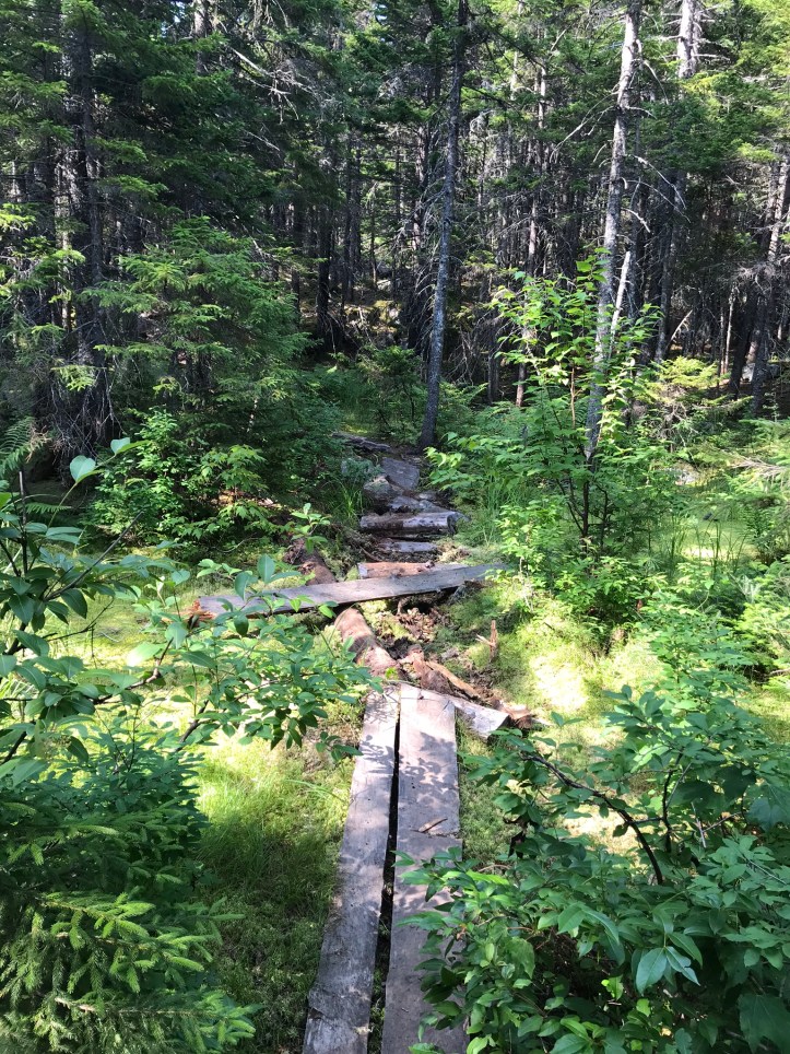
We made it down to the Fourth Mountain bog a little after 2pm. We could see someone heading our way in the distance, so we waited for him to cross the narrow boards so we wouldn’t have to step on the fragile bog plants to let him pass. He limped towards us with KT tape all over his left knee. He confirmed that there wasn’t decent water at the shelter. We started walking over the boards and immediately stopped when we saw marbled green and reddish purple pitcher plants. Some of their cups had water in them and some of the plants had long gangly stems with the weird blossom I saw at east carry pond. I had no idea at the time that I was looking at a pitcher plant blossom!
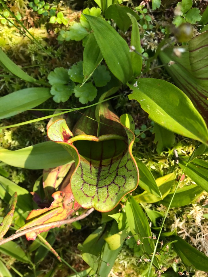
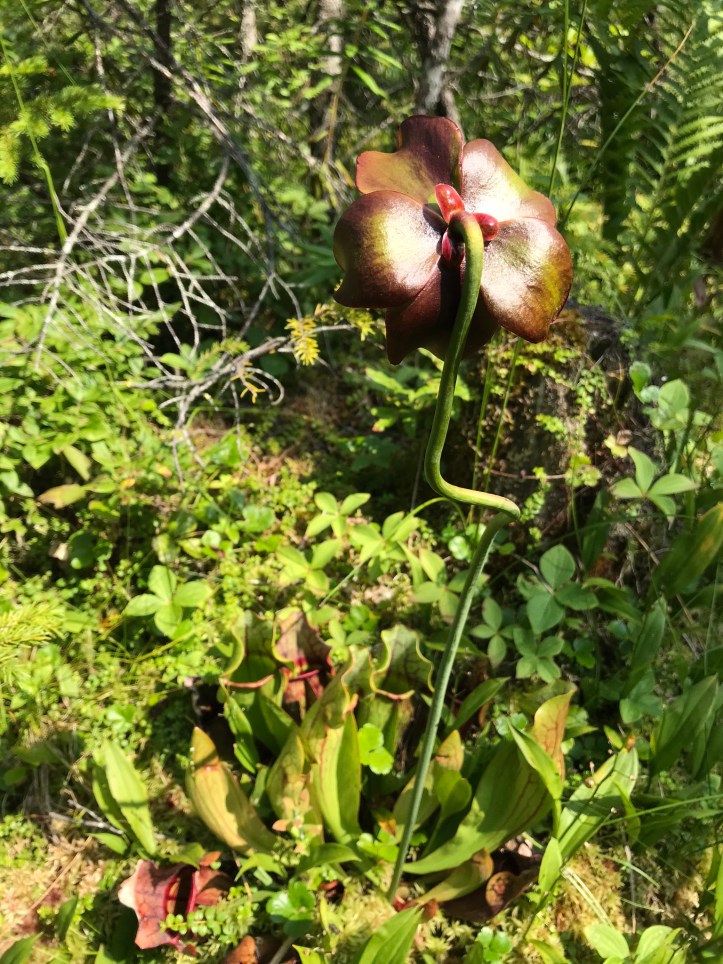
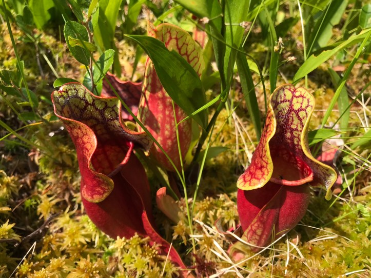
We were both fascinated by the bog plants, which slowed progress to a crawl because we took pictures every 4 feet. Another southbound hiker came along and asked us about water with an air of desperation (not a good sign for us). I told him there was a stream about a mile south of us, and he bumbled past, slopping over the side of the bog board, nearly stepping on the pitcher plants. I was so aggravated by his carelessness. There had been plenty of space to avoid stepping off the boards. We continued walking, ogling the various carnivorous plants and feeling grateful that there hadn’t been a major uptick in the mosquito population despite the presence of stagnant water.
The end of the bog marked the beginning of our Chairback Fourth Mountain ascent (not the most adventurous Colonial naming in this mountain range). The climb started with a bang and continued for most of the way to the summit.
The descent was also a whopper with several treacherous scrambles. I continued to be grateful that it hadn’t rained because it was hard enough with dry footing. Here are pictures looking backwards at what we’d just hiked, one with Oakland for scale.
By the time we reached more moderate footing, I was mentally exhausted by the white knuckle fear of taking a bad step over the steep, jagged rock piles. We took a short snack break towards the bottom of the hill before we lost elevation and opened ourselves up to the potential for more bugs. My feet were throbbing, and I wanted to eat everything in sight.
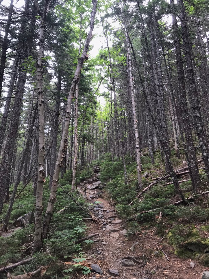
The trip over to “third mountain” wasn’t as extreme. There were a few stretches of pleasant pine needles with a few twists and turns across rock slabs.
One turn was a reroute that saved us from an especially muddy 10 feet of trail. It seemed like a lot an excessive amount of effort to cut the new trail versus adding a few planks to existing bog board bridge, but maybe the ground wasn’t stable enough to support it.
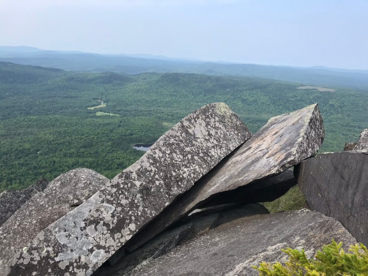
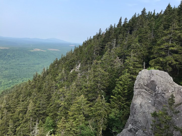
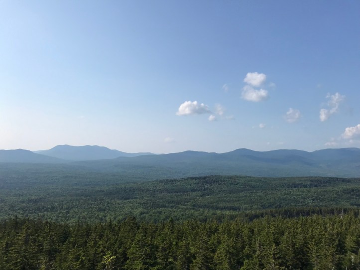
We made it to the top of Third Mountain at slightly faster than Maine mountain pace (aka faster than 1mph). We were in “get it done” mode so I don’t have as many terrain notes or pictures for the rest of the day, but don’t worry – I will still manage to bore you with the details I did record! There were stretches of gnarly rock piles and great views at the top of Third Mountain that we stopped to admire before pushing onward.
The descent down to West Chairback Pond Stream wasn’t too outlandish (no that’s not a typo – it is another stream named after a pond). There were a handful of stone steps and rocky slabs, for which we were both grateful.
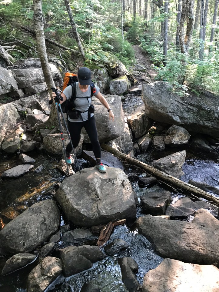
We heard the stream a few hundred yards before we reached the edge of the fast flowing water. It looked like our best option was a dicey rock hop with a step down onto a small pointy rock and a step up to a much bigger rock. I went first and had a false start lowering myself down from the tree onto the small rock. I felt wobbly and anxious about falling. The margin for error was much smaller here because the surrounding rocks were pointy and there was a short drop-off to the left of the step that looked like perfect ankle breaking territory. I tried again and got my right foot onto the intended rock. I would have preferred my left foot, but my intended trajectory forced me to use my right. I made sure my foot was planted before letting go of the tree trunk I’d been using as a stabilizer, and I swung my body weight forward to step onto the bigger rock. Success! My hands and legs were trembling by the time I reached the other side.
I was anxious about Oakland missing the first rock because she, too, seemed trepidatious about the move, but she made it like a champ. Here’s Oakland at the tricky spot – the distance between the two steps is farther than it appears because the front edge of the bigger rock was not a viable surface.
We put our bags down to filter water. Oakland scooped first while I scarfed a bag of fruit snacks to quell both my hunger and my receding anxiety. I heard the tinkle a dog collar, which seemed out of place, so I thought it was my imagination until a boisterous Rottweiler mix came trotting around the corner. It stepped all over my pack and kept trying to say hi to Oakland while she attempted to filter water. She finally gave up to avoid getting bumped into the water as we waited for the owner to catch up to her dog. The dog began to head towards the water, and I quickly asked the owner to make the dog wait so I could grab our plastic scoop that sat on a rock at the water’s edge. I had visions of it getting knocked downstream or of the dog drinking from it because I’d left it sitting there with water in it. The woman called her dog back while I hopped over to get the scoop. She didn’t say anything as she walked by with large pruning sheers and hung out by the waters edge. Maybe she thought my request to hold her dog was a sign of disapproval? Who knows. We continued filtering water upstream from the dog now that it was splashing around in our water source.
We donned our heavy bags and headed north for a 0.7 mile climb to the overgrown viewpoint (amusingly named “No View” in guthook) where someone claimed there was a stealth site. Unfortunately, the bare spot to the side of the trail looked more like a fish bowl made of pine needles than a habitable tent site, but it was a little after 6pm, and our goal shelter was still a mile of unknown caliber. At the very least, we knew that most of that mile would be downhill with extra weight, so we put our packs down to consider our options. We looked at our overall mileage to see if we could sacrifice the 1 mile loss for today in the context of our general plan for the next few days. It would mean a 12.8 mile day tomorrow instead of 11.8. Neither of us were excited about that idea, but it was doable. If we stopped short of 12.8 miles tomorrow, the following day would turn into 10 miles instead of the shorter 9 miles I had planned around a whopper of a mountain. (Whitecap). See, I told you I could still bore you with details!
We decided to make the tent site work rather than go downhill for a mile while racing daylight with water laden packs. We removed pine cones from the open ground and managed to get the tent to fit, but the corners were wonky and the tent fabric wasn’t taut.
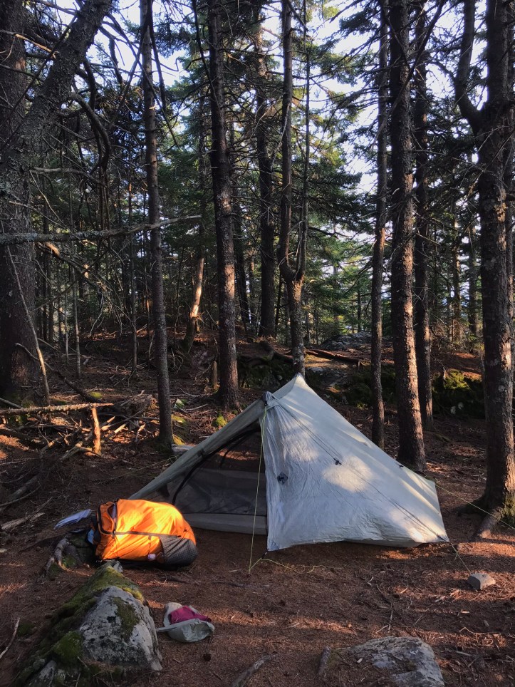
If it rained, we would most definitely be screwed. The forecast was dry, so we crossed our fingers and moved onto the next chore: bear bags. There were exactly zero feasible options because we were surrounded by gnarly evergreens with tightly packed branches. We decided to rig the bags such that squirrels couldn’t get in them, but with no chance of being defended against bears. A man with a pack and a chainsaw passed our site as we were troubleshooting our idea. I asked him if bears were common. He told me he’d seen one bear in all his life. Great! Question Answered. He then proceeded to mansplain to me that the bear line should be a hundred yards from the tent no matter what and to put all smellables in the bag, as if I had no clue what I was doing. I confirmed in a tight tone that I knew the proper procedures. Thankfully he went on his way without trying to be more “helpful.”
We went back to rigging each of our lines between two trees so our food bags would hang in midair away from the surrounding tree trunks and squirrel highways. Then we set up our dinners. I put my bed together while the food cooked. A light breeze cooled the air enough for my hands to get the tell tale numbness that comes with dropping temperatures. Another hiker passed us and said “nice spot.” I wondered if he had been counting on the stealth site, but there were better ones closer to the stream at the bottom of the hill, so I didn’t feel bad for long. We had passed those sites in favor of eeking out a bit more mileage for the day. I’m not totally sure it was worth it, but what’s done is done. The air felt damp, much like a sea breeze, which made my circulation continue to go haywire. We did our dishes and moved on to the frito course, then dessert and teeth brushing. Then we hung our food bags in a way that felt ridiculous, but we didn’t have enough room in the concave tent to give up completely and sleep with them.
Oakland pointed out that we could see the sun sinking through the trees, so we watched the blazing peachy, pink sun with intensely delineated edges. I couldn’t get it to come out in any of my phone pictures, but it was incredible in person. I continued to stare at the sunset while Oakland peed. Then she put her bed together while I went off for my (hopefully) final pee break of the evening. I got in the tent after Oakland squared away her sleeping pad. The left side of the tent was very sloped, and Oakland was justifiably anxious about having a bad night of sleep. I offered to switch with her, which she stoically declined. We changed into our long johns and sleeping shirts and shimmied into our sleeping bags for warmth. We reviewed our upcoming mileage in guthook and decided to try to get an earlier start because our evening arrival times have been challenging. Getting into camp after 6pm makes the days run together in an unsustainable way. I’m finishing this to the sound of the wind in the pines, the sagging tent flapping around, Oakland sleeping, and the occasional creature noise nearby. Fingers crossed the squirrels don’t get our food!
Mile 2091.2 to mile 2102.5 (11.3) – stealth site @ “No View”
Checklist total miles: 971.1
Oakland total miles: 493.7
Creature feature: several frogs, the water seeking Rottweiler, a song sparrow hopping over moss, a few juncos flashing through the trees
