July 24, 2019
I did not get a great night of sleep. The moose tromped around in the woods the entire time I finished my notes, and she was still out there when I finally fell asleep. The tent site sloped in such a way that I felt like I was falling downhill no matter which side I slept on. I woke up at 4am and had to pee so badly that I had to get out of the tent to take care of the problem. I sort of fell back asleep until Oakland went to the privy around 5:20. I followed suit to make sure I beat the gaggle of teens. It was a long walk to the privy. I saw the moose snacking in the water on my there, but she was gone by the time I made my return trip so no picture for me. We changed our clothes and packed half of our gear before eating breakfast in the tent. I was nearly out of peanut butter so Oakland gave me part of a payday bar for protein, but the sugar made me feel vaguely sick to my stomach. I finished packing my stuff while Oakland returned to the privy, which was so ripe that both of our raincoats (aka mosquito guards) smelled vaguely of privy as we took down the tent. We theoretically had a lot of stream fording on the agenda, which I was decidedly NOT looking forward to. It seems like we just can’t catch a break in Maine. No giant mountains to climb hand over hand?? Find a way to cross streams that should actually have bridges!
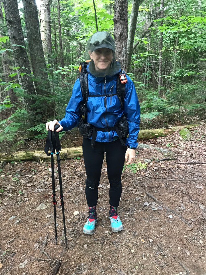
We donned our bug nets and raincoats and walked past the youth group’s food bags and cookware all sitting in a heap on top of folded tarps. We still didn’t realize that people don’t tend to hang their food bags in Maine, so we were horrified that we had gone through all the trouble to hang ours and this group hadn’t made an effort at all. The morning started with rocks and evened out to gentle ups and downs.
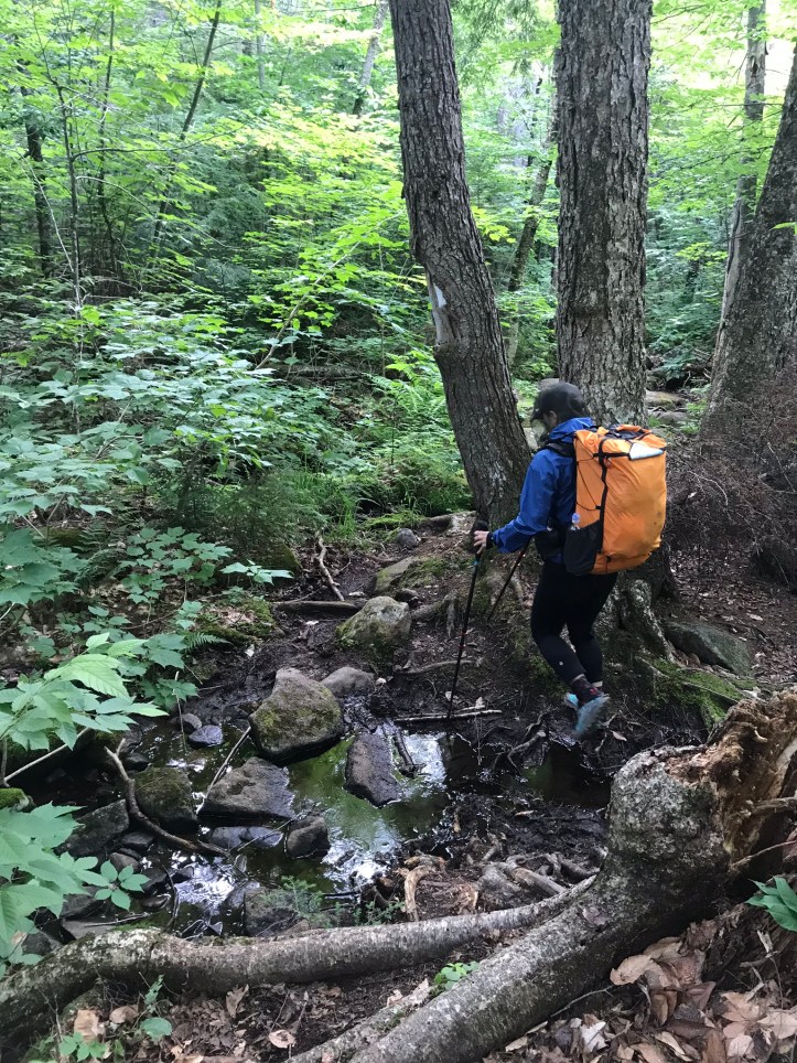
The bug levels waxed and waned between terrible and abominable. I pulled my head net over the brim of my hat (like a hairnet) to keep my ears covered while improving my vision and improving circulation. The pond sat to our right for a bit then the trail turned left, and we eventually walked within sight of the beautiful Bald Mountain stream. We crossed stone work with big rocks across mucky sections (thank you trail maintenance). There were some majorly rocky sections that raised my blood pressure because it was yet another instance in which my opinion of the footing (bad) seemed completely disparate with everyone else’s (“it’s fine”). There were a few especially mucky sections that required crossing over downed logs with no ability to use our poles because they sunk down into nothingness.

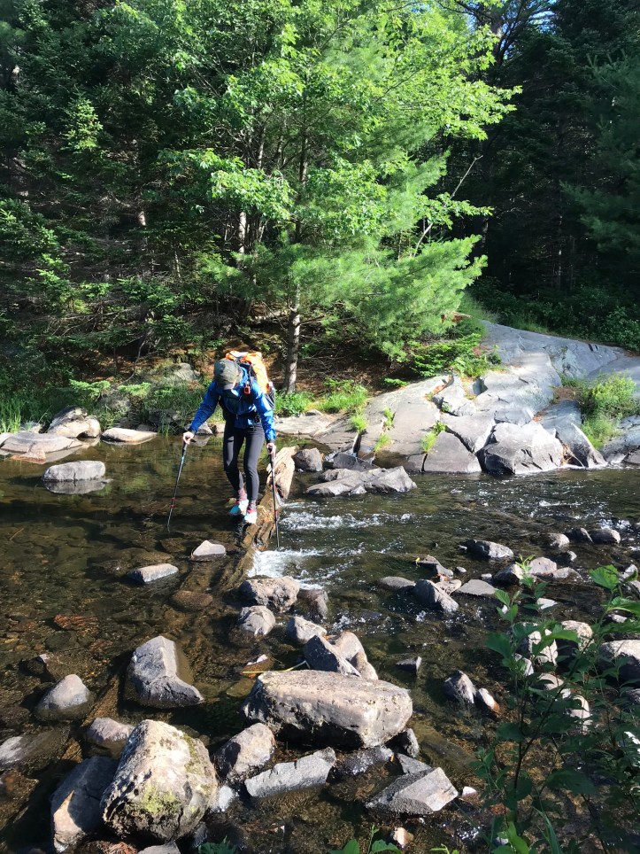
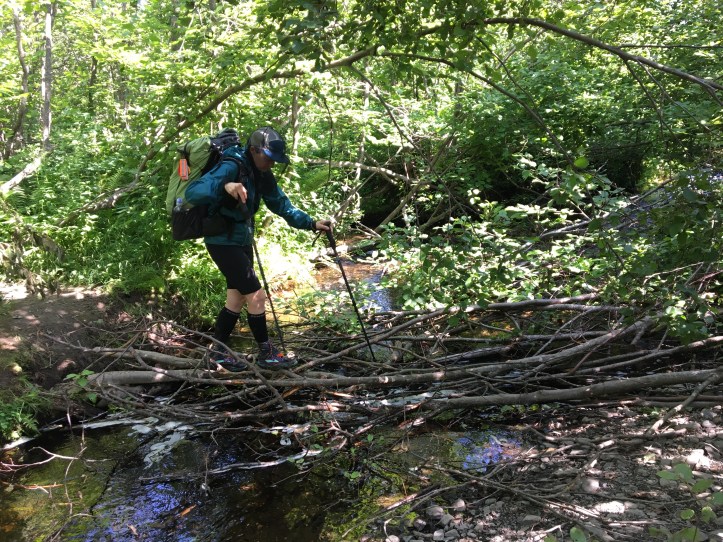
Then came our first tricky crossing over Bald Mountain stream. The dry rocks were spaced in such a way that we had to rely on a wet log to bridge the gaps or resort to fording it.
I decided to go for the rock hop and slowly picked my way across, somehow managing to not slip on the log and stick the landing for the pointy, small rocks in the middle. Oakland followed suit with some fancy footwork.
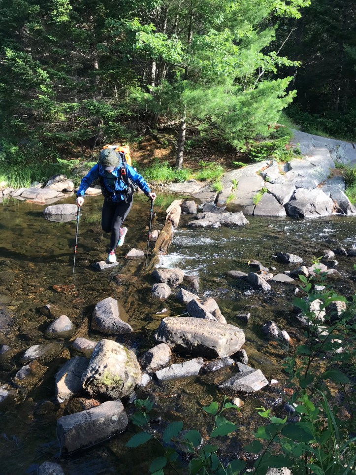
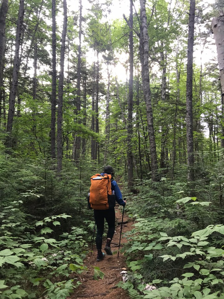
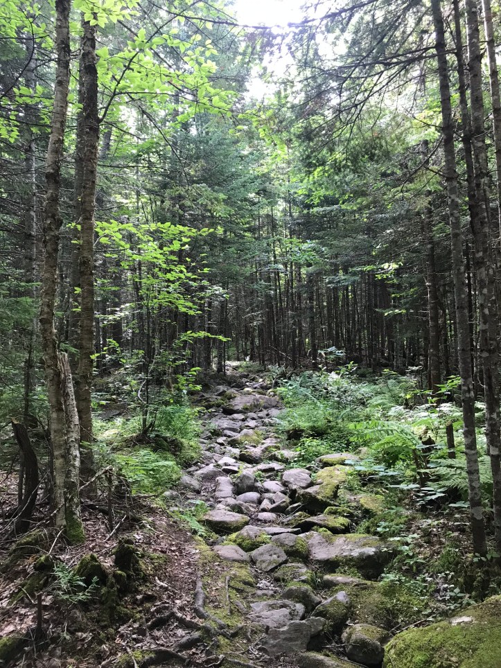
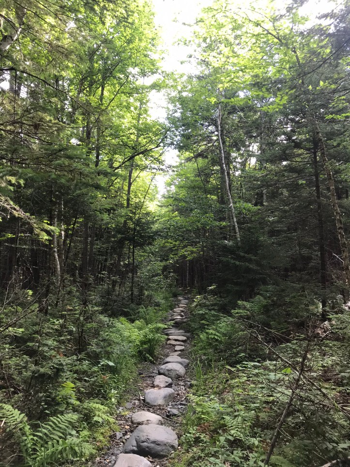
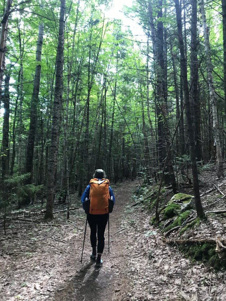
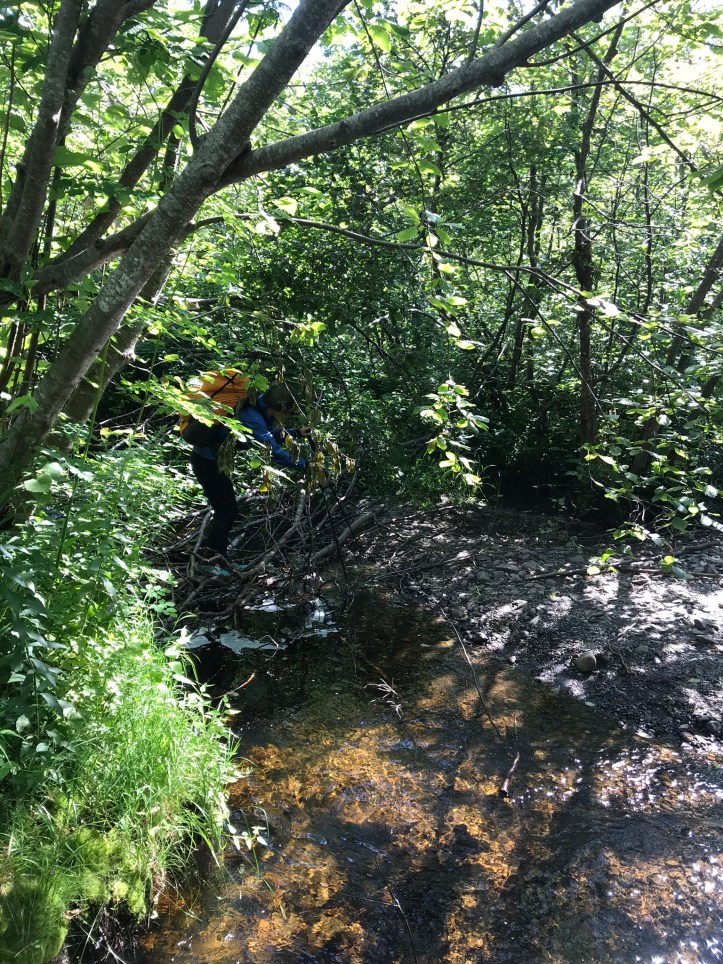
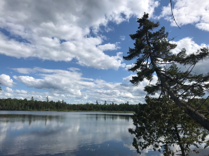
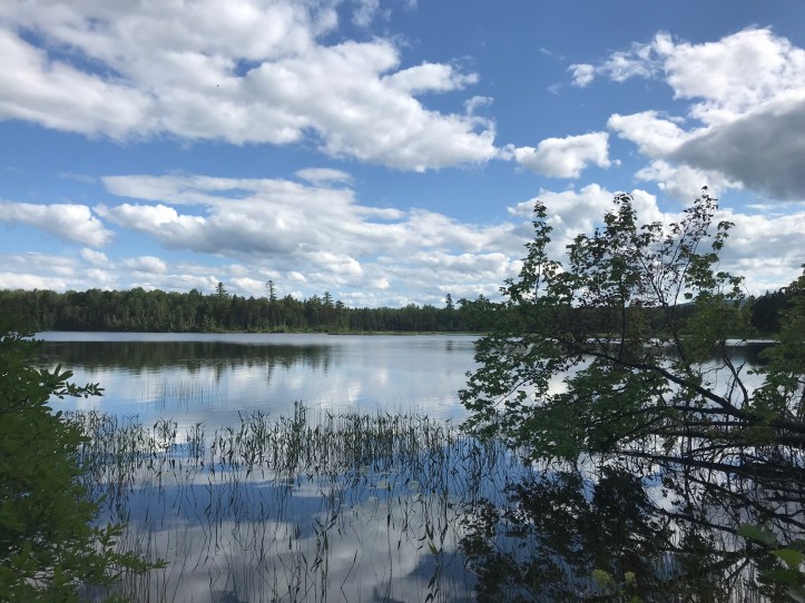
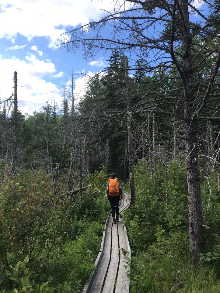
We both let out sighs on the other side and continued north over rocks and the occasional boggy section. Here are a few pictures because I didn’t take detailed notes, except to say that there were massive mosquito clouds along the way.
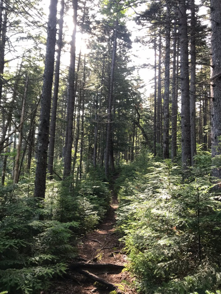


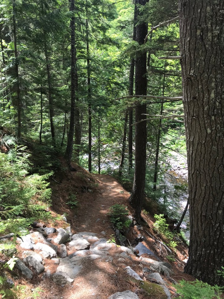
We eventually crossed a small woods road and turned away from the stream through pines over nice footing.
We stopped to eat snacks on a log with our bug nets and raincoats on. The vampires swarmed, but our chemical defenses kept them at bay. I made sure to put deet on my hands to prevent bites on my knuckles and the tops of hands. I find those bites to be insanely itchy for whatever reason. I hiked with the dread of impending stream crossings while also managing to appreciate the kinder footing and laughing at the massive amount of moose poop lining the edges of the trail.

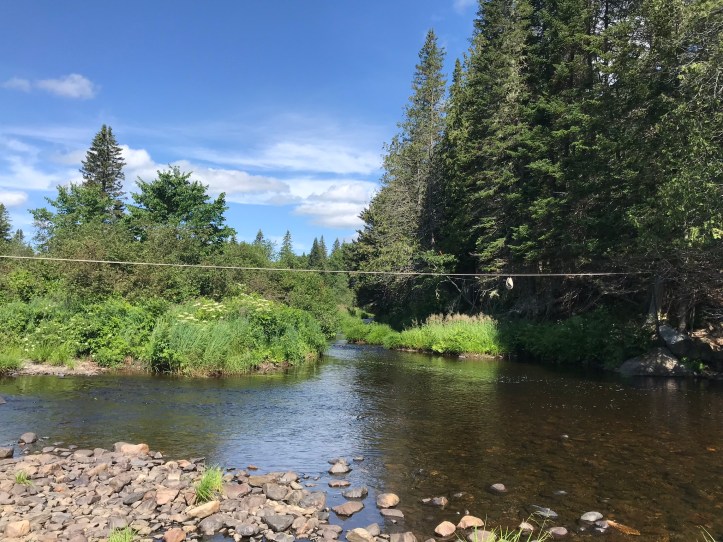
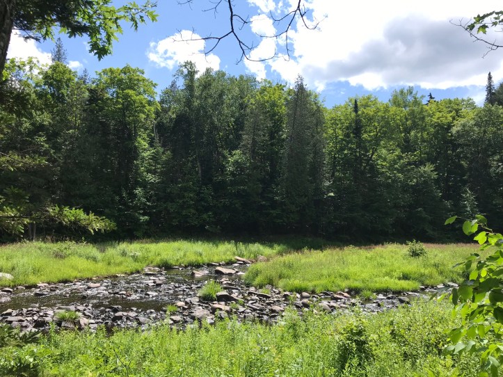
We made it to the edge of our first Marble brook crossing and surveyed our options. The fast flowing water was deep right below our feet and far too wide to jump across. That said, the water level must have been really low because the guthook pictures showed a much wider brook than the small curve that stood before us. There was a morass of saplings that crossed the narrowest point in the brook. I’m assuming a human constructed it based on the uniformity. We decided to use it as a makeshift bridge. Oakland inched her way across first and safely made it to the other bank.
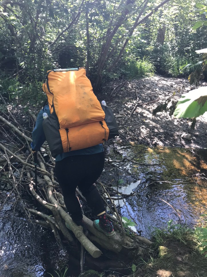
I also managed to make it across without snapping any of the branches. Success!
The second Marble Brook crossing was an easy step over a medium flow of water. The trail then took us up and over a hill across a piney ridge that was covered in moose poop. We laughed to ourselves and nicknamed it a Pooperhighway, which is a term we still use today. The trail went back down to the west branch of the Piscataquis river, which was wide and fast flowing, but thankfully the water level was very low. I spied the useless rope that guthook users had whined about in the comments (it’s way too high, especially near the far bank).
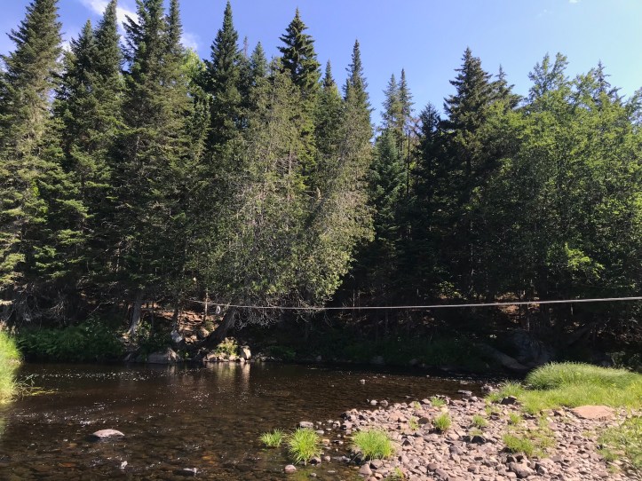
Apparently, the AMC doesn’t install ropes (shocking), so any ropes or cables you see at water crossings in Maine are not AT sanctioned – at least not in 2019 when we hiked this section. I sat on the rocks and removed my shoes, ankle brace, gaiters and calf sleeves. I shoved the loose items in the side pockets of my back, tied my shoes together and attached them to pack. The water was cold and the bottom was covered in smooth, slippery stones with a few sharp surprises, such as when my left foot slipped and landed on something unfortunately pointy. People with camp shoes arrived as Oakland reached the halfway mark. They quickly switched out their shoes and tromped through the water without worrying about their footing.
We sat on the bank and dried our feet off with our socks before reassembling ourselves. We hiked through more pines and hardwoods alongside the river. I found a new purple flower that looks like a collection of ruffled dresses.

Every so often, the trail veered away from the water, took us uphill and then plunged us back towards the river bank.

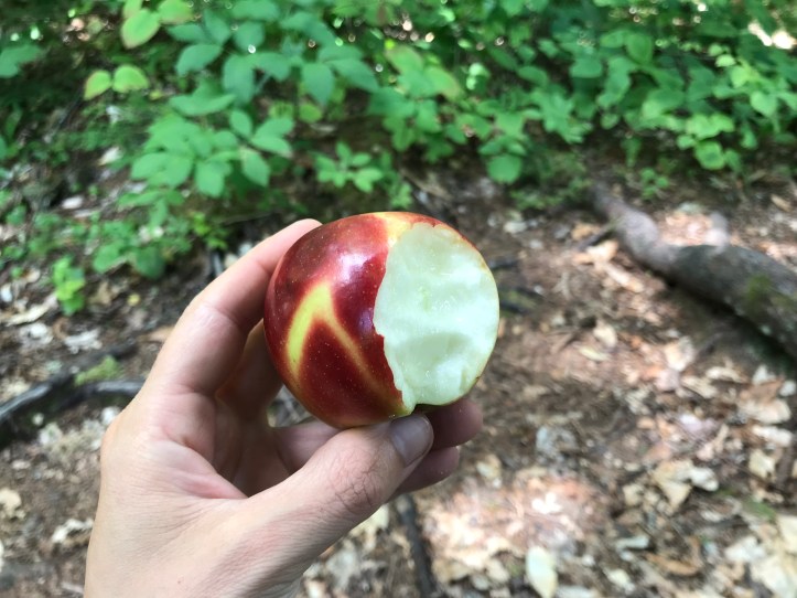
We stopped for water at a stream that crossed over the trail. We decided to remove our raincoats and deet-up rather than turn into complete greenhouses as the temperature rose. I was so hungry that my stomach actively rumbled, so I voted for an early lunch on a peeling birch log at the edge of the trail with a nice view of the river behind us. I ate pop tarts while Oakland made her customary tuna/cheese/frito wrap. I’m struggling to remember where we got this apple from, but I know it tasted good!
The gaggle of teenagers from our moose shelter passed us as we made our way through various lunch courses. We were back in action around 12:30 with 7 more miles to our intended destination (a stealth site a few miles from Route 15). Puffy clouds hung overhead and a light breeze filtered through the woods. We continued along the river, bending away from it and wending our way back down over roots and pine needles. The sound of rushing water greeted our returns to lower elevation, and sunlight glinted off the river’s surface. The shoreline was occasionally grassy with ferns and yellow lilies.
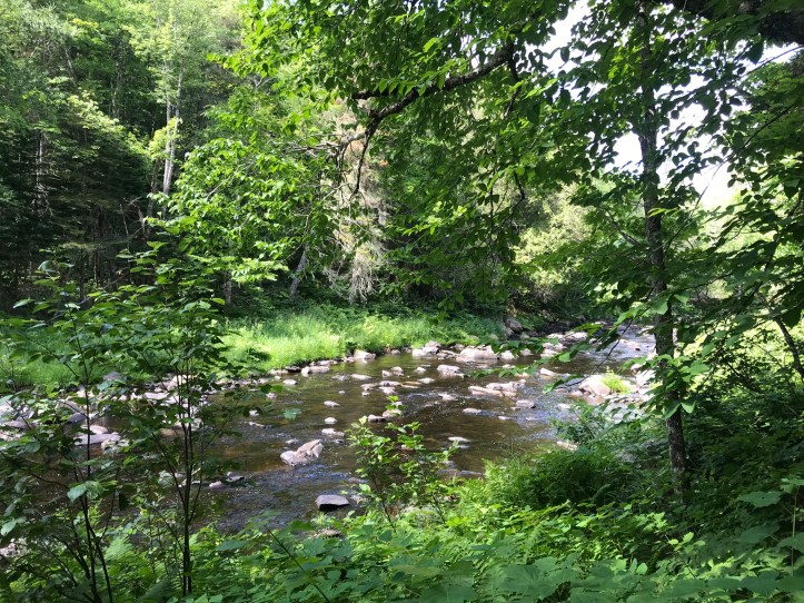
About a mile after eating, we came to what was described as a “rocky outcrop,” that looked inhospitable in the guthook pictures, but was actually a nice shoreline with rocks that would have made for a great lunch stop. Oh well.
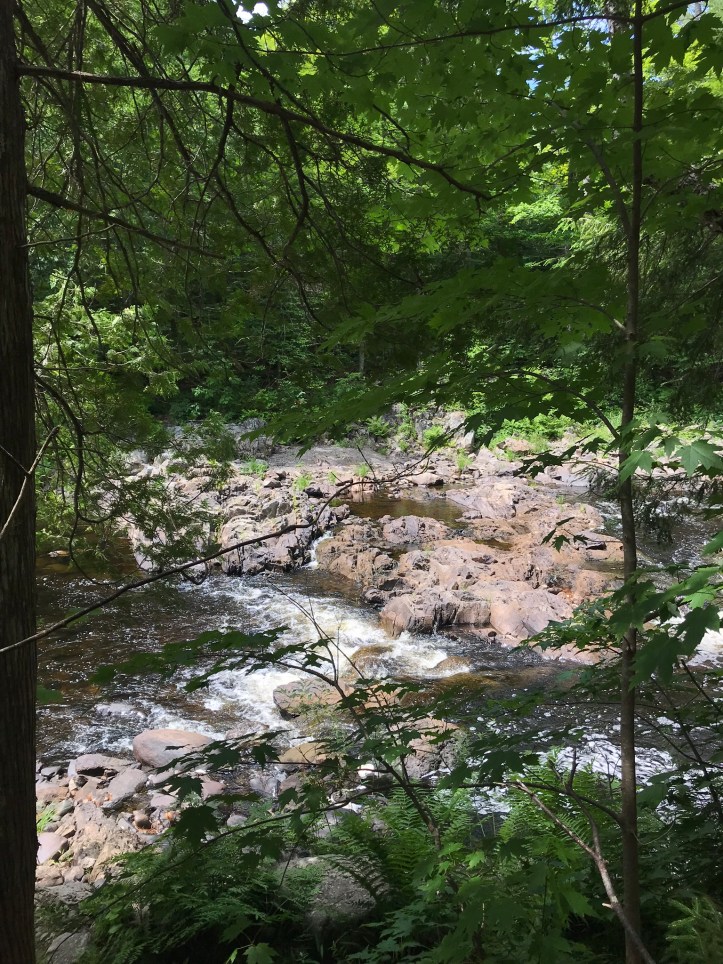
A few minutes later we passed the turn-off for Horseshoe Canyon shelter. Down a long, steep embankment, we could see deep water flowing over boulders in series of cascades. I tried to get a pano, but the height of the piney bank flattened out in all the pictures. I wish I had taken a video to capture the low gurgling and rushing sounds of the water.
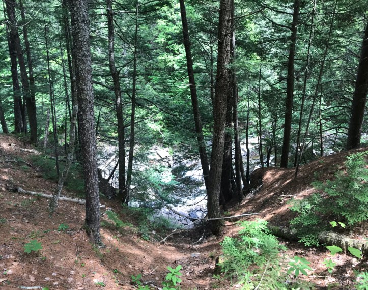
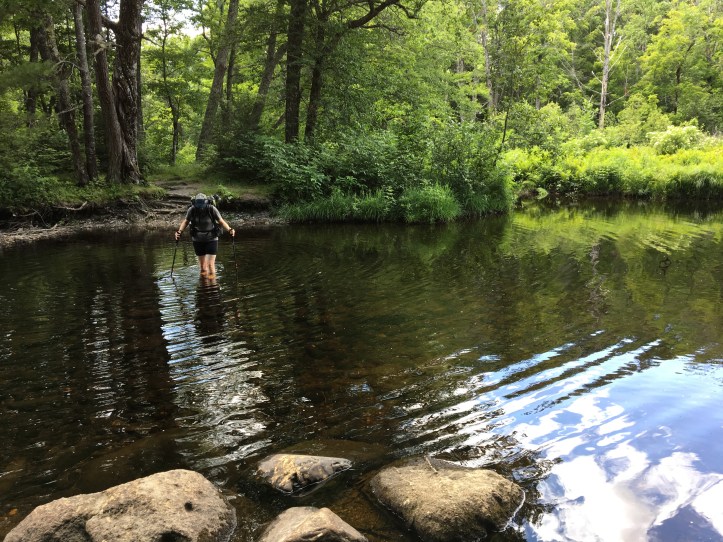
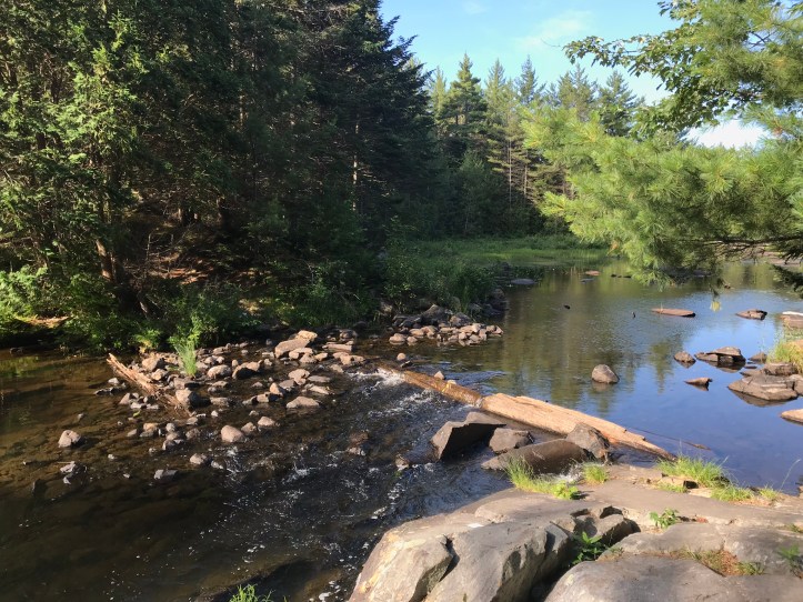
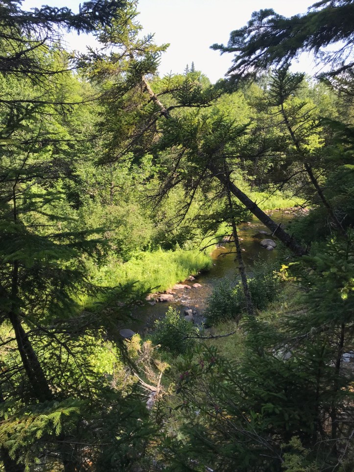
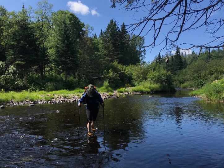
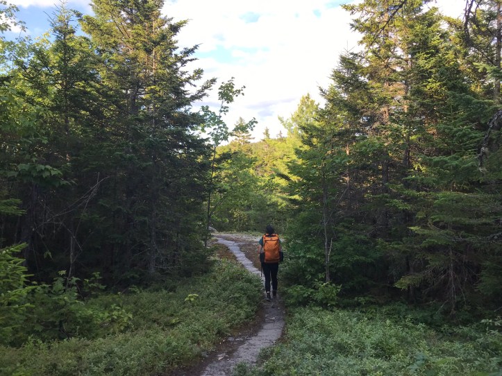
We stood still and watched the water for a few seconds before continuing north. The bugs intensified whenever the trail took us closer to the occasionally shallow, marshy banks. Gnats persistently bobbed in front of my bug net. Every time I swiped them away, I felt dozens of bodies bounce off my palm. I don’t know why I bothered, because they immediately returned, as if they were on a string. We eventually came to the second major river ford of the day across the east branch of Piscataquis river. It was about as wide as the last one, but deeper. Three SOBOs sat on the southern bank putting their shoes back on. We made small talk about the crossing, and I told them that the west branch was an easy ford at the moment. Oakland went first and found herself in water up to her lower thighs.
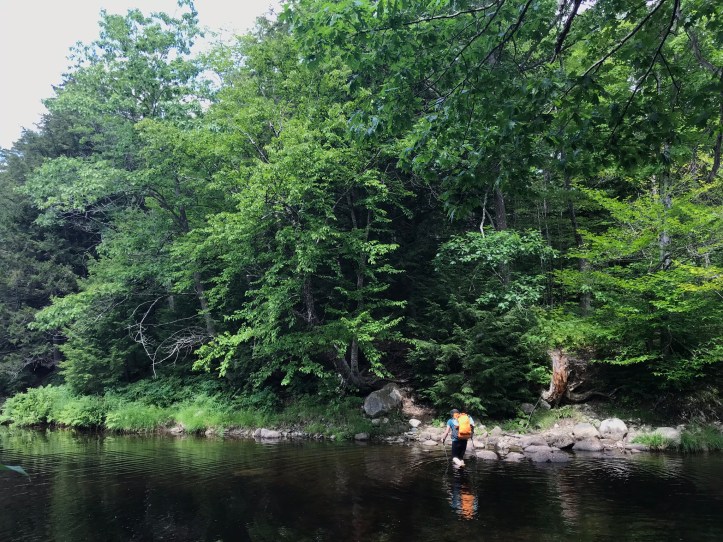
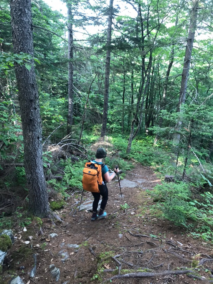
I followed after she’d reached the shoreline and managed to pick a route that only went up to my knees (today’s top pic). The rocks were better than the west branch, but my hyper sensitive feet were still cranky. We put our lower halves back together and used the roots of a giant tree to scramble up the steep bank. A hiker with a complicated hinging knee brace asked if the river was slippery. I replied with “no, not really,” which seemed to comfort her. She was shorter than both of us, and we could imagine how much harder the trail was for her given the differences we’d noticed between ourselves and the gazelles.

It was a beautiful, breezy, sunny day, but the wind was no match for the bugs, which continued to worsen as we got farther from the river. I floated the outlandish idea that we go long for the day and try to make it all the way to the pick-up point for Shaw’s hostel. This was probably the 4th or 5th time the idea had come up throughout the day, and I feared that I would exhaust Oakland with my constant hemming and hawing. To my surprise, she said she was game to shoot for hostel, so I turned my phone on to see if I could get a signal on our short climb. A few texts bounced through, but my signal wasn’t strong enough to call. We kept walking up through leaf covered, root-strewn path with long stretches of better footing. I finally got a good enough signal to make a call and managed to reserve a private room. I posed the question as a matter of tacking the night onto our existing reservation, which is how I found out that Shaw’s had no record of our original booking. Cool. Glad we found THAT out before arrival.
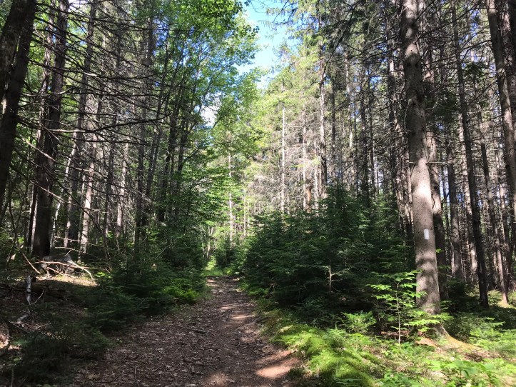
Hello, zero day! and hello, longer day than we’d expected. Thus began the semi-rushed late afternoon hiking in an attempt to make it to Route 15 at a reasonable time for Shaw’s to shuttle us back to the hostel. Oakland suggested we aim for a break at 4:30 to give ourselves a carrot to shoot for, but that felt like too long of a commitment for my psyche. We bargained for 3:45 snack break and hauled ass through the relatively easy woods. The terrain varied widely between pine forests, rooty sections and bog boards galore with the occasional muddy pocket that could have used boards. We crossed several logging roads, and somewhere along the way, I saw a new yellow flower. We also walked through a section that felt like we were surrounded by Christmas trees.


The bugs discovered the waning powers of our deet right before our break, which led to a lot of grousing and slapping at various limbs as we dropped our packs. I sat on a downed and peeling birch tree and got 6 new bites in the span of three minutes while I checked our mileage and dug out my snacks. After wiping ourselves down with more deet, we both crumpled onto our seats, feeling exhausted but determined. 5.1 miles to go. With food and water in our systems, we went back into Mission Mode and hiked faster than usual whenever the footing allowed for it. I felt burnt out almost as soon as we resumed hiking, but I tapped into my long-run mode where you just keep going and fight the urge to accept your body’s message that you’re too tired to move. Eventually, the trail wound us around part of Lake Hebron, which thankfully did not include much of the usual lowland roots that accompany ponds and lakes.
Then we went back into deciduous forest with multiple stream crossings and other areas of stagnant water. Oakland dubbed it Mosquito Mordor.

We climbed up buck hill, which consisted primarily of steep, packed dirt that aggravated my Achilles’ tendons. I tried my best to keep our “make it or break it” pace despite the angle. We were holding a solid 2.1-2.2 mile an hour pace at that point, which felt pretty fast relative to the footing and our usual Maine pace. The trail ran just below the top of Buck’s hill and took us past a small overlook where I plopped down for about 90 seconds to eat fruit snacks and get off my feet. They were getting pretty sore but had yet to reach code red.
Oakland stood the whole time because her shoulder hurt and taking her pack off wasn’t worth the trouble. She offered to go first down the hill, and I gladly accepted. We started with some 5-6 foot drops, but thankfully that didn’t last long before switching over to pine needles, exposed root barfs and the occasional rock slab.
We crossed over a marshy section with a nice bog board bridge. Then we went back into the woods and continued over tricky footing.
We heard loud road noise and the whining of industrial trucks about a half mile from the road. The last two tenths of a mile were an abrupt transition to what felt like the top of a bald mountain with frosty moss and pines scattered over rock slab.
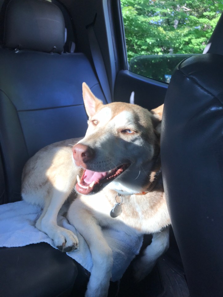
We edged our way down a small rock slab to the road level and crossed over to the parking lot. I sat down on a boulder immediately (as requested by my feet) and called Shaw’s. Someone would collect us in about 15 minutes. We ate cheezits, cashews and m&ms while we sat in a satisfied daze. Our driver arrived in a pickup truck with a cinnamon husky in the back seat. The young woman lowered the tailgate for us to put our bags in the covered truck bed. Oakland was about to sit behind the driver when she noticed a puddle on the seat. She said, “umm, maybe your dog peed?” The driver hopped out of the car and rushed to clean it up with a towel. Needless to say, Oakland got in on the other side, and I took the front seat to fulfill my uncommon role as the talker.
It was a short ride into Monson, which was a sleepy, picturesque town full of giant old houses. Shaws is like a complex, with multiple buildings on the grounds. The main hiker building has a living room, industrial grade kitchen, a communal dining area and an upstairs with several private rooms, two bathrooms and a few “bunk rooms” that were single twin beds, not actual bunks. The front 3/4 of the red building is the owners’ residence and there’s a gear and resupply shop in the back.
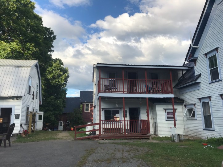
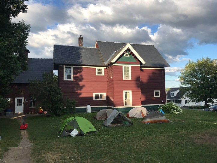
Our room had a framed mushroom picture on the wall, which felt appropriate. It was modestly sized, with simple furnishings, a double bed, wood floors, and two giant windows that faced the lawn. We ate more snacks and split one of our welcome sodas (ginger ale). Then we mustered the energy to go back down the wicked steep staircase and make chili Mac for dinner. Neither of us wanted to have any leftover food in our bags since we had full resupply boxes waiting for us, and we were both in the mood to keep it simple rather than go searching for town food.
There were clusters of people everywhere. It wasn’t crowded in any given area, but there were enough hikers to give it the feel of a busy hostel. I felt out of place and overwhelmed, and I worried about Oakland feeling left out. She assured me she didn’t care, and, while she does feel invisible in these spaces, she was okay with it. I, on the other hand, felt angsty and unsure of how to integrate, and whether I even wanted to make the effort. I strongly identify as a thru-hiker, but the reality of my hike never matches the traditional thru-hikers around us. After seeing how Oakland gets treated as a section hiker, I’ve also come to question whether I really want to be part of the current “thru-hiker” community.
We played a few hands of golf while our food cooked and had a good dinner despite my social angst. We split the other welcome soda and had the occasional company of Scout, the cinnamon husky mix from the truck.
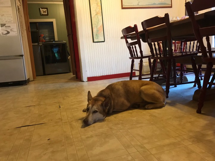
Her eyes were glued to our spoons, but she was a quiet mooch. We heard the occasional eruption of laughter outside, which kicked up my FOMO even though I had evidence from many months in the woods to suggest that I had great company right next to me. Oakland offered to do dishes in the kitchen while I went outside to say hi to Levi. He rolled cigarettes while his friend rolled a spliff. They had hiked 22 miles yesterday and 8 today. My eyes went wide when I heard his mileage, and he shrugged off the look by saying, “well, it’s flat.” I rejected his assessment, and said “we hiked the same trail and that flatness was not the entire experience. It was covered in roots and rocks.” He insisted in a blasé, dismissive tone, “But it’s flat.”
I didn’t bother continuing the argument. Instead, I listened to him wax on about the sadness of being almost done. Other people drifted over and interrupted the conversation, so I left to take a shower. Oakland and I took turns once a bathroom freed up. The water temperature vacillated wildly at times, but it was still a magnificent shower. Standards change after you spend days on end covered in layers of bug spray. I sent moose pictures to HQ and checked in with my dad and stepmom via email because I didn’t have any cell service for texting non-iPhones.
As we settled in for the night, I saw a woman with a hefty knee brace that was very clearly supporting a major injury. I asked her if she wouldn’t mind recounting her story for probably the 50th time that time. She apparently fell yesterday and broke her knee cap. Oakland went into the bathroom to brush her teeth while I continued to talk to the hiker. She had already done the entire trail once, but she really wanted to do Maine southbound. I made a comment about starting with the hardest part (referring more to Katahdin than the drudgery of the Hundred Mile Wilderness), and she said “but it’s flat.” I wanted to scream “SO WHAT.” Instead, I responded with a firm rebuttal by saying, “sure, it’s “flat,” but it’s covered in rocks and roots.” She said, “yeah, sure it is, but it’s flat.” I said, barely able to contain my rage, “give me a mountain to climb any day over this kind of flat.” With that, I made myself very busy in my room to end the conversation. An older guy paused in our open doorway and asked if I was NOBO or SOBO. Always with the same effing question. I gave him my usual “flip-flop/broken elbow/returned to finish” spiel, and him the version of the question that I really want people to use, which is “what kind of hike are you doing?” He said that he was hiking with his daughter at the beginning of her SOBO hike, but she had been having knee issues and would be getting off trail in a few days to try again another year.
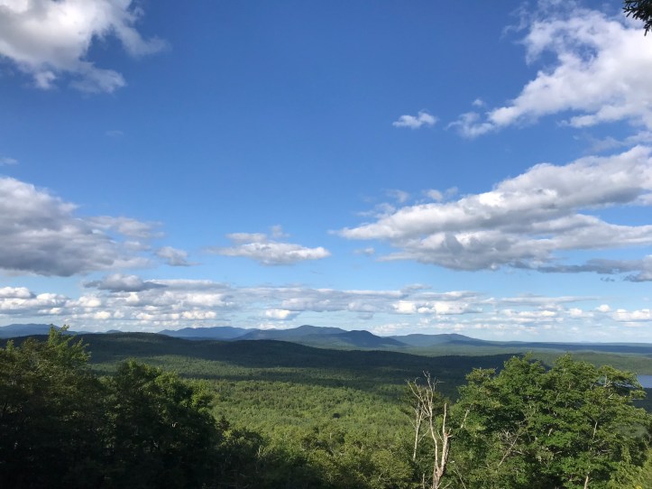
Oakland returned from the bathroom and we closed our door to prevent more questions. I realized that my watch was on the fritz, most likely because of all the bug spray. It was stuck in stopwatch mode, which meant it beeped every 10 minutes. That didn’t bode well for sleeping. After several minutes of pushing all the buttons, I finally managed to get it out of stopwatch mode and to turn off the 5:20am alarm. Oakland helped with my perspective on feeling left out and the unnecessary pecking order between hikers that gets in the way of the actual hiking experience, which is the point for me. She reminded me that in the last 24 hours, we’d watched a moose snacking in a pond, crossed two beautiful rivers on foot, watched snakes wriggle away into the brush, and seen beautiful views from atop Moxie bald. Those are the kinds of things I’m here for – not for the ego boost of feeling included or idolized. I’m finishing this to the sound of Oakland sleeping next to me, the wind blowing through the trees, a hodgepodge of noises downstairs (possibly dishes being done?) and the heinous bathroom fan right next to our room. Thankfully the raucous collection of people outside have all retired to their respective abodes.
Mile 2059.6 to 2077.5 (17.9) – Shaw’s Hiker Hostel in Monson, ME
Checklist total miles: 946.1
Oakland total miles: 468.7
Creature feature: at least 5 snakes, a few frogs of various sizes, a giant tadpole with legs, tiny minnows, scout the piddling husky, and a few of the usual bird suspects (juncos and song sparrows).
