
July 18, 2019
I woke up around 5:20 and had a hard time sleeping until the 6am alarm. We both laid like lumps for about 15 minutes before getting up to start the short process of using the bathroom and packing our gear. I spent a bit of my leftover time sending an email to Halfway while Oakland filled our water bottles. Dave knocked around 6:45 and we were in the car headed to the looney moose cafe by 6:55. I wanted to go there for breakfast as a nod to having gone with my friend Research in 2017 before we went to the Farmington ER.
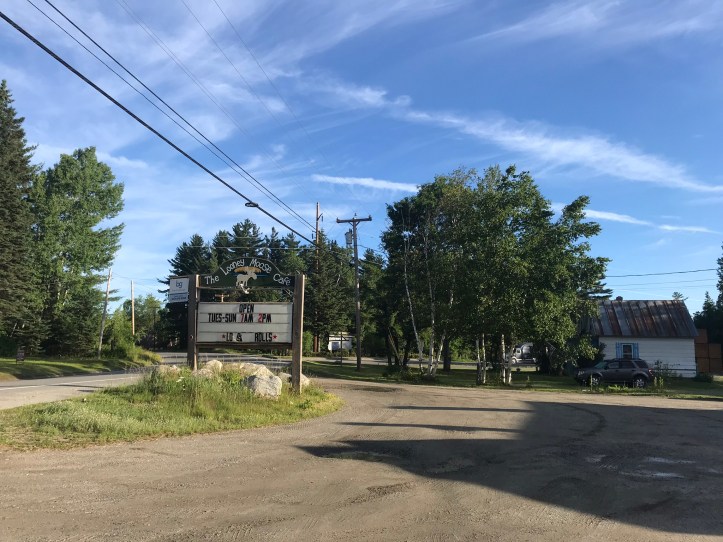
We drove about 3 minutes down the road and sat in the car waiting for it to open. A local wearing black suspenders, a black T-shirt and a Harley baseball cap asked us if we were from around here. I wanted to make a joke about having him guess but Oakland piped in with the real answer before I could mock us. A woman opened the cafe door and put out a giant open flag while she told us to go ahead inside. The local did the usual “ladies first,” which always makes me cringe on multiple levels, but I kept it to myself. I led us to the same booth that I shared with Research two years ago and watched a gaggle of locals file in to sit at the table in the middle of the room. I feared our ability to get out at a reasonable rate with that many meals to cook, but all they did was talk in their thick Maine accents and drink coffee. I ordered a short stack, as did Dave, and a piece of sausage. The food took about 20 minutes to arrive, which had me antsy and feeling guilty about delaying Dave’s departure for VA. The pancakes were outlandishly large.
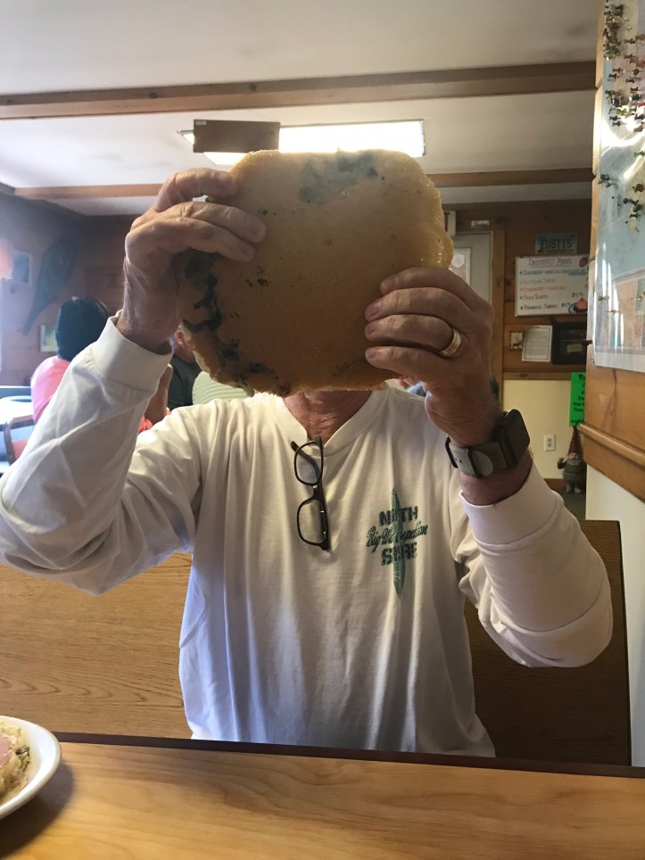
I could barely finish half of one, which left another gigantic pancake to go to waste. Dave made it through even less of his. Oakland had a persnickety stomach (yay, anxiety!), so she settled for a plain bagel with cream cheese. I’m not sure when I will learn to avoid pancakes on a day that I hike. Maybe when I’m done?
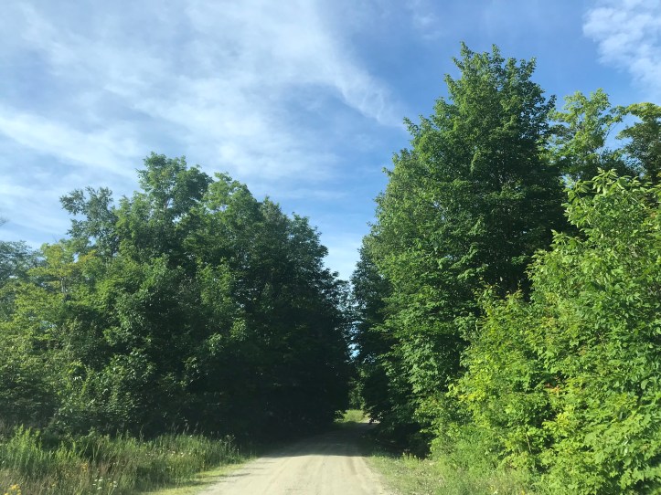
We left the looney moose around 7:45 and turned onto the logging road a few minutes later. Hurray! I can’t tell you how relieved I was to not see any closure signs. The road was well maintained and only had a handful of bumps and large rocks for the couple of miles it took to reach the end of vehicular access. It began to deteriorate a bit in the last half mile, but it was still better than I expected and a far more comfortable ride without a broken elbow.

Dave parked next to a work truck that clearly belonged to someone on the logging crew. We pulled our packs out of the car, and I remembered to put on my ankle brace while Dave expressed a desire to not let us walk off into the woods of Maine alone. The owner of the truck returned to the parking area right as we kindly told Dave to get a move on so he could start his long drive home. The workman told us that the road would be closed as of later today, so we literally JUST made it under the wire. He told us to let other people know about the closure if they asked about the road.
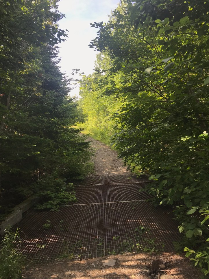
We waved to Dave as he drove off in his shiny SUV, and turned the other direction to head towards the trail. The walk was a little farther than I remembered. We immediately had to cross over a decrepit metal grated bridge that went over a small stream and Oakland jokingly protested the conditions of the grate.
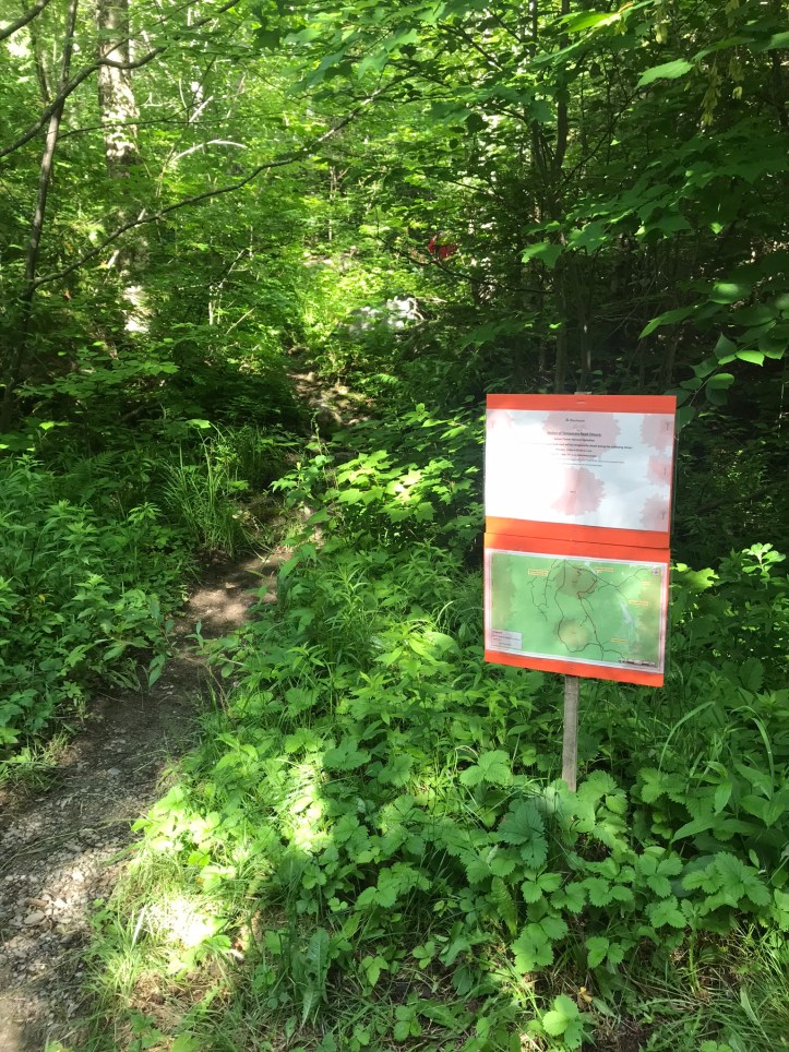
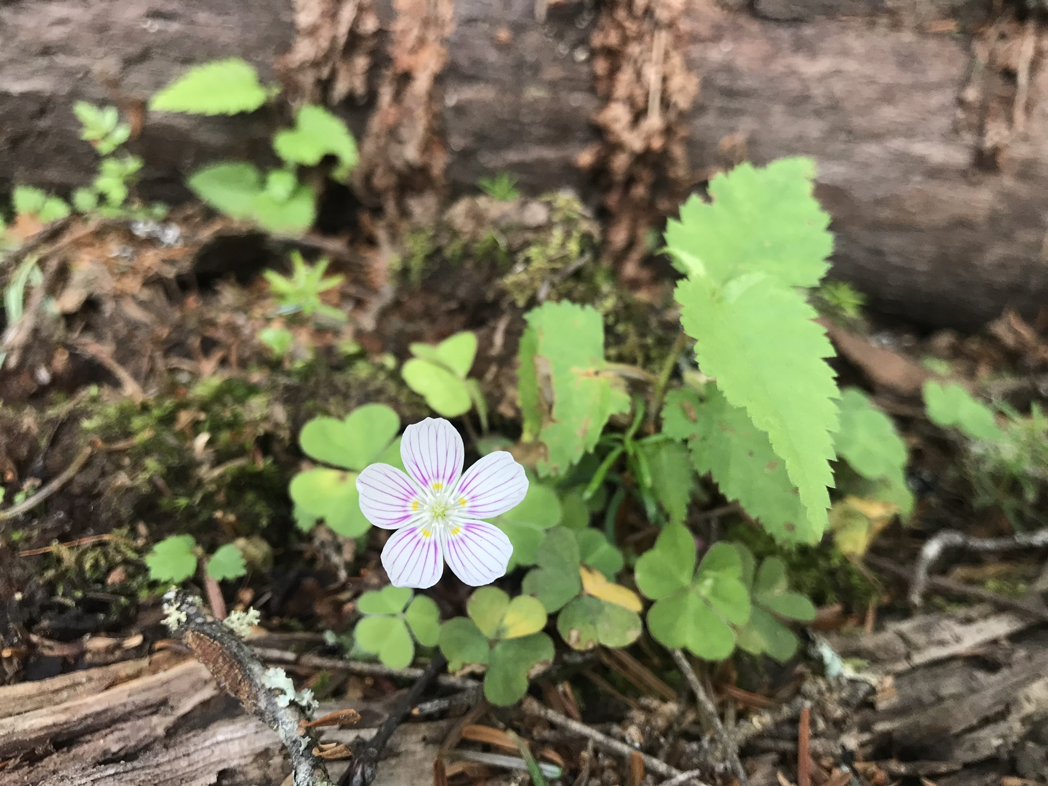
Wildflowers were in various stages of bloom alongside the road and the morning air was a bit cooler than we’re used to after so long in the humid south. After about 10 minutes of walking, we made it to the trail crossing. It felt so surreal to be standing in the place that felt like a wormhole to another day and a devastating moment in my life. I don’t know that I ever really believed I would make it back here even though I’d been stubbornly pursuing this moment for a long time.
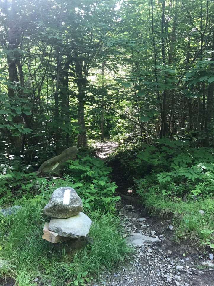
We saw the logging crew’s closure notice on the north side of the trail and still couldn’t believe our luck. I hoped the trio of hikers we met last night would make it back on trail in time. It seems like chances are high that they might get to the road after it’s been closed. I was about to pee when an older SOBO hiker arrived at the intersection and took off his pack mumbling about waiting for friends of his. I immediately put my pack back on and we took a left to head south. Sadly, I think my phone camera lens was smudged for much of today so there’s a bit of a halo in a lot of the pictures. Oops.
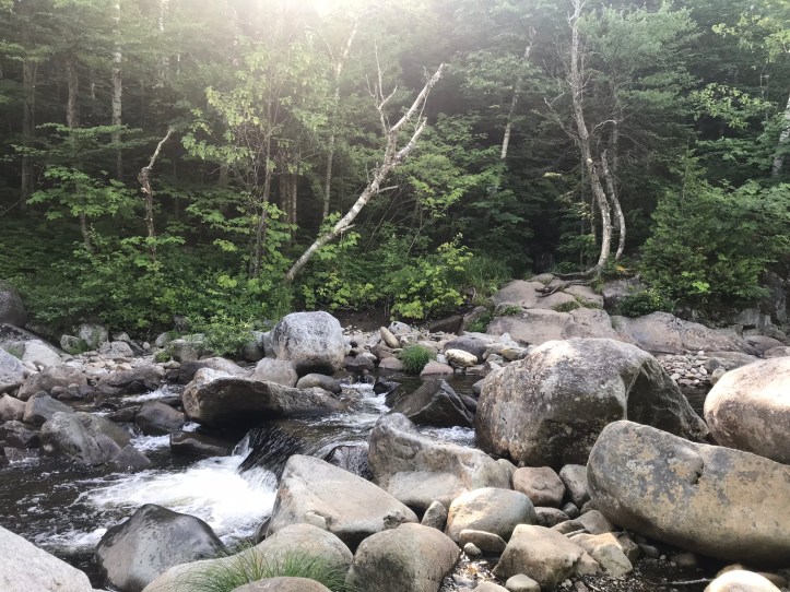
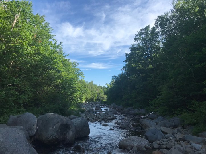
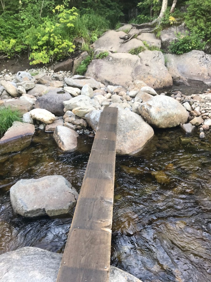
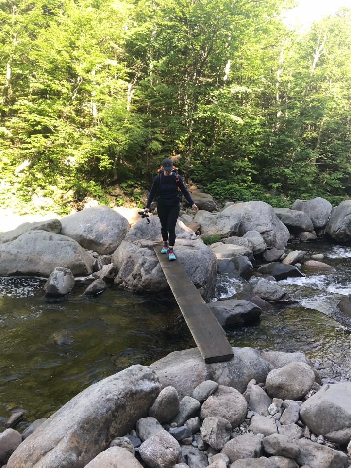
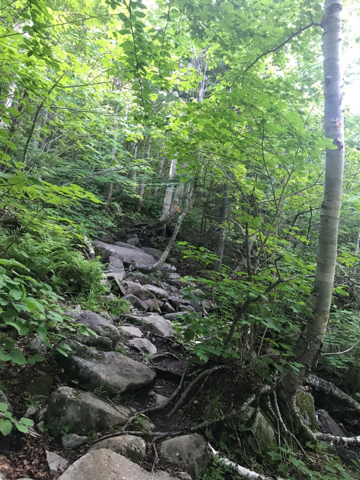
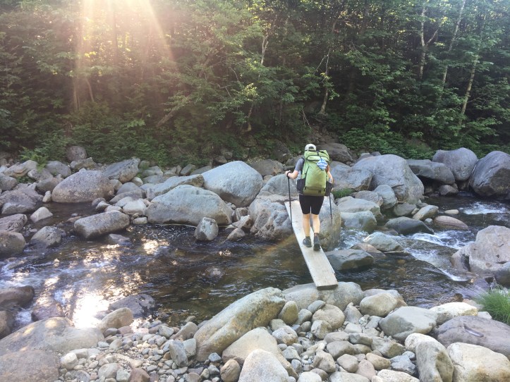
The river was so loud that we could hear it roaring as soon as we tucked into the woods. The trail started with the full Maine compliment of rocks and roots for the 0.2 mile walk to the southern branch of the Carrabassett River. I’ve been anxious about this crossing because it’s a fast moving river and a somewhat treacherous crossing if there’s no wooden plank in place. Thankfully the plank was still there, though it wasn’t fully secured on one side, and it was clearly soggy. We picked our way over rocks to cover the first third of the crossing and then took the rickety looking plank the rest of the way.
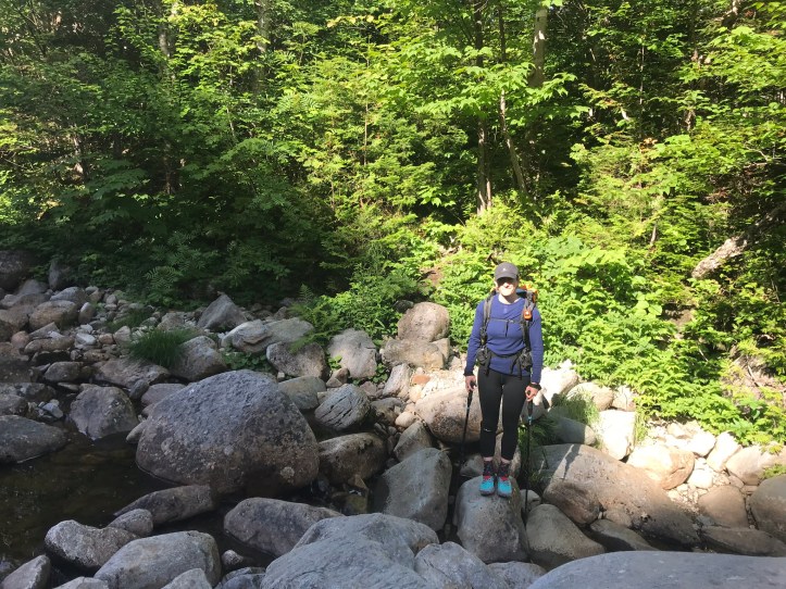
Once on the other side, Oakland was a bit out of sorts to be standing in the same place in which I took a selfie for her that she claims is one of the saddest pictures she’s seen of me (post-breaking of the elbow). I felt glad to have successfully crossed the river and unenthused about having to do it again at the end of our day, but that’s the price of going on this memory lane mission. The trail took us up short, sharp climbs over rocks and roots. I felt clumsy and out of breath (damn pancakes).
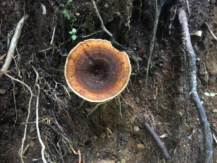
Oakland wasn’t faring much better. Her new shoes have more tread than she’s used to and they kept grabbing on things around her. The tedium didn’t stop her from taking mushroom pictures!
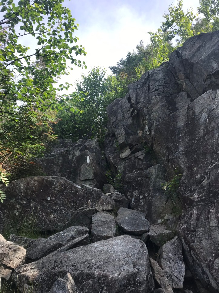
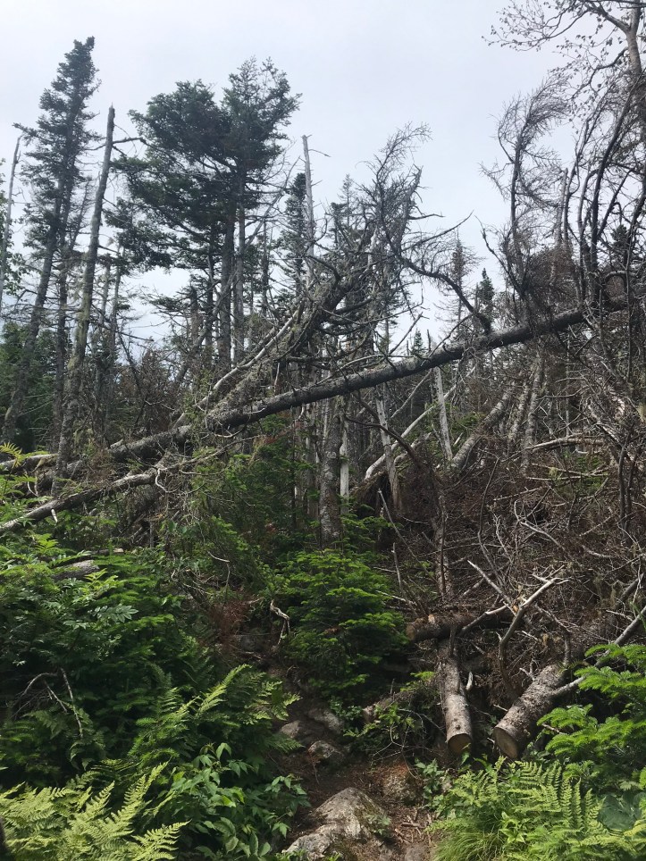
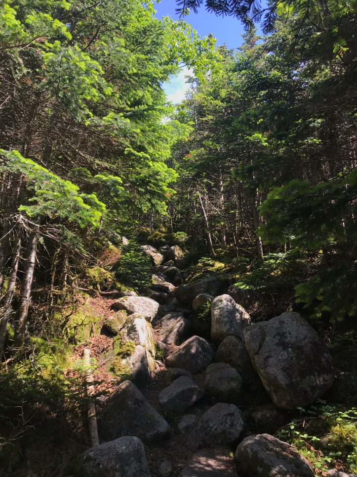
A NOBO passed us and informed us that we had a “fun rock scramble” ahead of us, and he wasn’t being facetious. I wanted to kick him, which made me feel like a grump. I resisted the urge to tell him I knew what he was talking about and that it wasn’t my idea of fun. A second NOBO came through and took wide, sloppy steps that made me cringe and made me detest his ability to not give a shit where his feet go. We continued carefully making our way through the rock maze, which then turned into a rock jumble, which then turned into full on bouldering.
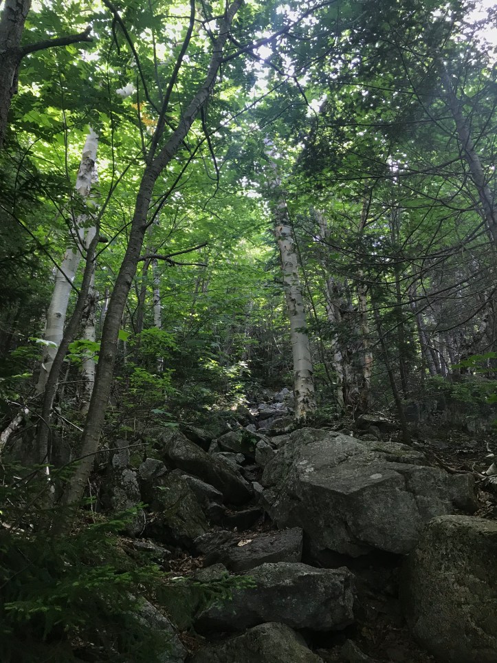
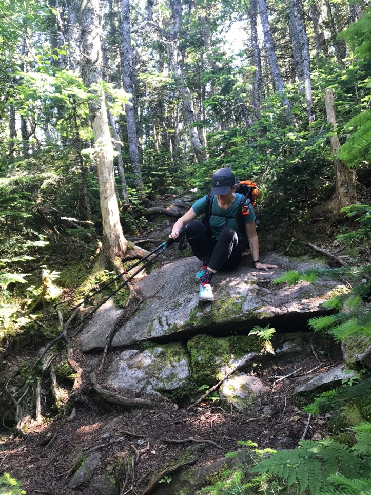
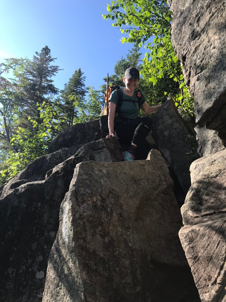
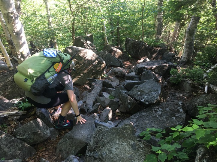
Oakland put her poles away, and I continued to hold mine in one hand as we clamored over rocks. The trail was already much more difficult than I remembered, which would end up being the running theme of the day. I didn’t take any notes throughout much of the day because our pace was already glacial, and we didn’t have a ton of time for extra curricular activities such as standing in one place. I did take a fair number of pictures and Oakland managed to find a few good mushrooms and yellow slime mold as we both tried to breathe through the feelings of shell shock with the terrain we faced. Here’s a southbound view of a particularly tricky bouldering section that I remember as the hardest spot to navigate with one arm.
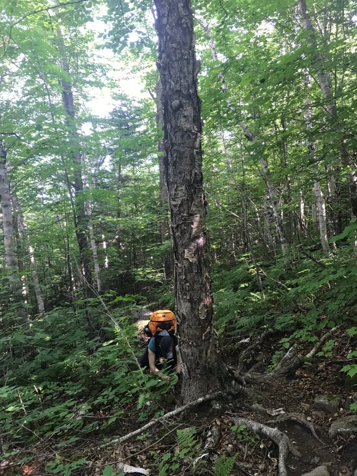
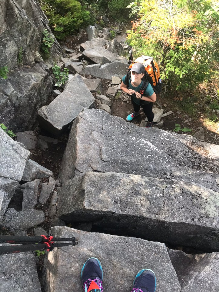
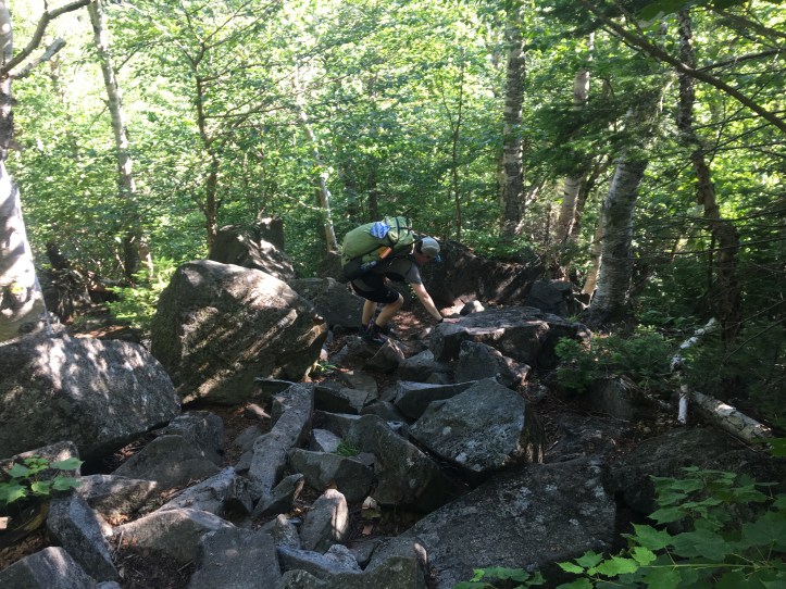
This picture looking down at Oakland is from the middle of the scramble. It’s hard to capture the steepness accurately, but I’m only about 2.5-3 feet away from her if that gives you a reference point and all of the rocks are slanted downhill making the feeling of tipping forward even more accessible on our way back.
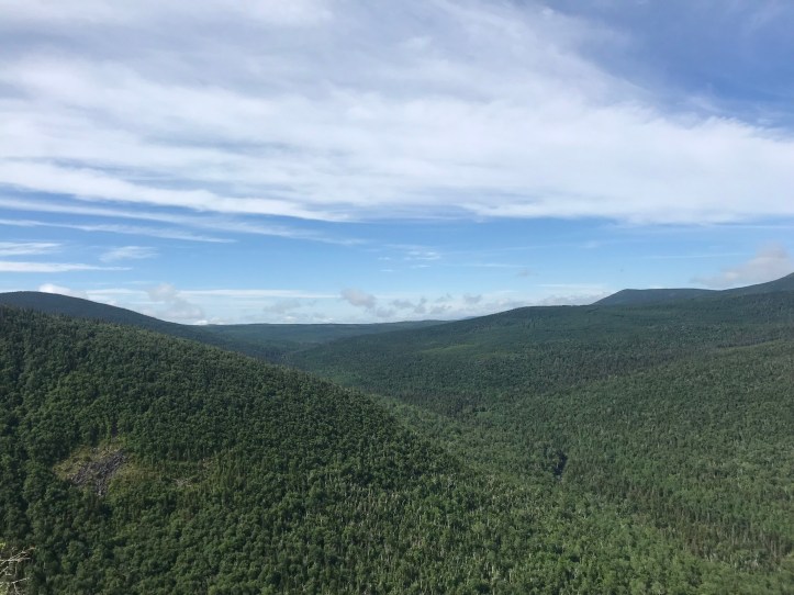
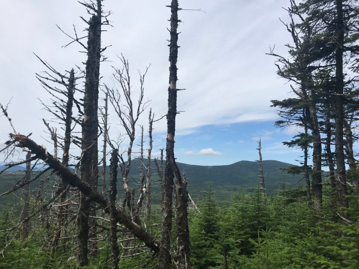
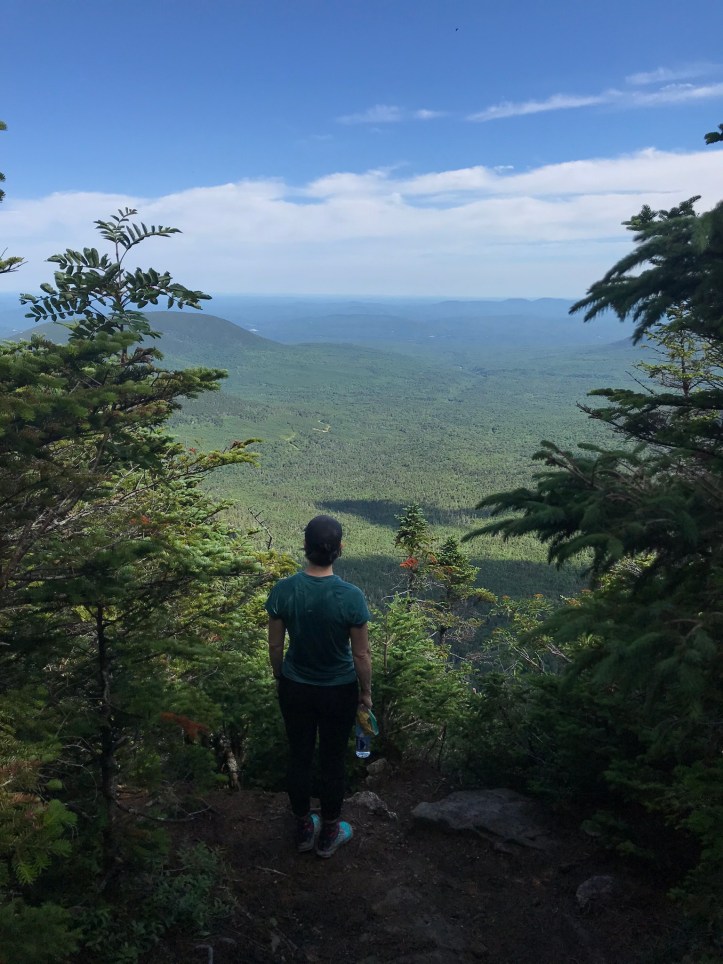
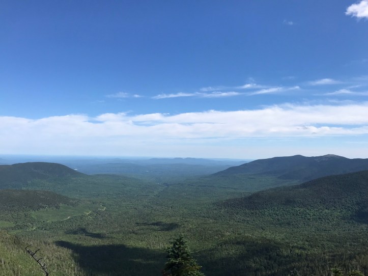
 After nearly an hour of climbing we reached one of the views that I remember most and love about this section of trail.
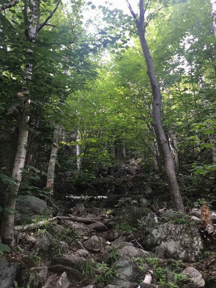
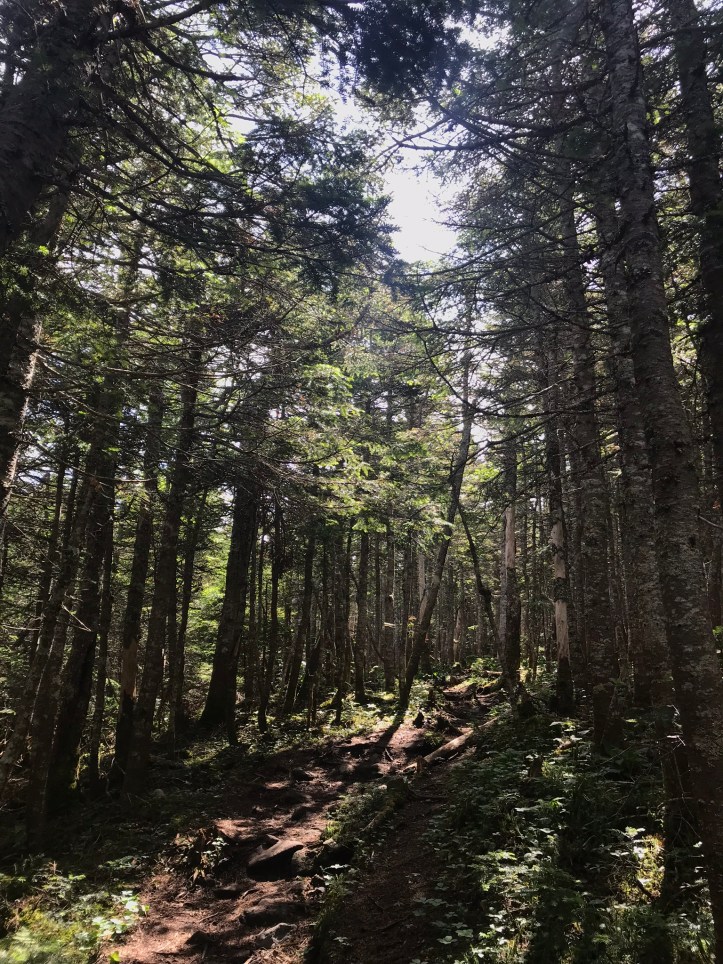
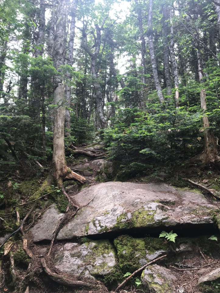
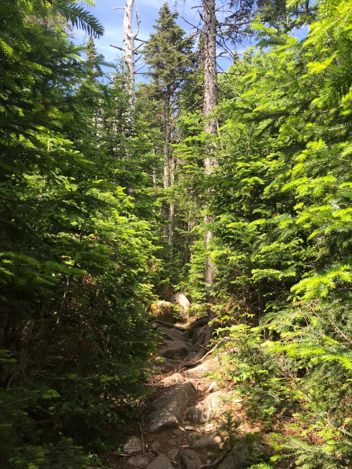
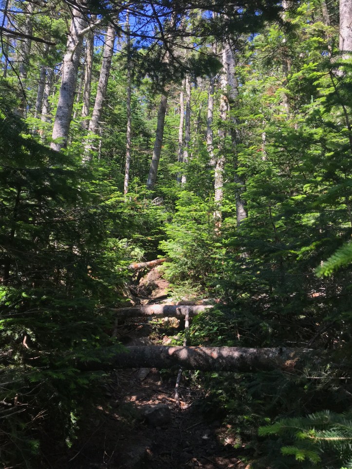
We made our way up the rocky, overgrown trail with blueberry bushes rustling against our arms. It definitely hadn’t been that overgrown when I came through a couple of years ago. That would also become a theme of the day because the surrounding forest felt much denser than I remembered. It’s safe to say that my memory of this stretch of trail is pretty rotten save a few notable exceptions.
We ran into another NOBO around a bend who called out “oh no you’re just a hiker” because he had hoped the rustling noises he’d heard were emanating from a moose walking up the trail. I told him we could poop in the trail if he wanted (there was moose poop everywhere), and he laughed as he continued up the trail. We passed through a few mucky sections as the trail continued to slowly climb at a slightly more reasonable grade than the previous half mile of scrambling.
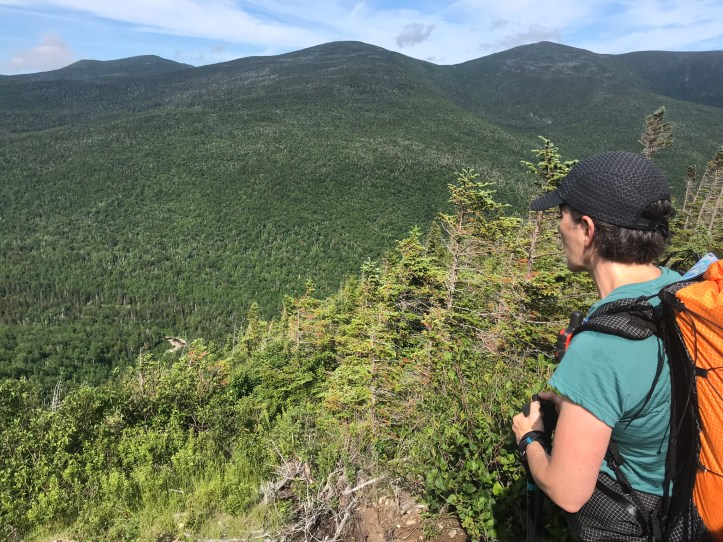
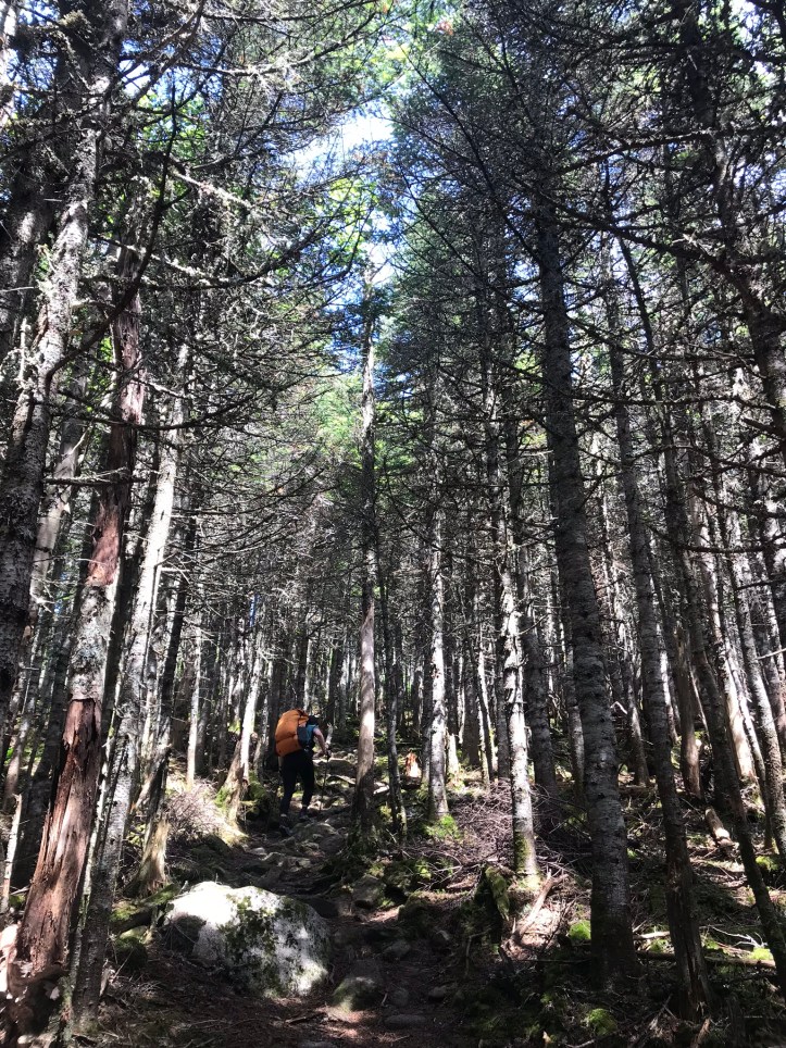
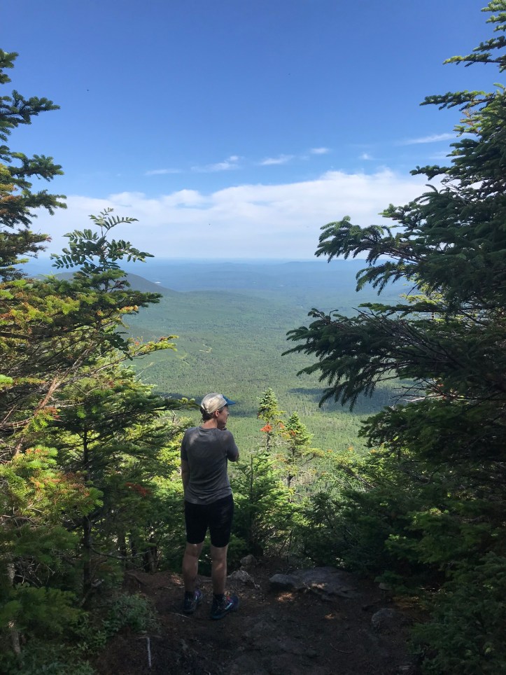
We ran into at least 4 more NOBOs, which was unexpected and overwhelming given how few hikers we had seen in VA. After awhile, we reached the blue blaze for sugarloaf mountain and both felt relieved that we hadn’t had to actually go through with our plan to hike up the ski trail. A couple of minutes past the turn off, we came to a view that I remember well. When I took Norseman and Tater’s picture at that overlook in 2017, all I could think about was the fact that my thru-hike as I knew it had just ended. Unfortunately, this time around, it was occupied by a mid twenties NOBO smoking a spliff and two older NOBOs. The younger guy asked me what direction we were hiking, and I tried to explain the convoluted south then north answer. We didn’t stick around long because neither of us felt that jazzed about the company. I have pictures from our stop there on our way back.
I was very happy to be in Maine, but also very anxious about the terrain and the camping resources because of the number of people we’d seen in such a short time span. The forest consisted of scrubby short evergreens with a strong smell of Christmas every now and then. The roots and muddy sections reminded me of so many bogs I’d picked my way through in 2017. We eventually stopped for a snack on a sodden log with our fancy new zseats that arrived before we left VA. We were both overwhelmed and did our best not to spin each other up while we ate our bars. When we finished our snack, Oakland put on her pack and noticed a strange feeling that turned out to be one of her frame rods poking all the way through its cloth housing. In essence, her pack frame had just broken. She released the tension on the arc in the frame, and we pushed the bar back into place, but she can no longer have an arc in her frame because the rod pushed right back out of its housing as soon we put any tension on the arc. Oakland was dejected and dismayed by the feeling of her pack directly on her back as we walked away from our break spot. I too felt upset about her basically brand new pack and was generally feeling awful about the way the day was going so far. If I had known these miles would be this hard, I might not have suggested the back track. I also worried about Oakland’s anxiety and her understandable lack of confidence about hiking in Maine. I shared all of this with her a little while later while crying and also expressing my own fear about being ill-equipped for this crazy landscape. Oakland assured me that she would be okay and that we would just keep going in general and in that moment.
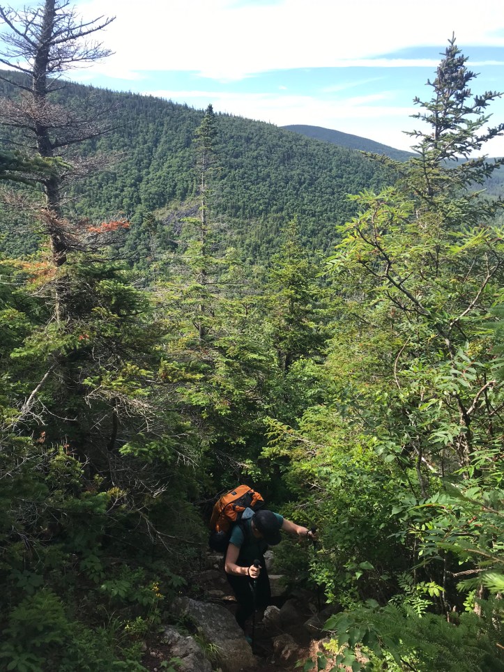
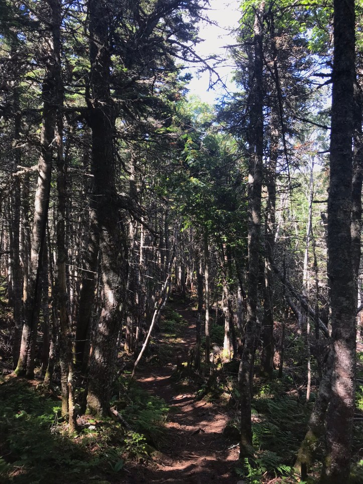
Next came a section of rolling, somewhat sharp hills that led us over pine needles, rocks, roots and the occasional blow downs. Oakland hit another low point in this section because she rammed her head into a tree that had blown over the trail. I had ducked under it, but Oakland’s hat rim had obscured it from her view, so she hit it with the full force of forward momentum. Thus began the system of announcing eye level obstacles by whomever was in front.
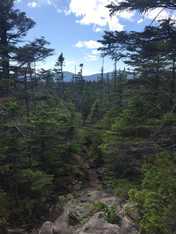
Not long after the sad head thumping, Oakland asked about a mountain that loomed in front of us and whether we would have to climb it. I sheepishly replied that we probably would have to do that. We made our way over the rocky, rooty hills and finally came to the climb for Spaulding, which turned out to be pretty manageable despite the crazy sight lines where the trail appeared to go straight up. We occasionally got beautiful views of the surrounding ridges through scrubby tree trunks. I’m pretty sure one of them was the saddleback range, but I forgot to verify that with the map on the way back.
The other side of Spaulding was steep in places and full of rocks, but it didn’t involve any full-body scrambling, which put it squarely in the easy category for Maine hiking. We reached the Spaulding lean-to (as the shelters are called in Maine) around 12:45, which was almost an hour later than I had anticipated. An older man stood around when we arrived. We said hello and he wandered away searching for something that we couldn’t figure out. We ate lunch in the shelter because there wasn’t any picnic table or decent seating to be had. This is the same shelter where I sat looking up symptoms for a broken elbow and where I hatched the plan to exit the trail from the logging road. Another surreal moment for the day.
My appetite wasn’t all that great because of my anxiety about getting hurt again, but I made myself a peanut butter wrap anyway. We talked to the SOBO who warmed up a bit, but overall was on the taciturn side. He’s had a hard few days because of body pain, and I’m not sure if we were the best people to help with that mindset given our own challenges of the day. When he asked how our hike was going I answered somewhat honestly by saying it had been a difficult day so far. I shared the story of my broken arm and our plan to revisit the spot just the south of the shelter after lunch.
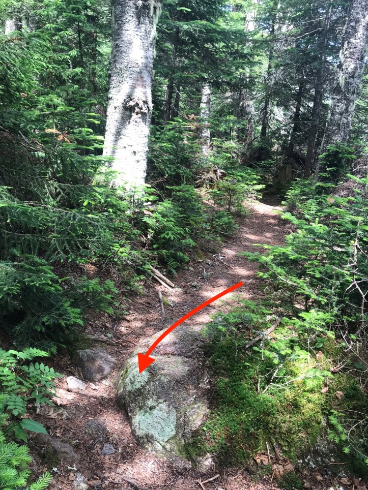
We eventually stowed our food gear and went to find the scene of the break. We left our packs at the shelter to give ourselves a break for the mission. I didn’t really recognize any of the terrain. Everything seemed narrower and denser than I remembered. I finally settled on the rock that I think made me trip and tried to figure out where my elbow had landed. I’m pretty sure my shoe got stuck on the edge of this rock:
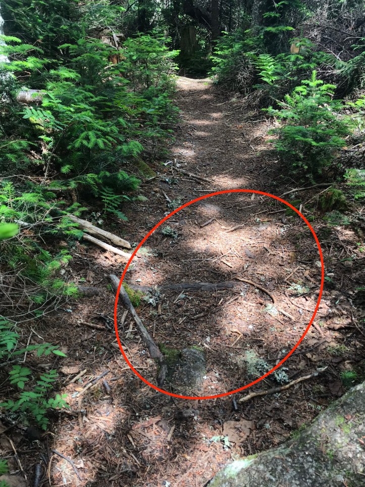
And then I pitched forward, and landed on something hard. I thought I remembered seeing a flat shale-like rock underneath my arm at the time, but I couldn’t find anything like that on the trail. Maybe my arm landed on a root? There were plenty of those in the theoretical fall zone. Who knows, but here’s the general zone of doom:
I thought I would be a crying mess in that place, but I frankly felt numb (read: overwhelmed) and somewhat uncertain as to whether I’d found the right spot (I feel more certain now that I’m looking at the pictures during the editing process, but who knows with the squishiness of human memory). I didn’t want to delay us any further, so I didn’t spend forever wandering up and down the trail to be certain. I took one more look around, and we headed back to the shelter. We put on our packs and said bye to the SOBO after getting his name (Joe). We stopped to get water at the shelter’s stream. Nothing looked familiar to me even though I knew I’d gotten water there the day I fell. We retraced our steps to orient ourselves north, and I immediately felt relieved to be walking towards camp. It had been dejecting to walk south with the knowledge that we would have to turn around and do it all over again. The return trip over Spaulding was much steeper than I remembered, but I appreciated the occasional spring beauty still in bloom. Here’s a slew of pictures from the hike over Spaulding and back to the overlook that we had given short shrift this morning.
It felt pretty different to look at the sea of mountains knowing that I wasn’t walking towards an unplanned ending. We ate a quick snack and continued inching our way north.
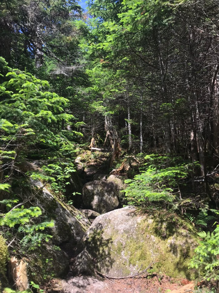
When we got to the top of the boulder scramble, we stowed our poles and took to scooching. Oakland taunted me because of the way I’ve been describing the trip down to the logging road after my fall as “not that bad for Maine” when in reality, this particular section was a full body sport.
I am honestly not sure how I managed to not hurt myself more when I went down the scramble with a broken arm. I guess that’s what happens when you don’t feel like you have any other option but to keep going, and you’ve been hiking in batshit southern Maine for about a hundred miles. That boulder in the front of the frame in the next picture is well over 5 feet tall by the way.
We finally made it back to the river around 6pm. Our pace had picked up around sugarloaf summit, but slowed to a crawl on the scramble and the jumbled trail that followed. Here are a couple of pictures Oakland took from the way back to the river:
We safely crossed river again with the sun on the opposite bank this time. It already felt less treacherous than this morning (brainwashing!).
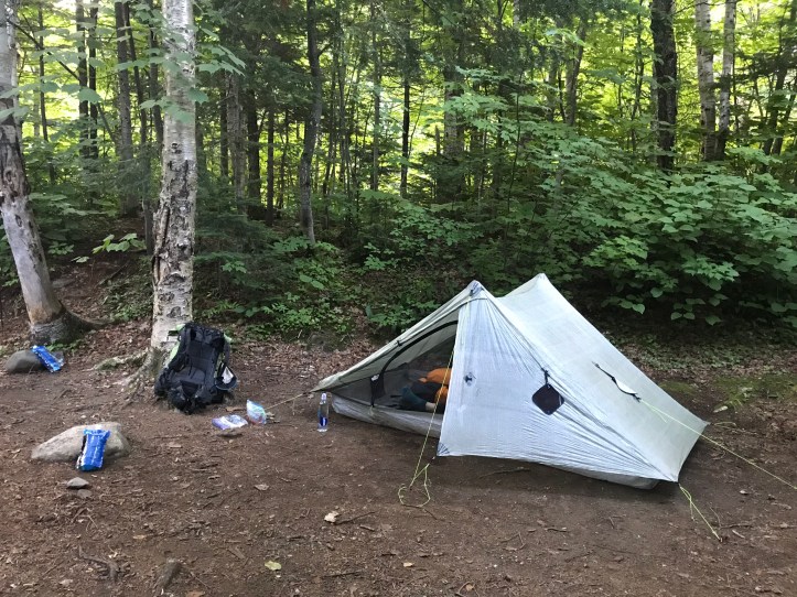
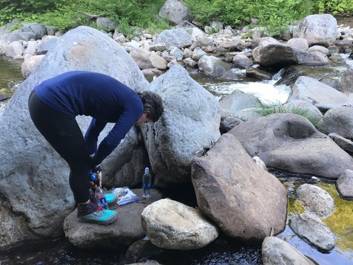
To our surprise, the tent sites just north of the river were empty. We surveyed our options and settled on large spot to the left of the trail. We pitched the tent, taking a break midway through to apply what would be our first of MANY (manyyyy) layers of deet. This picture is actually from the next morning because I forgot to take one in the evening:
We threw bear line on a branch that was a little low, but the options were limited. It wasn’t an easy throw, and our rock bag punctured several times on the multitude of sharp rocks along the trail. By the time we were done, the rock bag looked like a new version of duct tape plaid. Then we filtered water from the S. Carrabassett and went back to the tent to make dinner.
I had black beans and rice. Oakland had a jambalaya rice dish which was messy to clean up, but good with the addition of sausage. We washed our hands with bronners to remove some of the deet and then scrubbed our pots with our fingers and drank the water, as you do. The evening air was much cooler than we were used to (thank you, puffy coat). We each took a couple of bites of Snickers for dessert before we brushed our teeth.
A couple of NOBOs arrived just as we were hanging our food over top of the trail (the options off trail were dismal). We told them where to find the tent sites and they seemed super grateful. Our food bags were definitely not high enough, but neither of us had the energy to start all over. One of the NOBOs shrugged as he walked by and claimed that they were 10ft off the ground. That wasn’t really true, but it would have to do. The NOBOs’ 8pm arrival made me so tired for them, but they powered through their tent setups and cold dinners and were in bed around the same time as us. I have no clue where they hung their food (spoiler alert: no one hangs their food in Maine, which we didn’t realize until a few days later). Oakland was too tired to check her maps. My mileage for today is technically zero because I didn’t hike any new miles and Oakland’s is 5.3 because the return trip doesn’t officially “count.” We put 10.6 Maine miles on our feet and mine are currently reminding me of that fact, so I’m adding 10.6 to each of our total mileages because I don’t need to be a purist about it. I’m finishing this to the white noise of the river, a loud bug crackling against the side of the tent, and Oakland breathing deeply because she’s already asleep.
Mile 1990.1 to mile 1995.4 (5.3 “AT miles”/10.6 miles total hiking) – S. Carrabassett tent sites
Checklist total miles: 864.0*
Oakland total miles: 384.6
Creature feature: several tiny frogs, juncos, a few song sparrows, a few new birds, and a small auburn squirrel
