July 13, 2019
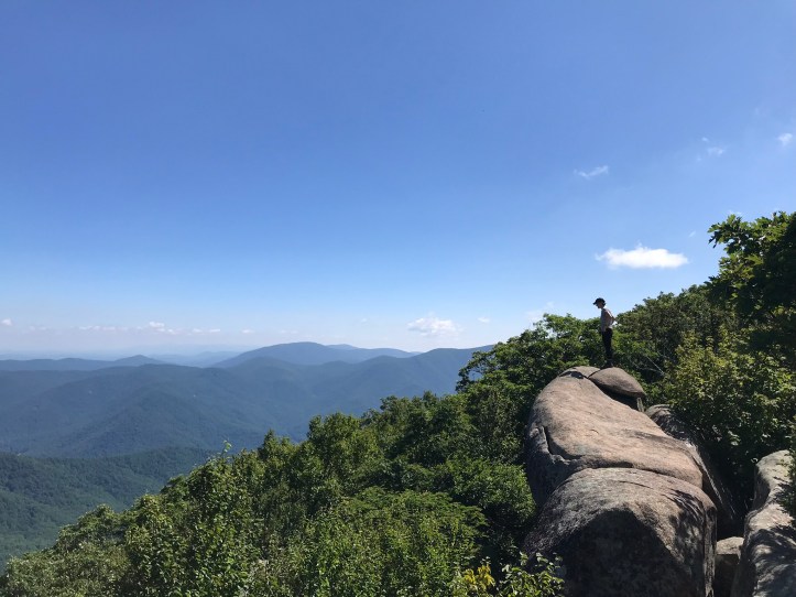
Our tent site turned out to be pretty comfortable with a welcome breeze and bright moonlight filtering into the tent (less welcome, but beautiful). I slept well for first half of the night, but then I was anxious about missing my watch alarm for my sunrise mission. I kept dreaming that it had gone off. When it finally DID go off, I was in no mood to leave my cozy sleeping bag, but I couldn’t resist the siren call of sunrise. I pulled on my hiking shorts and tossed a couple of layers into my day pack along with my trowel and TP (just in case). I put my phone in there as well so I wouldn’t crack it more should I take a fall in the dark with it in my side pocket. I said good morning and goodbye to Oakland who was not joining me for my outing. Then I put on my headlamp and stepped into the dim light. Oakland called out to say I should use her poles because mine were holding up the tent, but I said I wasn’t coordinated enough for poles yet. Probably not the most comforting thought to share as I left for sunrise on a giant boulder slab with steep drop-offs.
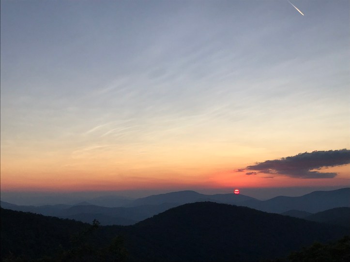
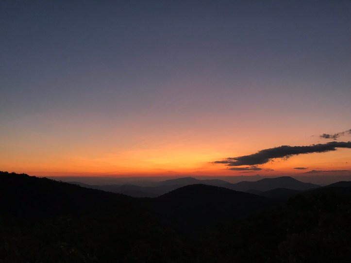
I walked past the people who tented directly on the side trail, not bothering to go too far out of the way. Maybe next time they’ll pay more attention to where they camp. I could see dark, vivid colors beginning to form on the horizon, so I did my best to move quickly over the rocky and rooty trail. I scrambled up the rock face to find the colors still in tact and a strong breeze that made me wish I’d brought my raincoat as a windbreaker. I immediately put on my long sleeve layer and used my day pack as a minor windbreak. The darker colors slowly gave way to pastels as the sky brightened.

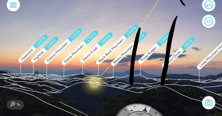
I decided to open the peak finder app, which unexpectedly also gave me the location of the sun below the horizon. Crazy.
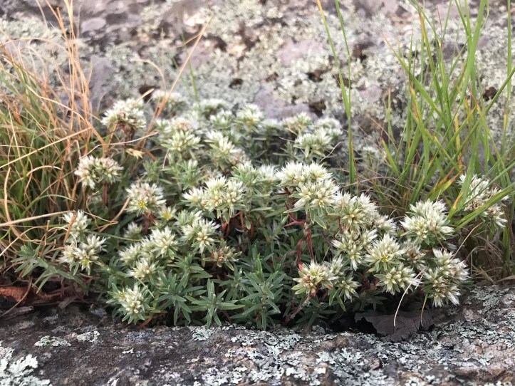
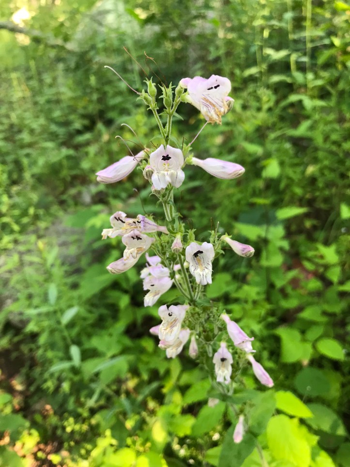
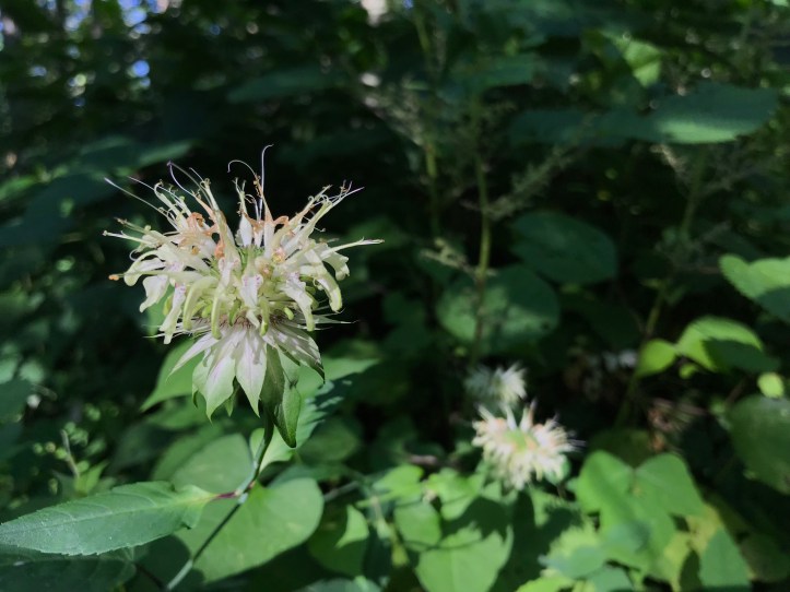
While I was up there waiting for colors to change, I also sent my mom the map pin for reeds gap where she should pick us up tomorrow. That will be the end of Oakland’s VA section and the beginning of our transition to Maine! The flaming pink sun finally crossed the horizon a little after 6 (today’s top picture). I stuck around to see if there would be more colors, but finally decided to head back to camp around 6:15. On my way down from the rock, I took a few pictures of the plant that we think is the subject of a sign asking us to stay on trail to avoid harming rare vegetation on the rock. The sign down by the side trail wasn’t very specific, but this seemed like a strong contender:
I stopped by the tent rather than heading straight for the rhododendrons so Oakland wouldn’t think I had fallen after having been gone for so long. Then I found a good digging spot and took care of the onerous task of pooping in the woods. When I got back, Oakland was already retrieving our food bags. Another successful night with our food intact!
Then we decided to ignore our grumbling stomachs to pack up the tent before breakfast. It was a clumsy but quick process made more challenging by the cold clamminess of everything. Then we sat in the sun with our rain coats on and ate breakfast while a brisk breeze moved through the trees. Next came teeth brushing and foot prep. Then I sat on the log and wrote notes while Oakland returned to the rhodies. She kindly filtered my water while I finished writing.
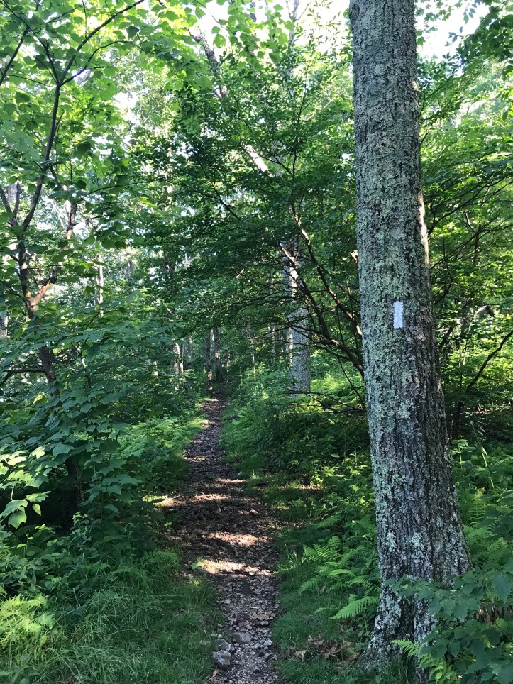
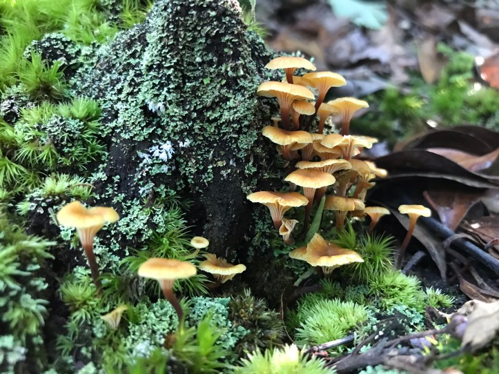
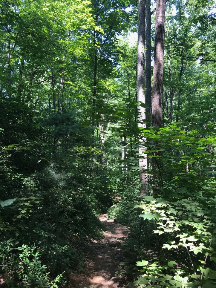
The morning started with a short climb up through bright green ferns with a handful of birds saying hello. Oakland found mushrooms almost right away so we paused on a flat stretch. A yellow swallowtail floated above the thick ground cover. Then came a descent through beautiful dappled sunlight and new wildflowers.
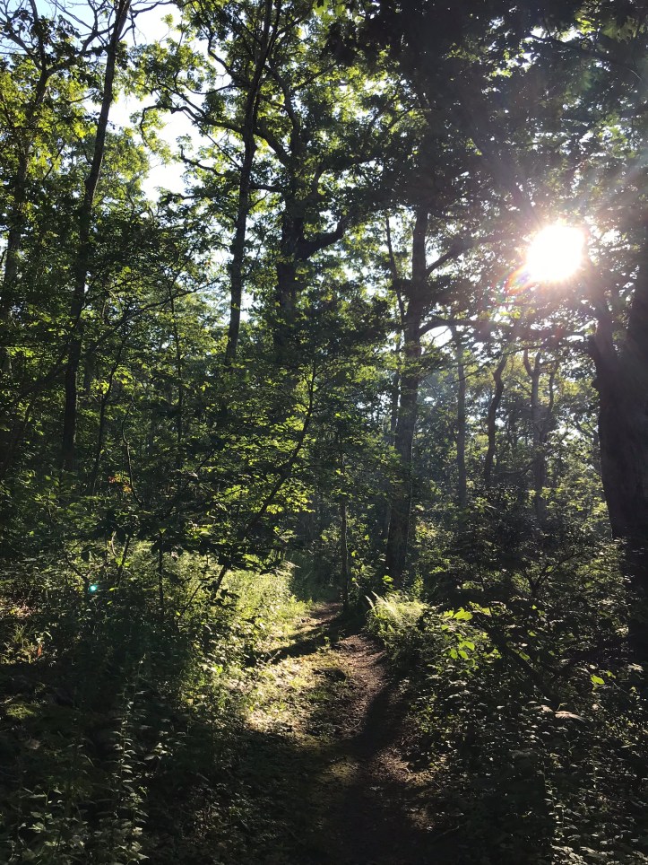
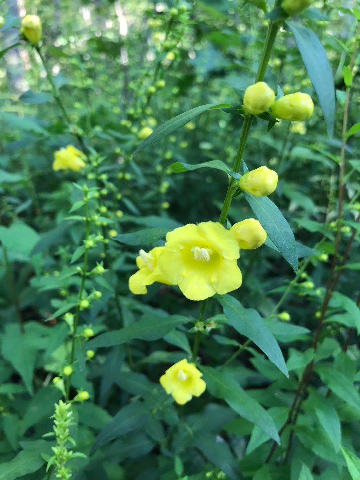
We slowly wound down to a laurel tunnel and went back up through tall jewel weed in and out of the hot morning sun. With no other options because of dense ground cover, we sat on a step to take an early break from the constant hill. As we pulled out our snacks, I heard a scarlet tanager and looked up to find that it was sitting on a high limb in front of us. I tried to point it out to Oakland, but she couldn’t spot it until it flew away. Not long after our break, we came to the Priest shelter intersection. My friend Halfway had highly recommended we stop there to look at the confessional style logbook, but we had both been feeling alienated by the logbooks so we decided to conserve our energy for hiking in the steamy weather. The trail veered sharply to the left and continued uphill over loose rocks and varying degrees of steepness. We stopped to enjoy a picture window view through a break in the trees and to ogle mushrooms, wildflowers, and a butterfly hard at work on a tiger lily. I don’t have a lot of notes from this section (probably because of the incessant hill), so here’s a batch of pictures to capture the experience.


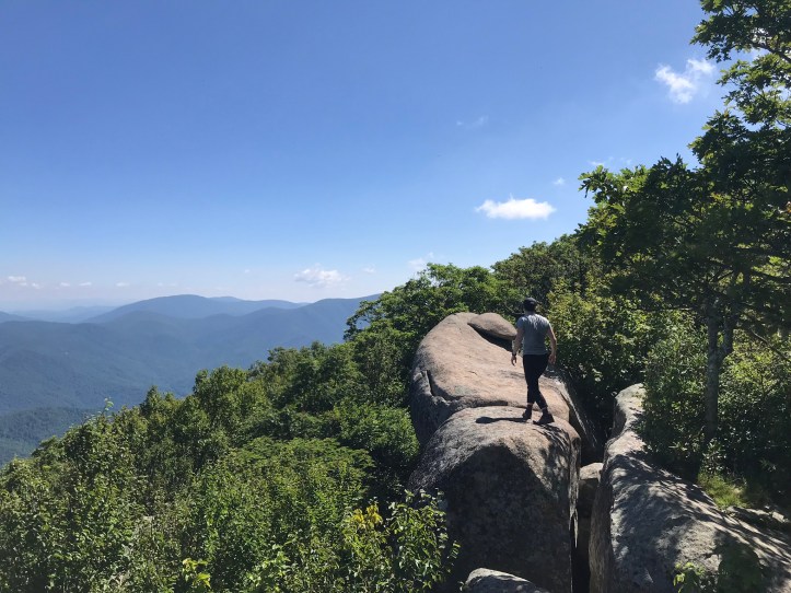
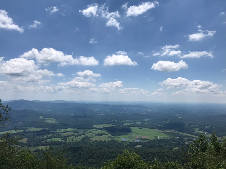
We nearly missed the priest overlook because it wasn’t a super obvious turn-off, but in less than a minute and we discovered panoramic views with a few day hikers perched on the rocks. Oakland and I set our packs down away from the hikers and walked to the far edge of the overlook to get some semblance of feeling alone in that incredible space.

After getting a sufficient dose of sky, we walked back to our packs where we answered a few questions from an outgoing day hiker who offered us apples. We gladly took a few because they were small and it’s hard to say no to fresh fruit (thank you, kind stranger!). Then we continued hiking along the ridge, which was enjoyably flat for a little while until we got to the rocky descent.


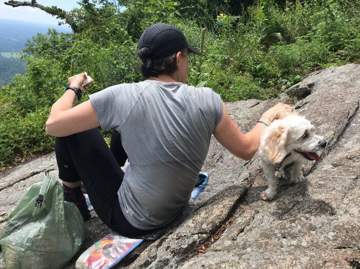
We stopped at an overlook about a third of the way down for lunch. A couple of day hikers were already installed on the rocks enjoying the views of the valley far below, but we didn’t have the energy to pass up the seating area, so we joined them. They were sadly taking the only shaded seats, so we roasted as we answered their questions and prepped our lunches. I spilled honey while making my wrap, which meant I had a lot of new ant friends headed my way. The hiker couple had a cute scraggly mutt who gave us some hellos. They also offered us apples (popular day for fruit), but we declined and ate 1 of the apples we’d already been gifted.
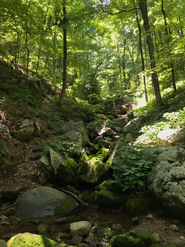
 They eventually left and we scooched into their seats for the tail end of our break. It was hard to get moving again, but we donned our sweaty packs and sluggishly made our way downhill. The air had become even more still as the humidity intensified (if that’s even possible). My knees ached and my feet were tired of the uneven surface. We eventually reached Cripple Creek, which I had taken a screen shot of earlier in the morning because it’s a well known old time song.

It’s not the same cripple creek, but it was a fun coincidence nonetheless. We stopped to get water at the creek and enjoyed the shady spot with the sound of water burbling down the hillside. The pictures didn’t come out all that well because the water ran through a densely rocky gully, but it was a nice spot to pause for a few minutes and refill our tanks.

The trail led us above the creek for a few minutes and then turned away to wind us over loose rocks. Thankfully the grade of the trail was never very steep. The cicadas seemed to start every time the breeze died down. If we had been walking uphill we would have been even more soaked with sweat.
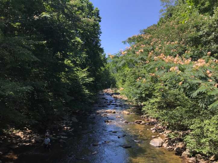
I heard road noise about a half mile from our crossing. We popped out of the woods to find over a dozen cars crammed into a gravel parking lot. We both felt shell-shocked by the volume of humanity. I chalked some of it up to the river proximity.

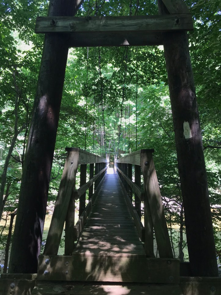
The trail crosses the tye river over a large suspension bridge. As we bounced our way over the river, we saw dozens of people wading along the water’s edge. One family seemed as if it was coaxing it’s chunky chocolate brown pit bull mix to swim. I watched the big oaf hoping that it was having an okay time.
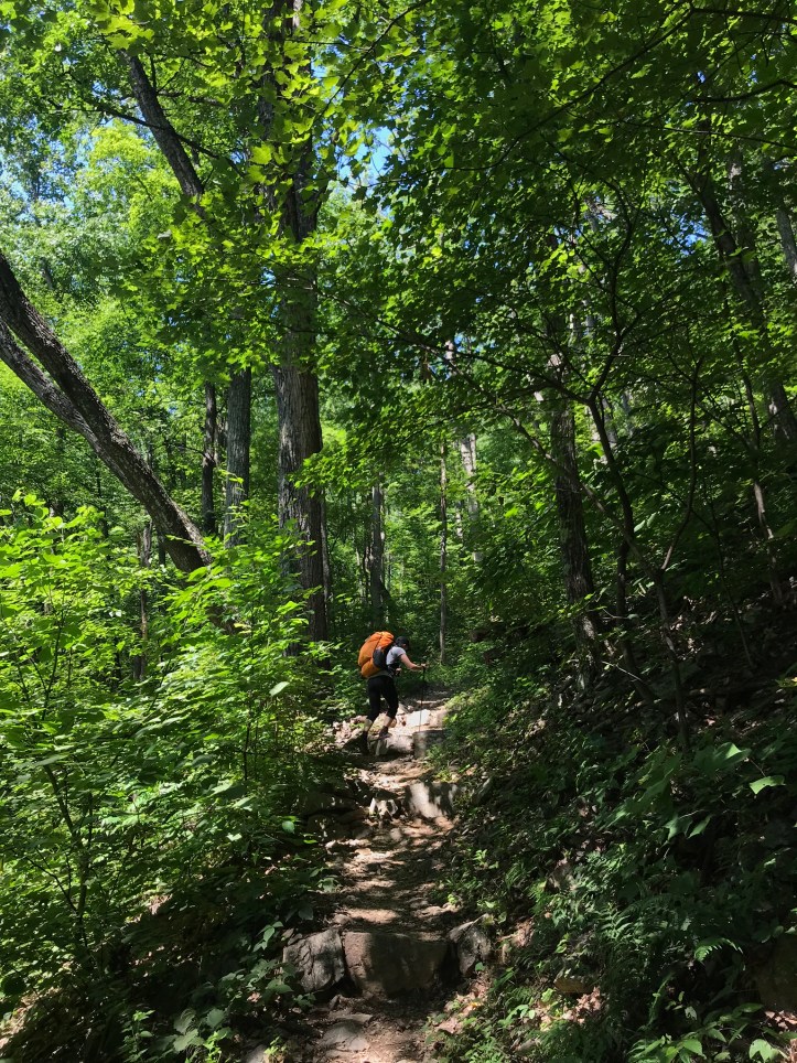
We took a left On the other side of the bridge and began the two mile climb to the first of the “three ridges” trail intersections. A few people in guthook whined about the ascent, but it didn’t feel like much to write home about. We climbed at a steady but manageable grade over rocks and the occasional stone steps. Towards the last 0.2 miles before the Mau-har trail, the path steepened a bit and went through an old mountain laurel tunnel.

We hit the trail intersection a few minutes after I wondered aloud when the hill would be over. Sweat trickled down my shins as I stopped to put my bag down against rocks. Oakland did the same and we sat on a fire pit a few yards off the trail. We ate a couple of snacks and mused about the guidebook complaints versus our experience of the hill. A man and a woman passed through. The guy appeared to have a home made pack or a type of pack I couldn’t recognize, but his hiking partner only had a small bag so I imagine they’re out for the day. We nodded from our perch as they went by. I had a bit of phone signal that I used to check in with my mom. Then we donned our packs and started the last 0.7 miles of the day. We walked over loose rocks as we wound down towards the sound of water. It appeared that someone had done haphazard trail maintenance leaving bits of chopped plant matter all over the trail, including poison ivy. So much for putting my shoes in the tent tonight. After about 20 minutes, we crossed harpers creek, which was a fast moving body of water that passed through a deep gulch (no picture because I was too torched at this point). There were supposed to be several campsites near the creek, but we couldn’t see more than 1 tiny, mediocre spot. I suggested we get water before we continued exploring the area just in case the tenting ended up being farther than the maps suggested. We drank a bit, topped off our bottles and filled our sawyer bags. Mine has a pin hole towards the very top that I’ve been plugging with my finger while I filter. It leaks a bit when it’s in my side pocket, but we didn’t have very far to go so I wasn’t worried about it.
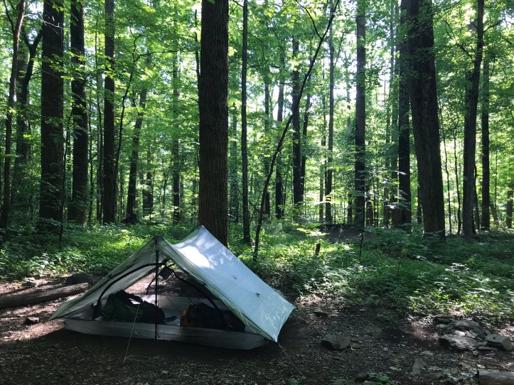
We followed the trail around a corner where we found a wide area scattered with rocky and uneven tent sites connected by small paths. The shelter was 0.1 miles north of here, but we didn’t bother heading that direction because someone had left a guthook comment labeling the tent sites rocky and slanted. Given that the same combination stood before us, we decided we may as well stay farther away from people. This shelter/tenting area is supposed to be popular with the locals. Little did we know how popular that would mean. We put our packs down and wandered through the tent area, taking care to avoid the copious amounts of poison ivy. We finally decided on a somewhat slanted but workable site. I grabbed a rock and we both started grooming the area to free it of sticks and sharp pebbles. It turns out swiping a rock against the ground is a great way to remove other rocks when you can’t do it with your foot. I also went through some effort to remove a couple of larger rocks, which amused Oakland to no end. After the site was clean and she finished mocking me, we set up the tent. The door placement was a bit tricky because of a nearby tree, but we made it work.
Then Oakland went to scope out and use the shelter privy. She was gone quite awhile. In the interim, I started to prep my side of the tent. As I moved around the site, a butterfly camped out on my gaiter presumably in search of salt.

It finally got tired of my movements and settled on Oakland’s pack. When she returned, she described a scene of chaos and bro-town up at the shelter. There were at least 16 people up there (it was only 5:30ish, so that number would surely increase). We decided to get our bear lines out of the way, but deciding where to throw was nearly impossible based on the abundance of poison ivy. We finally picked a tree in the tenting area that was near a tent site, but not right over top of it.
Not long after we threw our lines, a group of at least 10 people showed up. We saw them arrive at the intersection and worried that they would turn into the tenting area, but they decided to head up the hill towards the shelter and never returned. As we finished setting up our beds, an older couple came into the tenting area and began to setup camp near our bear line. I walked over to them and asked if they minded that our bear line was on a tree adjacent to their site, fully expecting them to wave it off as fine, much like the hammocker had done the other night. The guy said “oh NO, not at all” and I thought he meant that he didn’t care at all, but after a second, I realized he meant that he wasn’t at all okay with it. In a preaching tone, he said “no, it has to be at least 100 feet away. That’s like having a target on my back.” I returned his tone with one of my own and said “if there’s a target anywhere, it’s going to be up there,” motioning to the overcrowded shelter area. He said, as if I had put up an objection, “you wouldn’t want me to set up a bear line that close to your tent would you??” I didn’t bother to point out that our line was up far before his arrival. Instead I said “actually I think we have different standards, but I’m happy to move my line.” (LIES.) I pulled the line down and walked away without saying anything else to them. Oakland, who heard the whole exchange, exited the tent and walked towards me with her jaw clenched. We proceeded to abandoned the idea of dinner and switched into bear line mode. We wandered away from the older couple with Oakland muttering about how I had just been mansplained. We both refused to clomp around in poison ivy, so we finally settled on a mediocre limb over top of a mediocre tent site that looked like it would be low on anyone’s list of options. The limb wasn’t strong enough for two bags, so I wandered around a bit longer and found a limb that wasn’t over a campsite. I had to throw it without getting the line caught in surrounding poison ivy, which I barely managed to do. On the third try, the line went over the limb at a spot that was a bit too close to the trunk. Oakland worked her shimmying magic and managed to get the line a little farther out on the limb. Then we walked back to our tent to make a belated dinner. To be clear, I think it’s totally fine that the guy didn’t want our food hanging so close to his tent. My grief is with his tone of voice and the fact that all he needed to say was “no, please move your line farther away.” What he actually did was assume I had no idea what I was doing, and with that, took it upon himself to condescendingly explain the situation to me.
We attempted to let the interaction go while periodically commenting on it and enjoying our macaroni and cheese with peas for dinner. Then we did our dishes, which were followed by the Frito “crunchy” course and dessert. I made a joke to Oakland about how she should spit her toothpaste near the guys tenting area and she mockingly grumbled about that being a target on his back. We then walked back to our new bear line spots and hung our food, hoping no one else would come along to gripe about our chosen locations. I asked Oakland to show me the spot where she intended to poop in the morning so we could strategize about how to do it without being seen. Neither of us want to use the privy, but we were both too worried about poison ivy to wander too far off in the bushes. There were no beloved rhodies to use as cover. We each peed while we were somewhat out of sight from other campers who had setup across the trail. Then we hunkered down in the tent for our usual routine of changing clothes, checking for ticks, and writing notes/map checking.
Around dusk, a cadre of bobbing headlamps came down the path. Four men began setting up tents in the brush about 50 yards away from us. They made little attempts at being quiet or keeping their white headlamps out of line with anyone’s tent. Poor Oakland was crestfallen and anxious about how she would ever get any sleep given the influx of new noises. Another few men joined the group and proceeded to clamor about with tent poles clacking and stakes clanging against each other as they were thrown to the ground. Air mattresses were being blown up and rain flies flapped around. All told, I think there were about 9 or 10 hikers. At one point one of them yelled out to another about sharing water, and I very nearly left the tent to ask them to talk in lower voices. I had already shouted “hey can you move your light” when one of them left his light on our tent for almost a minute because he was staring at some part of his setup. To top it all off, there have been loud cracking noises not far from here that sound like gunshots or fire crackers; it’s hard to tell which. I’m finishing this to the sound of tent poles, a rock bag thudding to the ground, the full-volume voices of the new campers, frogs, and a chorus of crickets and other nightlife.
Mile 825.2 to mile 836.5 (11.3) – Harper’s Creek tenting area
Checklist total miles: 845.3
Oakland total miles: 365.9
Creature feature: the scarlet tanager, squirrels, a skittish chipmunk that saw me and turned on a dime, chickadees, the day hiking dog
