I did not brave the dark or the ledge last night. My alarm went off around 11. About two minutes later, I heard footsteps and saw the white beam of a headlamp coming down the backside of the ledge. The hiker blew past me. I listened to see if I had more company on the way, but all was quiet. I felt so confused and said “crazy bastard” out loud to the woods. I reasoned that if the person had been able to see the northern lights, they probably wouldn’t have kept walking. This was weak logic to feel betterabout my choice to stay in the safety of my tent. I woke up for good around 5am. I hobbled up the path to retrieve my foodbag and crawled towards a remote corner of the little tent site to take care of some things. It was a cool morning, so I had breakfast in my tent with my legs inside my sleeping bag. I slowly packed up and clumsily started walking around 630.
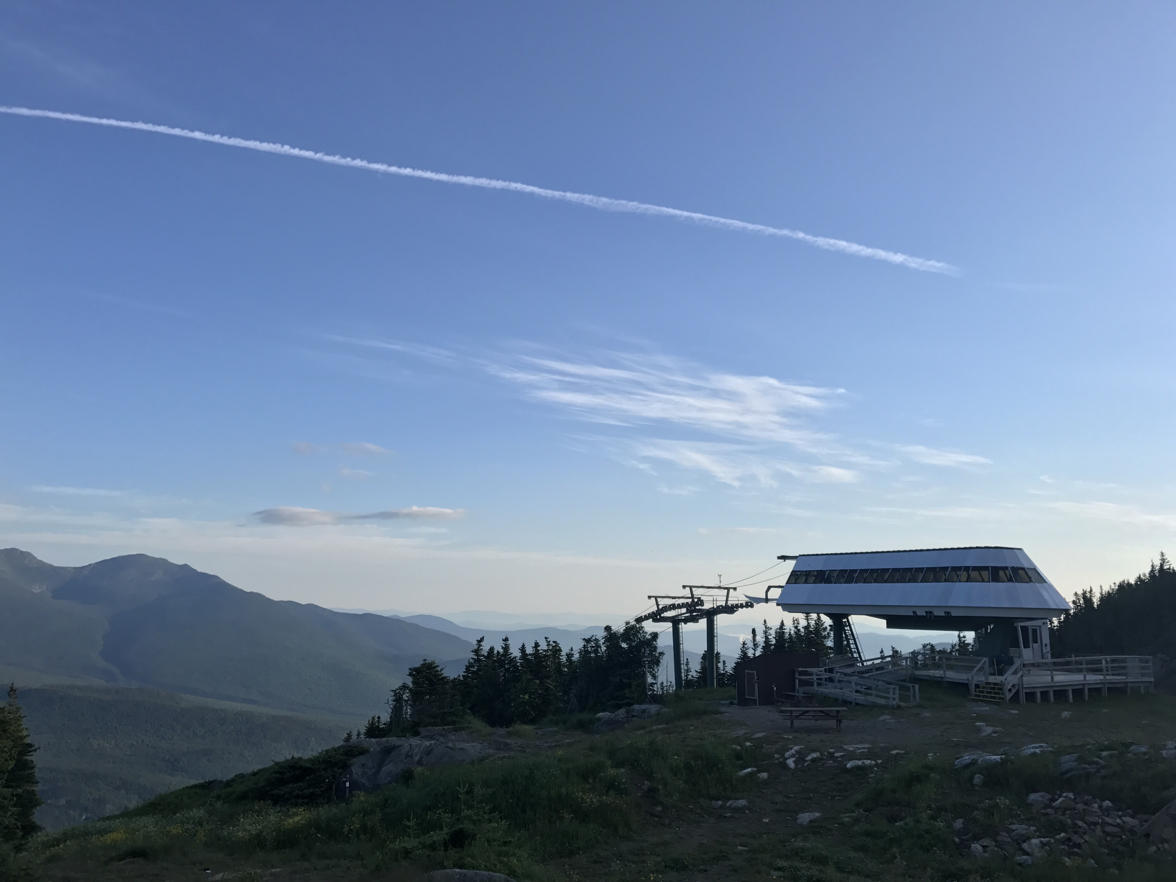
After about 20 minutes of winding my way over short, steep rock faces, I reached the wildcat ski gondola, which I naively thought was the top of wildcat mountain. As I approached the lift, I saw a hiker packing his bag. I walked over to check out the view and I said “are you the person who passed me at 11 last night??” Without looking up, the young guy grunted yes and continued shoving things in his pack. He warmed a fraction when he expressed curiosity about where I’d camped. He didn’t recall seeing my tent at all, which isn’t surprising given his pace. I wandered back over to the edge of the hillside to check out this view (the extra pointy peak is madison):
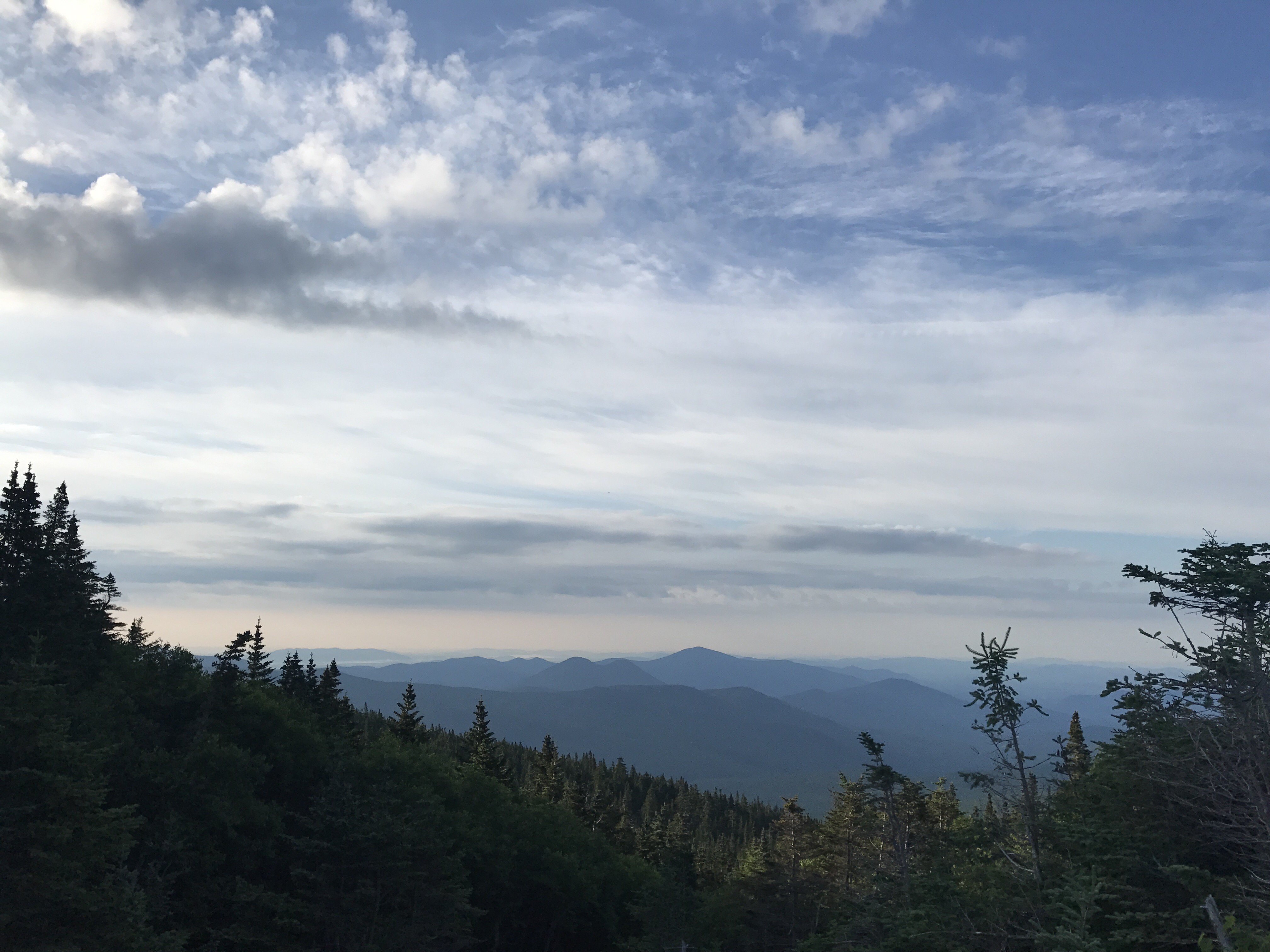
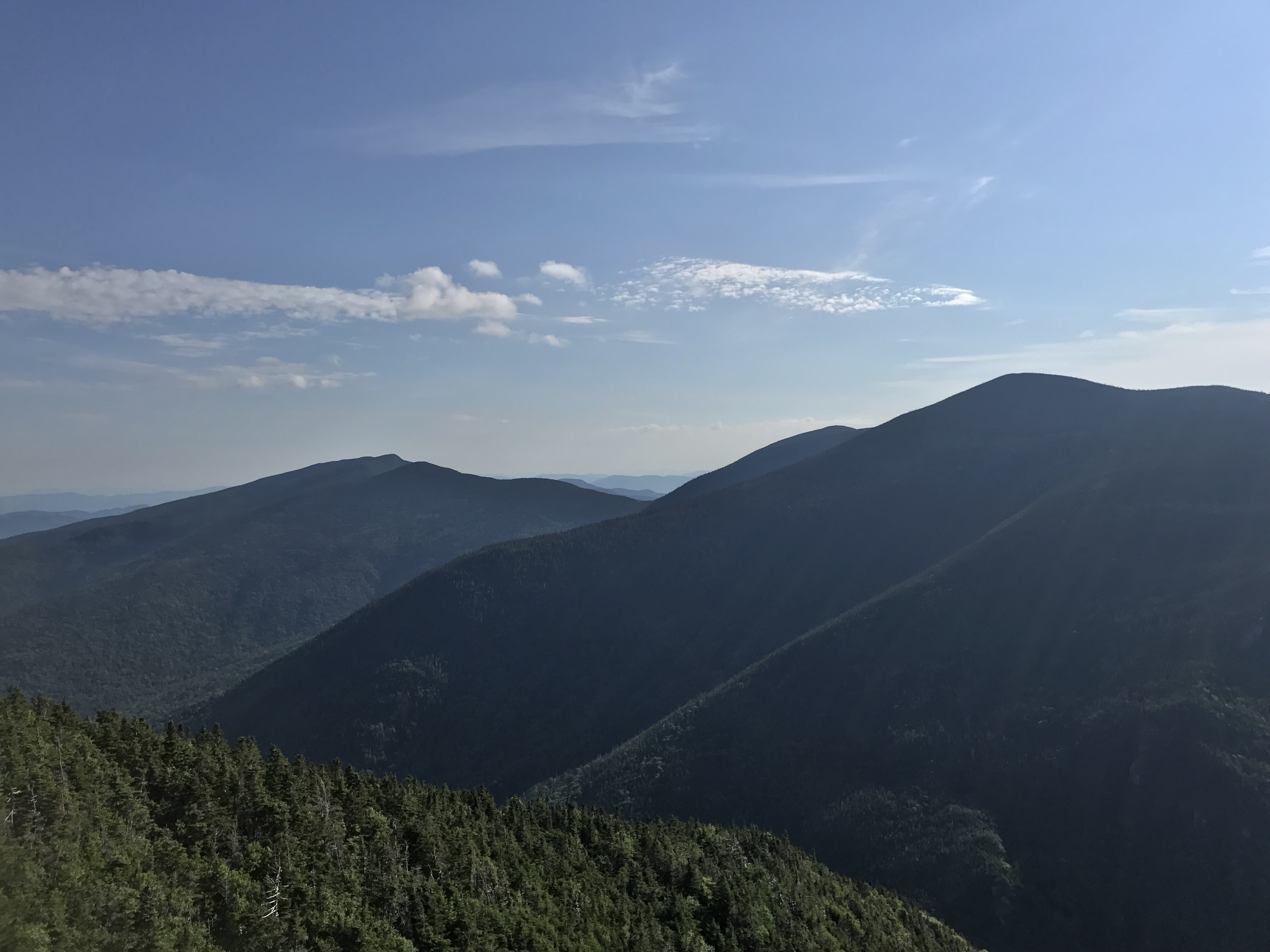
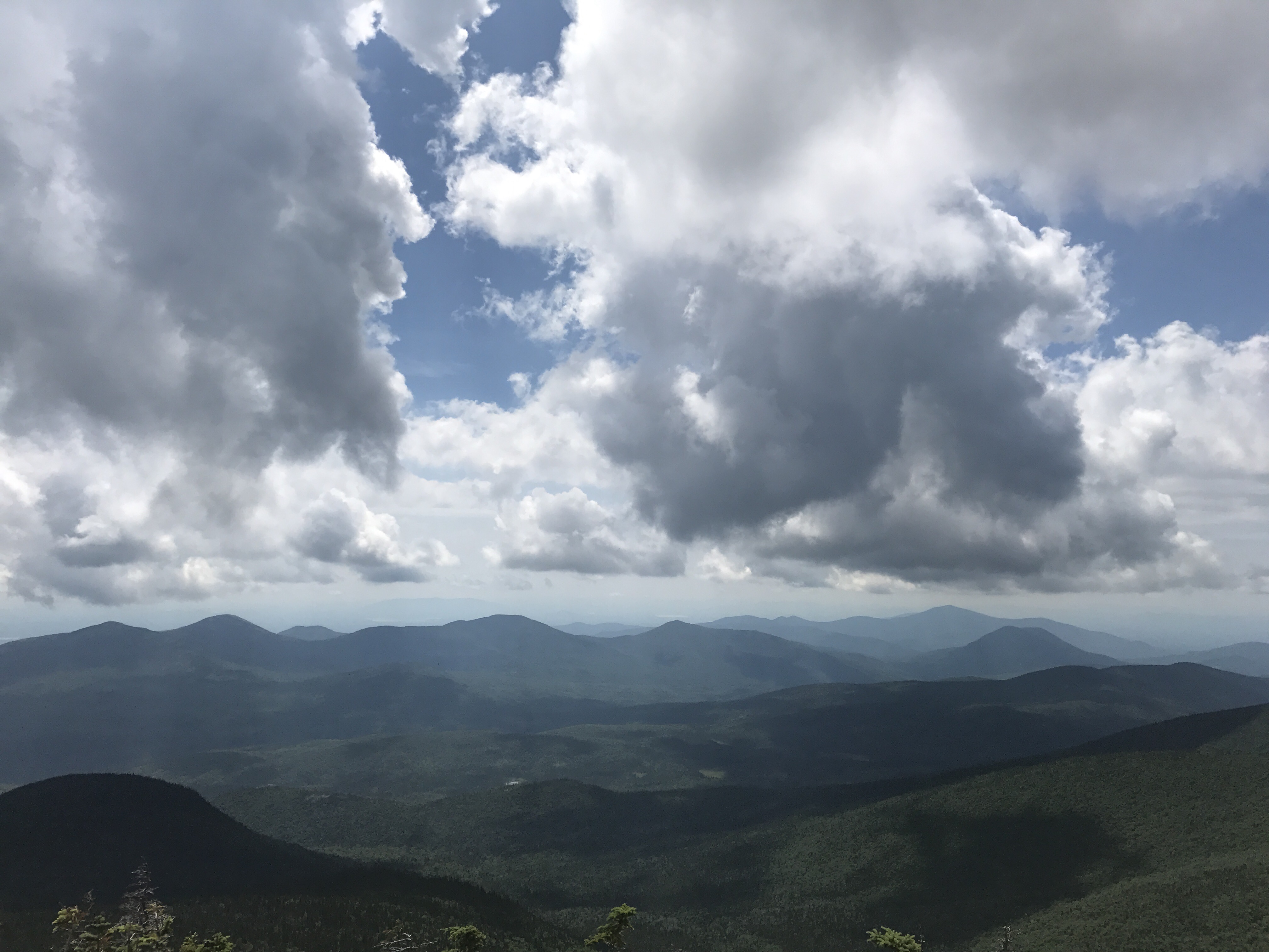
The trail immediately got steeper on the other side of the gondola. I gave a heavy sigh as I looked up at the rocks disappearing back into the trees. Nowhere to go but up. There were several false summits, which provided short relief in the form of flatter walking as eastern light streamed through the trees in front of me. I stopped at a wooded overlook to get a view of the mountains towards the east:
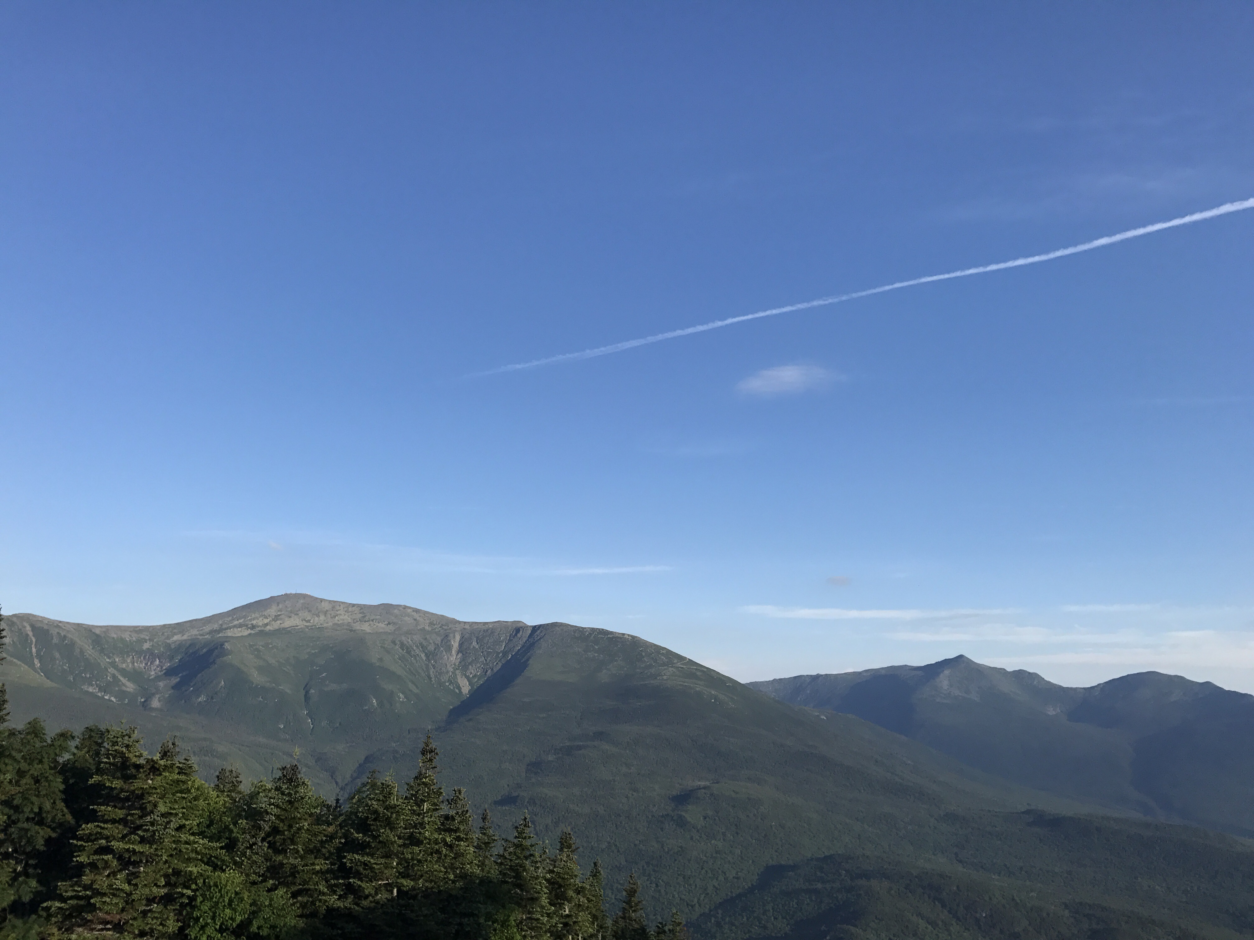
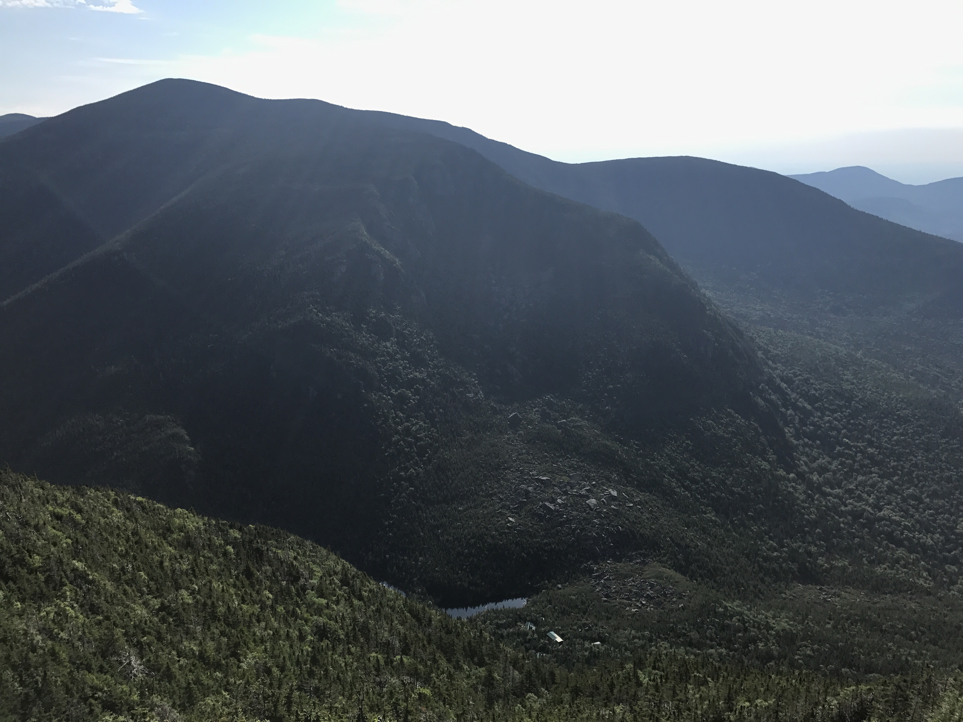
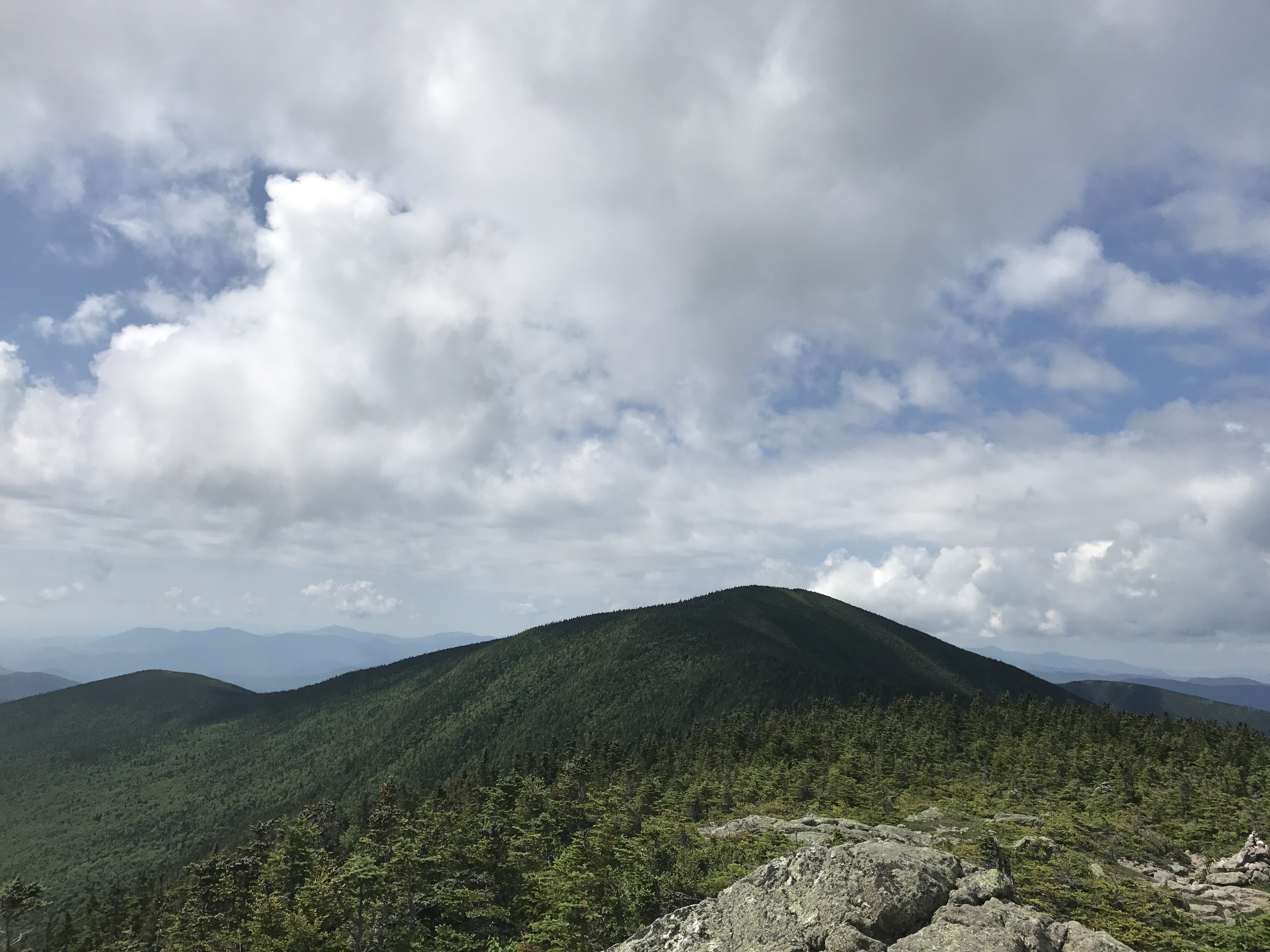
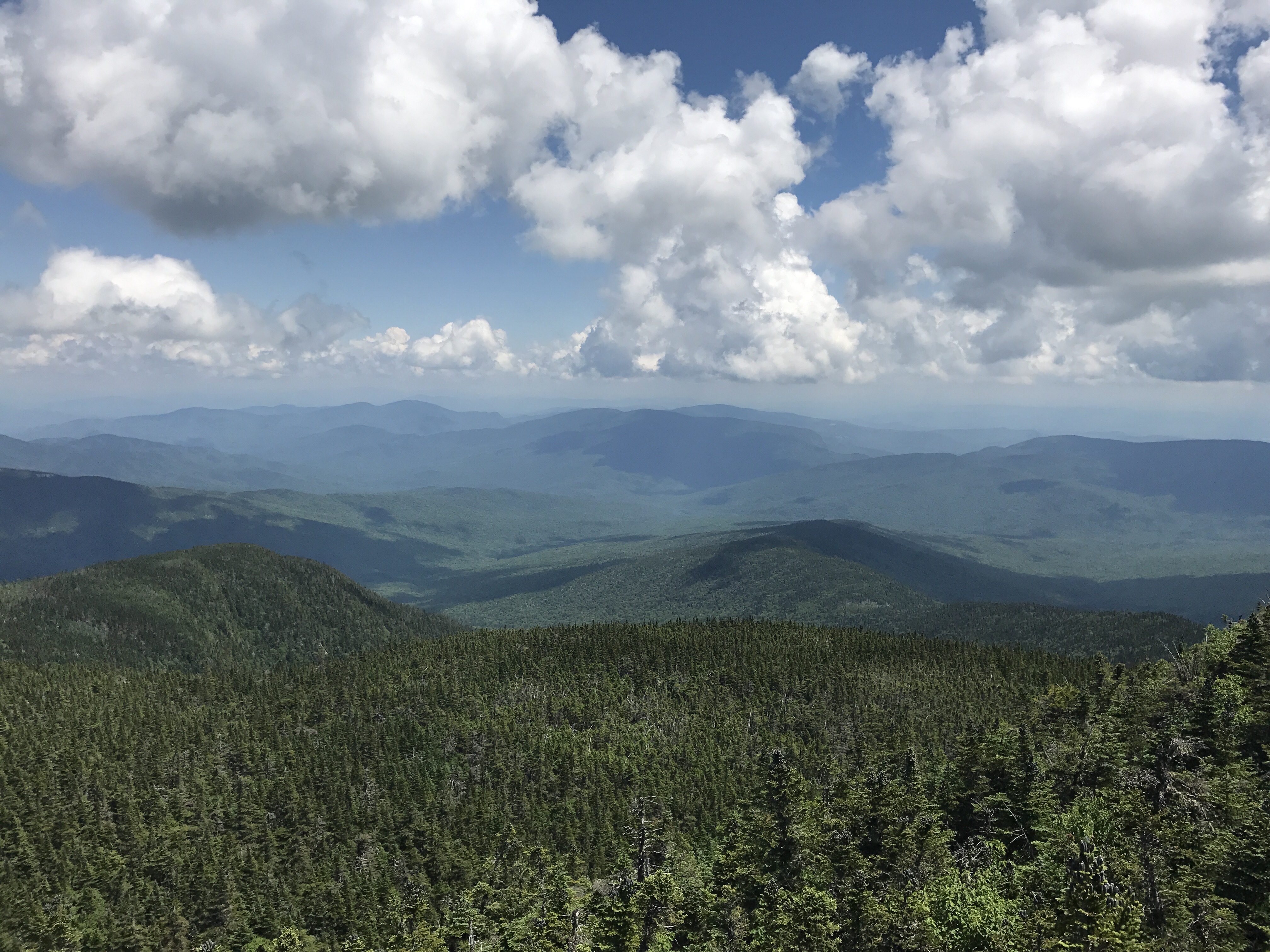
There were little side paths scattered about the woods. I couldn’t figure out their purpose even after wandering down a couple of them. They all seemed to peter out within 20 yards, and they didn’t lead to tent sites that I could see. I had a clear view of Washington to my left through the tress for most of the morning. It really is a behemoth of a mountain. After over an hour of climbing, I finally reached the summit of wildcat. A short side trail led to this overlook where I ate a snack and dreaded the changes in elevation that I faced going through carter notch. In the first picture, you can just barely make out the hut on the forest floor.
The late night NOBO named Maverick got to the overlook just as I finished my snack. He commented on the ridge we had to walk down into the notch and also didn’t seem all that enthused about what lay ahead. He left ahead of me as I lingered on my rocky perch. I imagined the descent to be like the climb: sheer rock faces and chin-thumping high steps, but it was actually quite manageable save a few jumbled sections. I made it down in about 40 minutes. The trail wound me around this pond where I paused to admire the lily pads and gawk at the fact that I had just been standing at the farther of the two rocky points: 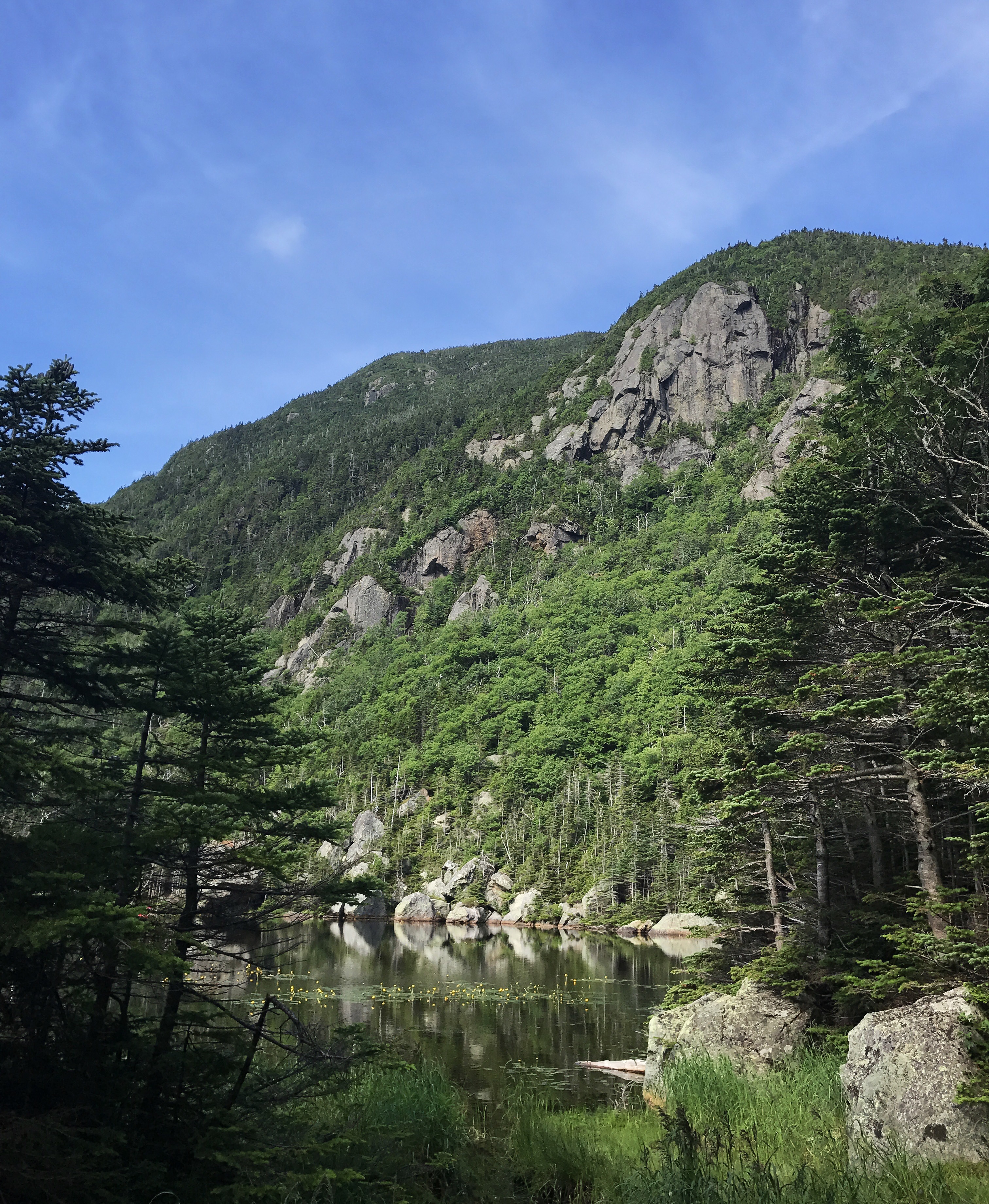
The hut was farther off the trail than I’d anticipated, but I needed water, so I made the .3 mile detour (one way). I felt grumbly because all of the other huts have been virtually on the trail. I passed a man sitting at the edge of another small pond wearing a bright orange shirt and playing a bright orange ukulele. I felt as if I’d just been dropped into a Wes Anderson movie. I dropped my pack outside the hut and walked inside with my water bottles. The young woman in the kitchen asked if I was a thru hiker, to which I replied yes, wondering what gave me away and hoping it wasn’t my smell. She offered me oatmeal leftovers, which I didn’t really need, but I ate some anyway because free food. Maverick came inside and we talked a bit about his time in the whites. Then I wandered off to find the bathroom and get started on the massive climb up to Carter Dome, mountain number 2 of the day. I felt anxious about how much time I’d spent at the hut, but there’s no way to really rush a 20% grade climb (that’s rise over run calculation, and I think the average idea of steep is around 10%, but I’m not certain of that). I heaved myself up the rocky trail feeling grateful for rocks instead of slabs of boulders. I expected maverick to pass me at any point, but I didn’t see him again until the next set of carter peaks. An anticlimactic pile of rocks sat at the top of the dome. I stood there staring at it while sweat clung to every surface of my skin. My phone had a weak signal, so I took a zombie break to rest my legs and post a few things.
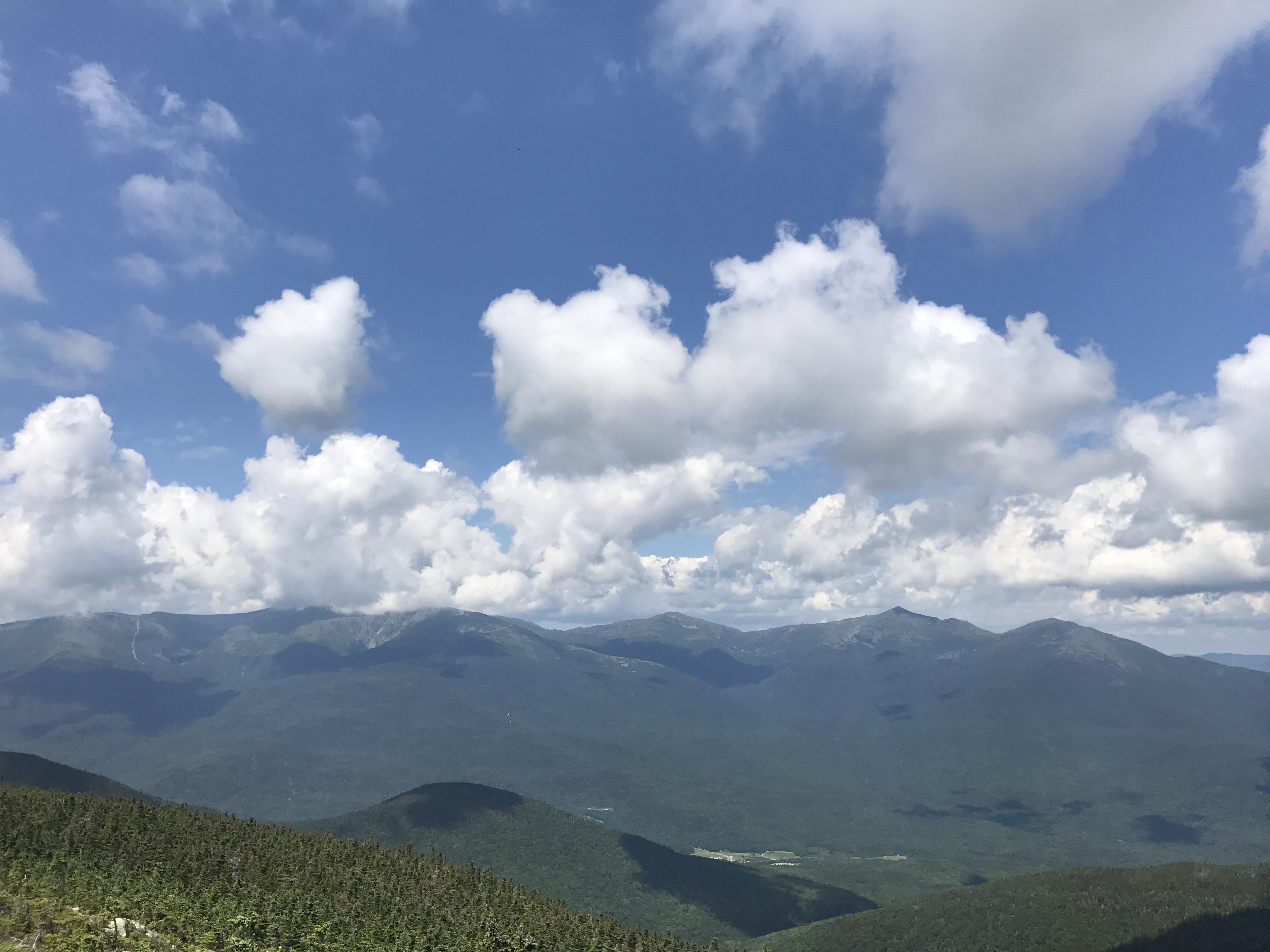
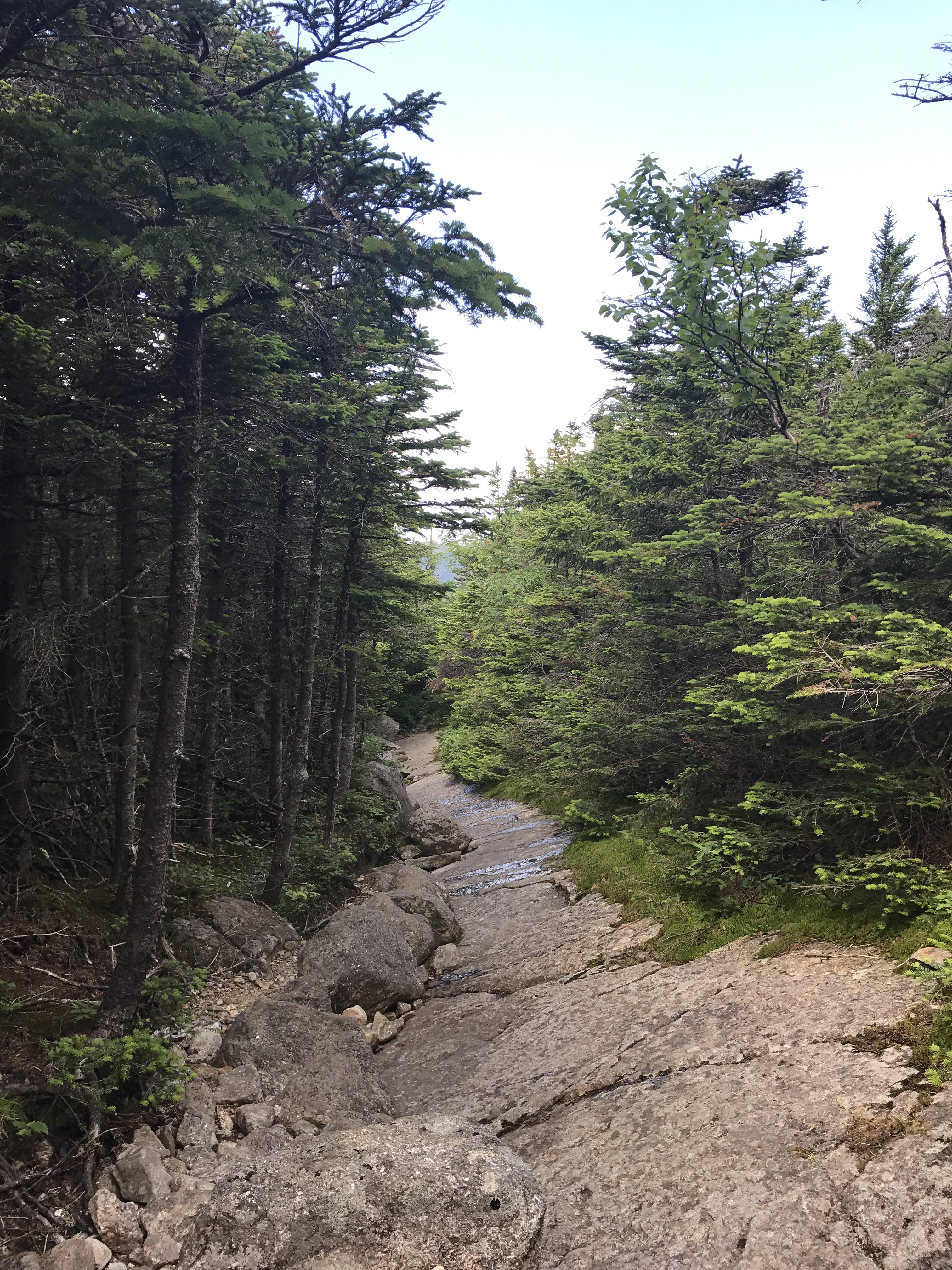
The trail then went through a strange flat area that almost seemed as if it was under construction with various piles of rocks and a wide sandy trail. Then it took a slight right down a narrow corridor that descended gradually until taking a sharper right to wind around towards Hight mountain. There was virtually no ascent required to reach Hight’s wide open peak with sweeping views of the surrounding mountains:
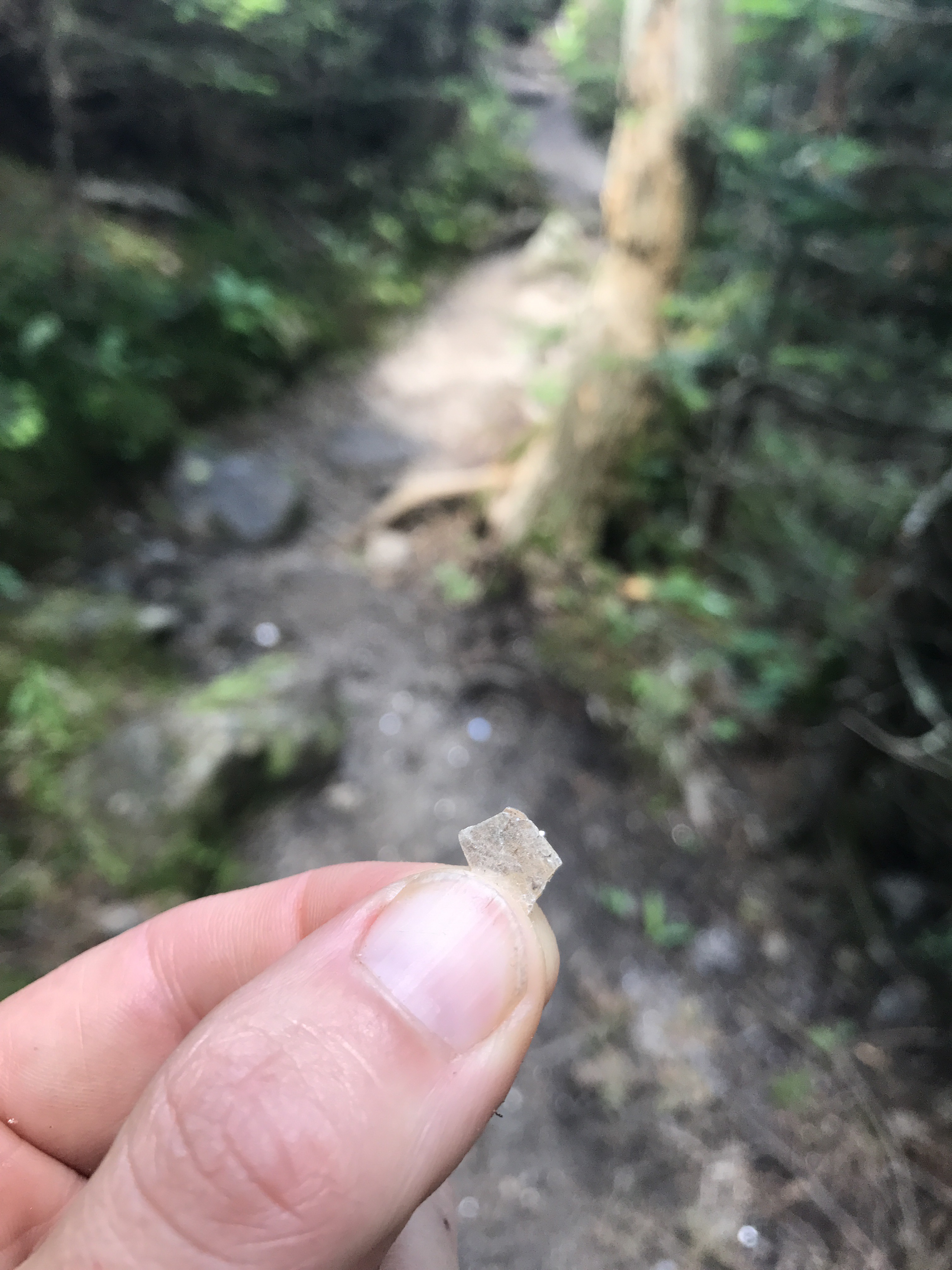
Several day hikers lunched on the peak. I silently walked around taking pictures and immediately began the descent down to Zeta pass. The nearly hypothermic woman from Madison had cited this section as her hardest, but I couldn’t figure out why as I navigated my way down the steep but manageable mountainside. I reached Zeta pass far sooner than I expected. Well, I reached the spot my guthook app denoted as Zeta pass, but it felt unremarkable in person with the exception of mica sparkling everywhere:
The trail then took an upward turn towards south carter, mountain number 4 of the day. The climb was short and reasonable. Light streamed through the thin firs and blooming bunchberries and wood sorrel dotted the sides of the trail. I felt excited by how the day was progressing so far. Nothing felt too hard or had taken as long as I expected. When I reached the somewhat obstructed summit, I perched on a good rock and ate lunch. You’ll never guess what I ate. Okay, fine, you already know. A day hiker approached as I crunched away on my wrap. She stopped, pulled out a giant dSLR and stepped around me to take a picture of the summit marker. Peak bagger at work. She commented on how she’d been able to make up some time on the ridge between north and south carter, which made me happy because I had started brewing a crazy idea to hike all the way to gorham tonight instead of staying at the shelter 2 miles from the hostel. I still had several mountains to cross, so I wasn’t sure if I could manage it. I emailed the hostel to check about bed availability. Maverick passed me as I ate the last of my chocolate stash. Then I packed up and continued my presidential marathon.
The ridge between the two mountains was indeed a pleasant walk with a few boulder scrambling speed bumps and a generous number of bog boards. I passed maverick on what we both thought was the summit of Middle carter. He was sprawled out on a sunny boulder eating iced ginger cookies out of a giant tub. I laughed at the size of the container and wondered aloud how he fit that thing in his pack. He said he went through a period of eating a pound of peanut butter a day. He would carry 5 pounds at a time, but he got sick of it. Go figure. I saw him later near North Carter, and he had a bloody leg and elbow from a fall he couldn’t recall. I nearly fell over a dozen times, but managed to make it out of the day without actually hitting the ground.
North carter was another easy summit, checking peak number 6 off the list. As I checked my email to see if the hostel had responded (no), I received a text from Halfway letting me know he was in gorham. I’ve managed to close the gap between us just in time for banjo camp to widen it to a nearly insurmountable because I’m going to be off trail for about 13 days with all the traveling and my awkward stopping point. Maybe someday we can actually hike together for more than a day at a time.
Halfway warned me that the North Carter descent was tricky at best and Mount Mariah should be taken seriously. He was also kind enough to check with the hostel owners to see if they had any space for tonight. I really wanted to make sure there would be a bed waiting if I committed to Operation Insanity. He eventually reported back that he’d reserved a bed for me and that I needed to arrive by 9p to claim it.
As I crept my way down the laughably steep boulders of North Carter, a NOBO turned flip flop named Dr J passed me. He commented on the sketchy sections of our descent that involved rock climbing, spider man moves. We both remarked on how grateful we were for dry conditions. He kept moving, and I hiked on as carefully as I could, trying not to rush the technical sections. There was much butt scooching and pole tossing.
The relentless descent from North Carter exhausted me both physically and emotionally. I did my best to return to speed mode (read: average hiker pace) as I made my way towards Mount Mariah. About a mile from the base of the mountain, I heard a low rumble of thunder. I cursed the weather and then pleaded with it to let me get over my last mountain before storming. There were places to camp along the way, but I felt anxious to be done with the whites even though they’re beautiful and like no other hiking I’ve ever done. There wasn’t much in way of water for about 4 more miles, and I hadn’t been drinking enough, so I took the turn off for imp campsite. It seemed doubly irresponsible to go up a mountain in a storm without enough water. The path to the campsite was a rocky mess that felt much longer than necessary. I nearly turned around, but I knew I would regret it, so I cursed and rushed onward. Dr. J passed me right near the water source. He whined about the distance from the trail and we discussed thunderstorm strategy. Neither of us had any intention of stopping at imp for the day, so we both shrugged and crossed our fingers. A common coping mechanism for uncertainty out here. I hurriedly filtered water and bolted past the shelter where a handful of hikers were standing around.
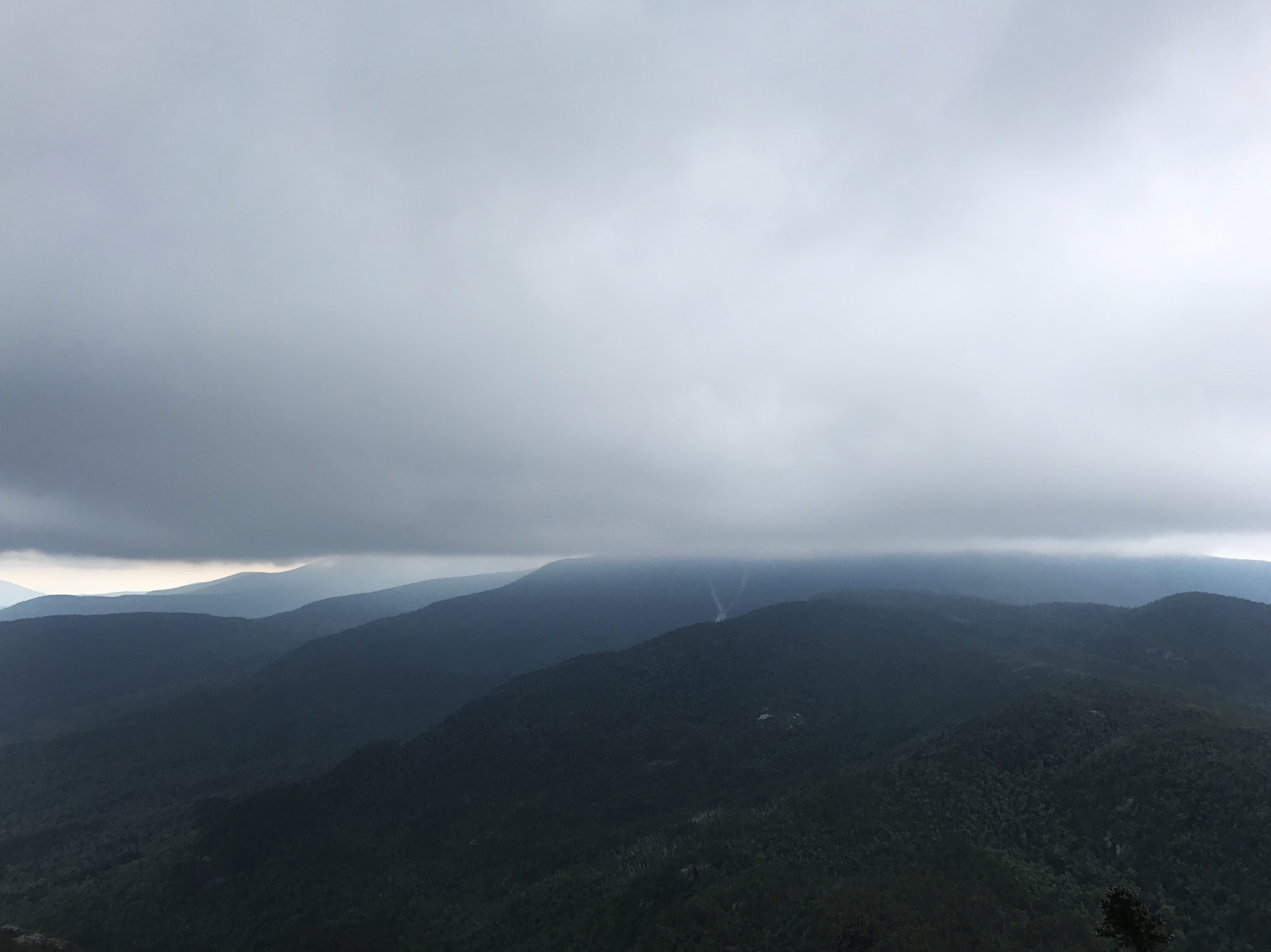
The hike to the base of Mariah was aggravating and serpentine. Then came the mountain (number 7 of the day), which was a series of exposed rock slabs, some of which I literally had to jog in order to stay upright. There was little in the way of foot or handholds. I could feel tightness in my lower back from the twisting I’d had to do getting down North Carter. As I gained elevation, I got a better look at the impending storm (top picture). My pace was just short of a run for as much of the ascent as I could muster without making my legs seize up. The occasional clap of thunder sounded as I made my over the boulders. The trail doesn’t actually go to the summit, which I didn’t realize until I crossed a bog surrounded by bright green moss and began descending again. I checked my map to find that the summit would involve a side trail. Not a detour I had any desire to take on a day like today.
I moved as quickly as I could, feeling grateful for tree cover and far fewer rock slabs on the descent. I came to an out of place bog board perched on top of a rock, which seemed like the perfect makeshift bench. I sat and ate a snack and forced myself to drink the water I had taken the time to retrieve. Two NOBOs came tearing down the trail clearly in hot pursuit of safety. They called out hellooo and were out of sight in seconds. My feet and knees were getting noticeably sore, but I continued at the semi pounding pace because I needed to get off that mountain before the sky decided to explode.
About halfway down, I met a cranky woman filtering water with a bug net over her head. She simpered about the lack of camping options and the rain. I gave a generic but empathetic response and hurried out of the splash zone of her kvetching. A few minutes later, I passed another woman choosing her steps wisely along the rocky decline. She turned out to be safari, whom I had heard of at carter notch hut when I asked if anyone did work for stay last night. Right as I passed her, the thunder intensified, cracking loudly, but no lightning. I made a remark about how we were about to get some weather and hurried past her. A light drizzle began to fall. It quickly turned to fat drops with lightning flashes and chest rattling, sustained thunder that rolled for 5-7 seconds at a time. There were a few deafening cracks that sounded as if the lightning had found a solid home to strike. The storm stayed overhead for about 45 minutes as I half-walked, half-jogged once the terrain eased up to a basic path. The rain seemed like it might let up for a few minutes, but then it poured even harder and the thunder continued.
The trail crossed rattle river where I nearly fell in because of the slippery rocks. I saw a forest protection sign and felt relieved about nearing the shelter, but then I arrived at another crossing of rattle river. I couldn’t believe it. Always with the barriers right before the end the day. About halfway through the second river crossing, there was a white flash of lightning followed by a crack of thunder. It seemed unwise to be standing on wet rocks holding metal poles dipped in water. As I got to the other bank, safari showed up and yelled “we have to cross this fucking thing twice?!” My thoughts exactly. I shared her outrage and kept moving. I arrived to a very full shelter, the inhabitants of which included Boss and goddess from MA, some people who seemed pretty high with a very cute dog, Dr J, and maverick. Safari came in about 2 min after me. Apparently, the cranky woman is mrs joy. she seemed far from joyful.
Everyone made motions to clear room for me in the shelter, but I told them I was heading for the road. Safari suggested I said out the rain, but I was already soaked and needed to keep moving before I got any colder. I pushed on through ankle deep puddles and yet another dicey stream crossing. I could feel a chill coming on, and I told myself that if I got any colder, I had to stop to put on my wool layer. That took all of 5 minutes to be necessary. I tossed my pack onto a rock and tugged my shirt over soggy arms. I forced myself to eat snack as I walked because I was too hungry and also thought it might somehow help with warmth. My knees were VERY unhappy with the near jogging pace, but I just needed to be done so I could shower and eat an actual meal.
I covered the last two miles in record time, moving at nearly 4pmh. I finally got to the road where I took a left and slowed to a walk for the remaining tenth of a mile to the hostel. I was greeted into an open garage with a wall of packs on hooks, a changing room and a giant stockpile of loaner clothes. I felt overwhelmed, exhausted and starving. I hung my saturated pack on a hook and brushed the inches of bark and mud off my legs with a towel from the hostel. Then I went into the changing room and peeled out of my wet clothes. My room was upstairs in another building. I came close to losing it during the tour of the facilities, but I managed to pay attention long enough without exposing my inner meltdown. Halfway waited for me in the kitchen. I felt so grateful to see him in a house full of strangers after such a long day. We caught up as I went through the motions of making macaroni and cheese. because the idea of waiting for food delivery was too much for me. We eventually wandered away from each other, and I remembered that I had yet to shower. With that taken care of, I collapsed into my bed and went into full on zombie mode. My knees are actively throbbing with the occasional sharp stab across my knee caps. I don’t think I will be hiking tomorrow. Stockpiling 11 more miles seems far less important than the longevity of my knees. Only 22 miles to Maine!
So this is where I would have left you for my music break, but it’s already come and gone, and I’ve taken today (8/8) off, so there should be more posts in your future as soon as I can unmangle my notes on this tiny, TINY keyboard that drives me batty.
Mile 1872.7 to mile 1891.6 (18.9)
J
Total miles: 888.4
Creature feature: nothing to report. had my head down when I wasn’t staring at mountains in the distance and the woods were pretty quiet.
